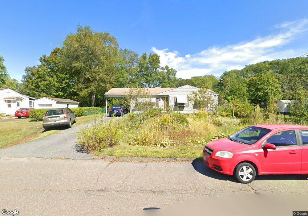
202 Brookside Cir Florence, MA 01062
Florence NeighborhoodEstimated Value: $346,200 - $388,000
3
Beds
1
Bath
1,062
Sq Ft
$348/Sq Ft
Est. Value
About This Home
This home is located at 202 Brookside Cir, Florence, MA 01062 and is currently estimated at $369,550, approximately $347 per square foot. 202 Brookside Cir is a home located in Hampshire County with nearby schools including Northampton High School, Hilltown Cooperative Charter Public School, and Lander Grinspoon Academy.
Ownership History
Date
Name
Owned For
Owner Type
Purchase Details
Closed on
Oct 22, 2010
Sold by
Douglas Herbert E and Douglas Joanne M
Bought by
Zadworny Stephen and Zadworny Wendy
Current Estimated Value
Home Financials for this Owner
Home Financials are based on the most recent Mortgage that was taken out on this home.
Original Mortgage
$138,600
Outstanding Balance
$91,196
Interest Rate
4.37%
Mortgage Type
Purchase Money Mortgage
Estimated Equity
$278,354
Create a Home Valuation Report for This Property
The Home Valuation Report is an in-depth analysis detailing your home's value as well as a comparison with similar homes in the area
Home Values in the Area
Average Home Value in this Area
Purchase History
| Date | Buyer | Sale Price | Title Company |
|---|---|---|---|
| Zadworny Stephen | $180,000 | -- |
Source: Public Records
Mortgage History
| Date | Status | Borrower | Loan Amount |
|---|---|---|---|
| Open | Zadworny Stephen | $138,600 |
Source: Public Records
Tax History
| Year | Tax Paid | Tax Assessment Tax Assessment Total Assessment is a certain percentage of the fair market value that is determined by local assessors to be the total taxable value of land and additions on the property. | Land | Improvement |
|---|---|---|---|---|
| 2025 | $4,310 | $309,400 | $123,200 | $186,200 |
| 2024 | $4,271 | $281,200 | $123,200 | $158,000 |
| 2023 | $3,631 | $229,200 | $111,900 | $117,300 |
| 2022 | $3,882 | $217,000 | $111,900 | $105,100 |
| 2021 | $3,418 | $196,800 | $106,900 | $89,900 |
| 2020 | $3,306 | $196,800 | $106,900 | $89,900 |
| 2019 | $3,047 | $175,400 | $91,900 | $83,500 |
| 2018 | $2,985 | $175,200 | $91,900 | $83,300 |
| 2017 | $2,924 | $175,200 | $91,900 | $83,300 |
| 2016 | $2,831 | $175,200 | $91,900 | $83,300 |
| 2015 | $2,819 | $178,400 | $91,900 | $86,500 |
| 2014 | $2,746 | $178,400 | $91,900 | $86,500 |
Source: Public Records
Map
Nearby Homes
- 723 Lot B Ryan Rd
- 815 Burts Pit Rd
- 296 Ryan Rd Unit A
- 296 Ryan Rd
- 296 Ryan Rd Unit B
- 635 Florence Rd
- 697 Florence Rd
- 42 Clark St
- 832 Westhampton Rd
- 967 Florence Rd
- 0 W Farms Rd
- 892 Westhampton Rd
- 404 Sylvester Rd
- 20-11 Sylvester Rd
- 37 Landy Ave
- 296 Old Wilson Rd
- 751 Park Hill Rd
- 98 Park Hill Rd
- 67 Park St Unit A
- 76 Maple St
- 194 Brookside Cir
- 4 Overlook Dr
- 20 Overlook Dr
- 186 Brookside Cir
- 30 Overlook Dr
- 199 Brookside Cir
- 207 Brookside Cir
- 191 Brookside Cir
- 215 Brookside Cir
- 127 Deerfield Dr
- 224 Brookside Cir
- 135 Deerfield Dr
- 38 Overlook Dr
- 176 Brookside Cir
- 11 Overlook Dr
- 223 Brookside Cir
- 143 Deerfield Dr
- 23 Overlook Dr
- 31 Overlook Dr
- 232 Brookside Cir
Your Personal Tour Guide
Ask me questions while you tour the home.