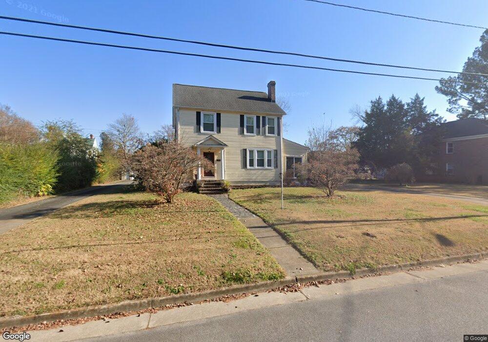
202 Causey Ave Suffolk, VA 23434
Holy Neck NeighborhoodEstimated Value: $308,000 - $379,391
4
Beds
3
Baths
2,203
Sq Ft
$156/Sq Ft
Est. Value
About This Home
This home is located at 202 Causey Ave, Suffolk, VA 23434 and is currently estimated at $342,598, approximately $155 per square foot. 202 Causey Ave is a home located in Suffolk City with nearby schools including Elephant's Fork Elementary School, King's Fork Middle School, and King's Fork High School.
Ownership History
Date
Name
Owned For
Owner Type
Purchase Details
Closed on
Aug 9, 2010
Sold by
Federal Home Loan Mortgage Corporation
Bought by
Perkins Louis E
Current Estimated Value
Home Financials for this Owner
Home Financials are based on the most recent Mortgage that was taken out on this home.
Original Mortgage
$152,910
Outstanding Balance
$100,870
Interest Rate
4.73%
Mortgage Type
New Conventional
Estimated Equity
$241,728
Purchase Details
Closed on
Jun 15, 2010
Sold by
Samuel I White Pc
Bought by
Federal Home Loan Mortgage Corporation
Home Financials for this Owner
Home Financials are based on the most recent Mortgage that was taken out on this home.
Original Mortgage
$152,910
Outstanding Balance
$100,870
Interest Rate
4.73%
Mortgage Type
New Conventional
Estimated Equity
$241,728
Create a Home Valuation Report for This Property
The Home Valuation Report is an in-depth analysis detailing your home's value as well as a comparison with similar homes in the area
Home Values in the Area
Average Home Value in this Area
Purchase History
| Date | Buyer | Sale Price | Title Company |
|---|---|---|---|
| Perkins Louis E | $169,900 | -- | |
| Federal Home Loan Mortgage Corporation | $234,000 | -- |
Source: Public Records
Mortgage History
| Date | Status | Borrower | Loan Amount |
|---|---|---|---|
| Open | Federal Home Loan Mortgage Corporation | $152,910 |
Source: Public Records
Tax History
| Year | Tax Paid | Tax Assessment Tax Assessment Total Assessment is a certain percentage of the fair market value that is determined by local assessors to be the total taxable value of land and additions on the property. | Land | Improvement |
|---|---|---|---|---|
| 2025 | $4,103 | $341,400 | $79,100 | $262,300 |
| 2024 | $4,103 | $330,900 | $79,100 | $251,800 |
| 2023 | $3,934 | $312,900 | $79,100 | $233,800 |
| 2022 | $3,146 | $288,600 | $71,900 | $216,700 |
| 2021 | $3,044 | $274,200 | $57,500 | $216,700 |
| 2020 | $2,754 | $248,100 | $57,500 | $190,600 |
| 2019 | $2,754 | $248,100 | $57,500 | $190,600 |
| 2018 | $2,705 | $231,700 | $57,500 | $174,200 |
| 2017 | $2,479 | $231,700 | $57,500 | $174,200 |
| 2016 | $2,479 | $231,700 | $57,500 | $174,200 |
| 2015 | $1,300 | $240,000 | $57,500 | $182,500 |
| 2014 | $1,300 | $240,000 | $57,500 | $182,500 |
Source: Public Records
Map
Nearby Homes
- 909 Howard Place
- 921 Howard Place
- 117 Bute St
- 112 Linden Ave
- 309 Linden Ave
- 203 Saint James Ave
- 207 Saint James Ave
- 109 Saint James Ave
- 204 Bute St
- 118 Saint James Ave
- 314 Linden Ave
- 212 Saint James Ave
- 215 Wellons St
- 655 3rd Ave
- 552 2nd Ave
- 208 Wellons St
- 603 Mason Ave
- 721 Ashley Ave Unit A
- 433 Wellons St
- 1107 Lake Point Ln
Your Personal Tour Guide
Ask me questions while you tour the home.