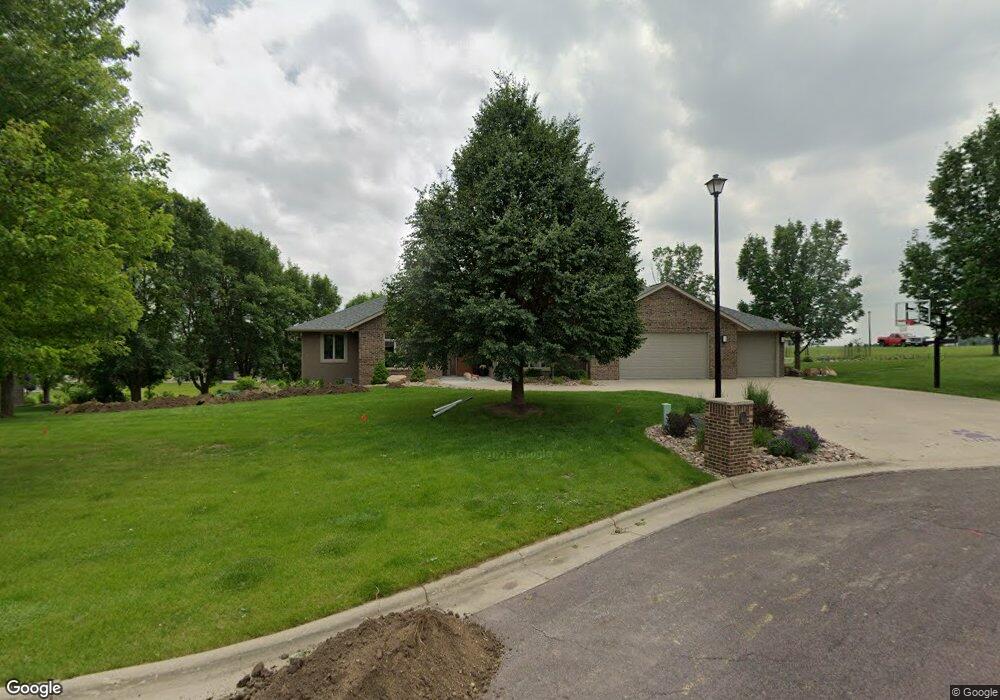
202 Cedar Ln Rock Rapids, IA 51246
Estimated Value: $485,000 - $650,000
Studio
2
Baths
2,343
Sq Ft
$244/Sq Ft
Est. Value
About This Home
This home is located at 202 Cedar Ln, Rock Rapids, IA 51246 and is currently estimated at $570,940, approximately $243 per square foot. 202 Cedar Ln is a home located in Lyon County with nearby schools including Central Lyon Elementary School, Central Lyon Senior High School, and Ignite Christian Academy.
Ownership History
Date
Name
Owned For
Owner Type
Purchase Details
Closed on
Feb 2, 2022
Sold by
East River Development Llc
Bought by
Elbert Michael D and Elbert Jennifer Ann
Current Estimated Value
Purchase Details
Closed on
Oct 1, 2009
Sold by
Tolvstad Julie V and Taylor Gary L
Bought by
Taylor Julie and Taylor Gary L
Home Financials for this Owner
Home Financials are based on the most recent Mortgage that was taken out on this home.
Original Mortgage
$229,100
Interest Rate
5.19%
Mortgage Type
New Conventional
Create a Home Valuation Report for This Property
The Home Valuation Report is an in-depth analysis detailing your home's value as well as a comparison with similar homes in the area
Home Values in the Area
Average Home Value in this Area
Purchase History
| Date | Buyer | Sale Price | Title Company |
|---|---|---|---|
| Elbert Michael D | $45,000 | None Listed On Document | |
| Taylor Julie | -- | Midwest Community Title |
Source: Public Records
Mortgage History
| Date | Status | Borrower | Loan Amount |
|---|---|---|---|
| Previous Owner | Taylor Julie | $229,100 |
Source: Public Records
Tax History
| Year | Tax Paid | Tax Assessment Tax Assessment Total Assessment is a certain percentage of the fair market value that is determined by local assessors to be the total taxable value of land and additions on the property. | Land | Improvement |
|---|---|---|---|---|
| 2025 | $8,274 | $625,390 | $58,890 | $566,500 |
| 2024 | $8,274 | $552,560 | $58,890 | $493,670 |
| 2023 | $7,838 | $553,400 | $58,890 | $494,510 |
| 2022 | $7,258 | $437,450 | $58,890 | $378,560 |
| 2021 | $7,258 | $437,450 | $58,890 | $378,560 |
| 2020 | $7,230 | $373,310 | $60,650 | $312,660 |
| 2019 | $7,170 | $352,930 | $0 | $0 |
| 2018 | $7,040 | $352,930 | $0 | $0 |
| 2017 | $7,040 | $320,940 | $0 | $0 |
| 2016 | $6,494 | $320,940 | $0 | $0 |
| 2015 | $6,494 | $316,987 | $0 | $0 |
| 2014 | $6,426 | $316,987 | $0 | $0 |
Source: Public Records
Map
Nearby Homes
- 204 S 15th Ave
- 104 Cedar Ln
- 1009 S Tama St
- 1007 S Tama St
- 707 Mill Pond Rd
- 505 Mill Pond Rd Unit 2
- 603 Mill Pond Rd
- 505 Mill Pond Rd Unit 1
- 507 Mill Pond Rd
- 903 S Jansen St
- 1400 S Greene St
- 601 Mill Pond Rd Unit 2
- 601 Mill Pond Rd Unit 1
- 708 S Story St
- 709 S Carroll St
- 507 S Greene St
- 904 Davis St
- 1100 S 6th Ave
- 1104 S 6th Ave
- 1102 S 6th Ave
- 105 S 15th Ave
- 205 Cedar Ln
- 106 Cedar Ln
- 201 Cedar Ln
- 105 Cedar Ln
- 103 S 15th Ave
- 103 Cedar Ln
- 204 Old Mill Ln
- 202 Old Mill Ln
- 102 Cedar Ln
- 106 Old Mill Ln
- 101 Cedar Ln
- 1509 S Tama St
- 1509 S Tama St
- 1509 S Tama St Unit 1
- 1509 S Tama St Unit 13
- 1509 S Tama St Unit Ste 1
- 1509 S Tama St Unit 10
- 205 Old Mill Ln
- 104 Old Mill Ln
Your Personal Tour Guide
Ask me questions while you tour the home.