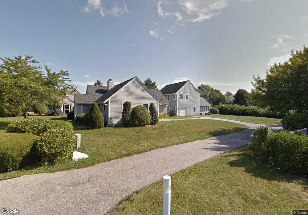
202 Corey Ln Middletown, RI 02842
Estimated Value: $593,141 - $827,000
3
Beds
2
Baths
1,375
Sq Ft
$506/Sq Ft
Est. Value
About This Home
This home is located at 202 Corey Ln, Middletown, RI 02842 and is currently estimated at $695,285, approximately $505 per square foot. 202 Corey Ln is a home located in Newport County with nearby schools including Middletown High School, All Saints STEAM Academy, and St George's School.
Ownership History
Date
Name
Owned For
Owner Type
Purchase Details
Closed on
Mar 24, 2016
Sold by
Corscadden James B and Corscadden Kathleen M
Bought by
Corscadden Kathleen M
Current Estimated Value
Purchase Details
Closed on
Jun 9, 2000
Sold by
Hayes Christopher J and Hayes Brigitta
Bought by
Corscadden James B and Corscadden Kathleen
Home Financials for this Owner
Home Financials are based on the most recent Mortgage that was taken out on this home.
Original Mortgage
$156,000
Interest Rate
8.12%
Create a Home Valuation Report for This Property
The Home Valuation Report is an in-depth analysis detailing your home's value as well as a comparison with similar homes in the area
Home Values in the Area
Average Home Value in this Area
Purchase History
| Date | Buyer | Sale Price | Title Company |
|---|---|---|---|
| Corscadden Kathleen M | -- | -- | |
| Corscadden James B | $195,000 | -- |
Source: Public Records
Mortgage History
| Date | Status | Borrower | Loan Amount |
|---|---|---|---|
| Previous Owner | Corscadden James B | $156,000 | |
| Previous Owner | Corscadden James B | $156,000 | |
| Previous Owner | Corscadden James B | $156,000 | |
| Previous Owner | Corscadden James B | $22,000 |
Source: Public Records
Tax History Compared to Growth
Tax History
| Year | Tax Paid | Tax Assessment Tax Assessment Total Assessment is a certain percentage of the fair market value that is determined by local assessors to be the total taxable value of land and additions on the property. | Land | Improvement |
|---|---|---|---|---|
| 2025 | $5,487 | $465,400 | $0 | $465,400 |
| 2024 | $5,240 | $465,400 | $0 | $465,400 |
| 2023 | $4,341 | $344,800 | $0 | $344,800 |
| 2022 | $4,144 | $344,800 | $0 | $344,800 |
| 2021 | $4,144 | $344,800 | $0 | $344,800 |
| 2020 | $4,388 | $318,900 | $0 | $318,900 |
| 2018 | $4,385 | $318,900 | $0 | $318,900 |
| 2016 | $4,529 | $293,700 | $0 | $293,700 |
| 2015 | $4,417 | $293,700 | $0 | $293,700 |
| 2014 | $3,794 | $236,100 | $0 | $236,100 |
| 2013 | $3,709 | $236,100 | $0 | $236,100 |
Source: Public Records
Map
Nearby Homes
- 223 Corey Ln
- 318 Corey Ln
- 310 Corey Ln
- 119 Corey Ln
- 16 Ward Ave
- 980 Green End Ave
- 0 Honeyman Ave
- 476 Green End Ave
- 0 Saltwood Dr
- 16 Sachuest Dr
- 6 Wabasso Terrace
- 74 Valley Rd
- 0 Wolcott Ave
- 55 John Clarke Rd Unit 8
- 55 John Clarke Rd Unit 3
- 138 Green End Ave
- 141 Gray Craig Rd
- 533 Forest Park
- 118 Wolcott Ave
- 529 Forest Park
- 201 Corey Ln
- 203 Corey Ln
- 204 Corey Ln
- 205 Corey Ln
- 205 Corey Ln Unit 205
- 229 Corey Ln
- 420 Corey Ln
- 421 Corey Ln
- 421 Corey Ln Unit 421
- 228 Corey Ln
- 228 Corey Ln Unit 228
- 419 Corey Ln
- 423 Corey Ln
- 206 Corey Ln
- 422 Corey Ln
- 418 Corey Ln
- 207 Corey Ln
- 417 Corey Ln Unit B
- 417 Corey Ln Unit A
- 417 Corey Ln Unit 409