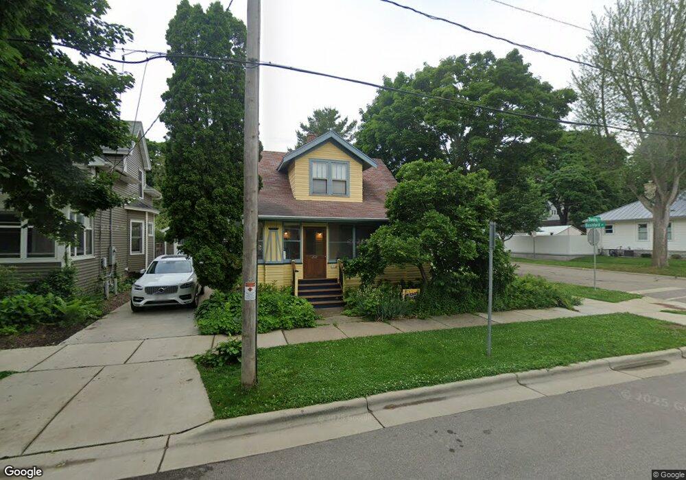
202 Dunning St Madison, WI 53704
Atwood NeighborhoodEstimated Value: $502,000 - $572,000
3
Beds
2
Baths
1,166
Sq Ft
$459/Sq Ft
Est. Value
About This Home
This home is located at 202 Dunning St, Madison, WI 53704 and is currently estimated at $535,700, approximately $459 per square foot. 202 Dunning St is a home located in Dane County with nearby schools including Marquette Elementary, O'Keeffe Middle, and East High School.
Ownership History
Date
Name
Owned For
Owner Type
Purchase Details
Closed on
Apr 29, 2024
Sold by
Franki Julie
Bought by
Williams Heather E
Current Estimated Value
Purchase Details
Closed on
Aug 8, 2005
Sold by
Gilbertson White Joel and Gilbertson White Stephanie
Bought by
Franki Julie and Willims Heather E
Home Financials for this Owner
Home Financials are based on the most recent Mortgage that was taken out on this home.
Original Mortgage
$185,900
Interest Rate
5.66%
Mortgage Type
New Conventional
Create a Home Valuation Report for This Property
The Home Valuation Report is an in-depth analysis detailing your home's value as well as a comparison with similar homes in the area
Home Values in the Area
Average Home Value in this Area
Purchase History
| Date | Buyer | Sale Price | Title Company |
|---|---|---|---|
| Williams Heather E | -- | None Listed On Document | |
| Franki Julie | $235,900 | None Available |
Source: Public Records
Mortgage History
| Date | Status | Borrower | Loan Amount |
|---|---|---|---|
| Previous Owner | Franki Julie | $185,900 |
Source: Public Records
Tax History
| Year | Tax Paid | Tax Assessment Tax Assessment Total Assessment is a certain percentage of the fair market value that is determined by local assessors to be the total taxable value of land and additions on the property. | Land | Improvement |
|---|---|---|---|---|
| 2024 | $16,140 | $473,600 | $88,300 | $385,300 |
| 2023 | $7,966 | $438,500 | $88,300 | $350,200 |
| 2022 | $15,988 | $406,000 | $88,300 | $317,700 |
| 2021 | $7,849 | $369,100 | $76,800 | $292,300 |
| 2020 | $7,744 | $348,200 | $71,100 | $277,100 |
| 2019 | $7,459 | $334,200 | $62,900 | $271,300 |
| 2018 | $6,764 | $303,800 | $56,200 | $247,600 |
| 2017 | $6,544 | $283,900 | $46,800 | $237,100 |
| 2016 | $6,340 | $267,800 | $42,500 | $225,300 |
| 2015 | $6,096 | $250,000 | $41,700 | $208,300 |
| 2014 | $5,979 | $250,000 | $41,700 | $208,300 |
| 2013 | $5,462 | $240,400 | $40,100 | $200,300 |
Source: Public Records
Map
Nearby Homes
- 2205 Winnebago St
- 2146 Winnebago St
- 2418 Bashford Ave
- 256 Waubesa St
- 2528 E Washington Ave
- 2025 E Dayton St
- 1835 Winnebago St Unit 207
- 2122 E Johnson St
- 2330 Upham St
- 206 Dixon St
- 2617 Hoard St
- 3014 Union St
- 2670 Hoard St Unit 1
- 33 Sherman Terrace Unit 3
- 28 Sherman Terrace Unit 4
- 13 Sherman Terrace Unit 4
- 2852 Commercial Ave
- 3401 Dawes St Unit 1
- 3606 Atwood Ave
- 1332 E Dayton St
- 206 Dunning St
- 2127 Bashford Ave
- 210 Dunning St
- 174 Dunning St
- 214 Dunning St
- 170 Dunning St
- 201 Division St
- 205 Division St Unit 1
- 201 Dunning St Unit 2
- 209 Division St
- 205 Dunning St
- 220 Dunning St
- 177 Division St Unit 1
- 209 Dunning St
- 166 Dunning St
- 173 Dunning St
- 213 Division St
- 175 Division St Unit 1
- 213 Dunning St Unit 1
- 222 Dunning St
Your Personal Tour Guide
Ask me questions while you tour the home.