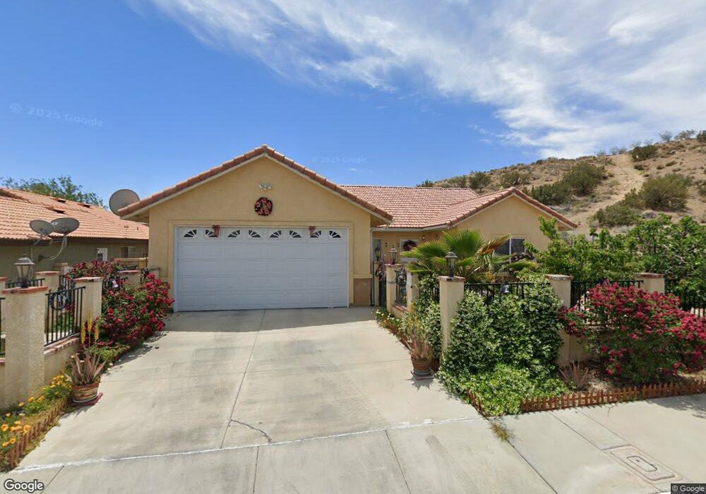
202 E Avenue r9 Palmdale, CA 93550
East Palmdale NeighborhoodEstimated Value: $492,000 - $572,000
4
Beds
3
Baths
1,865
Sq Ft
$284/Sq Ft
Est. Value
About This Home
This home is located at 202 E Avenue r9, Palmdale, CA 93550 and is currently estimated at $529,290, approximately $283 per square foot. 202 E Avenue r9 is a home located in Los Angeles County with nearby schools including Palm Tree Elementary School, David G. Millen Magnet Academy, and Highland High School.
Ownership History
Date
Name
Owned For
Owner Type
Purchase Details
Closed on
Oct 21, 2011
Sold by
The Secretary Of Housing & Urban Develop
Bought by
Taglianetti Jirapan M
Current Estimated Value
Home Financials for this Owner
Home Financials are based on the most recent Mortgage that was taken out on this home.
Original Mortgage
$133,919
Outstanding Balance
$92,519
Interest Rate
4.37%
Mortgage Type
FHA
Estimated Equity
$436,771
Purchase Details
Closed on
Jun 9, 2010
Sold by
Bac Home Loans Servicing Lp
Bought by
The Secretary Of Housing & Urban Develop
Purchase Details
Closed on
May 28, 2010
Sold by
Montelongo Carlos J and Montelongo Margarita B
Bought by
Bac Home Loans Servicing Lp and Countrywide Home Loans Servicing Lp
Purchase Details
Closed on
May 19, 2008
Sold by
Wells Shelley A
Bought by
Montelongo Carlos J
Home Financials for this Owner
Home Financials are based on the most recent Mortgage that was taken out on this home.
Original Mortgage
$217,585
Interest Rate
6%
Mortgage Type
Purchase Money Mortgage
Purchase Details
Closed on
Jul 15, 2007
Sold by
Wells Loren C
Bought by
Wells Shelley A
Purchase Details
Closed on
Aug 29, 2001
Sold by
West Bay Development Llc
Bought by
Risman Michael
Home Financials for this Owner
Home Financials are based on the most recent Mortgage that was taken out on this home.
Original Mortgage
$850,000
Interest Rate
7.09%
Mortgage Type
Construction
Purchase Details
Closed on
Aug 28, 2001
Sold by
Risman Rebecca R
Bought by
Risman Michael
Home Financials for this Owner
Home Financials are based on the most recent Mortgage that was taken out on this home.
Original Mortgage
$850,000
Interest Rate
7.09%
Mortgage Type
Construction
Purchase Details
Closed on
Dec 29, 2000
Sold by
Swf 1996 Ltd Partnership
Bought by
West Way Development Llc
Purchase Details
Closed on
Feb 26, 1998
Sold by
Plymouth Reo Inc
Bought by
Swf 1996 Ltd Partnership
Purchase Details
Closed on
Sep 5, 1997
Sold by
Rojany Avi and Rojany Janis
Bought by
Swf 1996 Ltd Partnership
Create a Home Valuation Report for This Property
The Home Valuation Report is an in-depth analysis detailing your home's value as well as a comparison with similar homes in the area
Home Values in the Area
Average Home Value in this Area
Purchase History
| Date | Buyer | Sale Price | Title Company |
|---|---|---|---|
| Taglianetti Jirapan M | $120,000 | Pacific Coast Title Company | |
| The Secretary Of Housing & Urban Develop | -- | Landsafe | |
| Bac Home Loans Servicing Lp | $228,196 | Landsafe Title | |
| Montelongo Carlos J | $221,000 | Lawyers Title | |
| Wells Shelley A | -- | None Available | |
| Risman Michael | -- | Chicago Title Co | |
| Risman Michael | -- | Chicago Title Co | |
| West Way Development Llc | $171,000 | -- | |
| Swf 1996 Ltd Partnership | -- | Northern Counties Title Co | |
| Swf 1996 Ltd Partnership | $215,000 | -- |
Source: Public Records
Mortgage History
| Date | Status | Borrower | Loan Amount |
|---|---|---|---|
| Open | Taglianetti Jirapan M | $133,919 | |
| Previous Owner | Montelongo Carlos J | $217,585 | |
| Previous Owner | Risman Michael | $850,000 | |
| Previous Owner | Risman Michael | $850,000 |
Source: Public Records
Tax History
| Year | Tax Paid | Tax Assessment Tax Assessment Total Assessment is a certain percentage of the fair market value that is determined by local assessors to be the total taxable value of land and additions on the property. | Land | Improvement |
|---|---|---|---|---|
| 2025 | $7,089 | $503,553 | $150,858 | $352,695 |
| 2024 | $7,089 | $493,680 | $147,900 | $345,780 |
| 2023 | $2,780 | $144,863 | $36,214 | $108,649 |
| 2022 | $2,679 | $142,023 | $35,504 | $106,519 |
| 2021 | $2,622 | $139,239 | $34,808 | $104,431 |
| 2019 | $2,548 | $135,112 | $33,777 | $101,335 |
| 2018 | $2,505 | $132,464 | $33,115 | $99,349 |
| 2016 | $2,346 | $127,322 | $31,830 | $95,492 |
| 2015 | $2,325 | $125,410 | $31,352 | $94,058 |
| 2014 | $2,305 | $122,954 | $30,738 | $92,216 |
Source: Public Records
Map
Nearby Homes
- 0 Cor Ave R9 28th Ste Unit 25002337
- 130 Mountainside Dr
- 321 E Avenue r11
- 203 E Avenue r5
- 153 Deblynn Ct
- 431 E Avenue r6
- 37842 Kittyhawk Ln
- 0 S Avenue Vic Ave S Unit 25006877
- 566 E Avenue r8
- 37825 5th St E
- 0 Av Freeway and Rayburn Unit 25006555
- 38010 San Mateo Ave
- 000 W Avenue S4 Vic Av Fwy
- 0 W Avenue South 4
- 38202 Delacour Dr
- 325 Rainbow Terrace
- 0 California 14 Unit 202406189
- 0 California 14 Unit 202507008
- 0 Ave S4 & El Camino Dr
- 000 W Vic Avenue S4 Av Fwy
- 206 E Avenue r9
- 205 Taos Place
- 216 E Avenue r9
- 209 Taos Place
- 203 E Avenue r9
- 211 E Avenue r9
- 220 E Avenue r9
- 215 Taos Place
- 215 E Avenue r9
- 228 E Avenue r9
- 225 E Avenue r9
- 221 Taos Place
- 202 Tahquitz Place
- 230 E Avenue r9
- 208 Taos Place
- 210 Tahquitz Place
- 225 Taos Place
- 231 E Avenue r9
- 212 Taos Place
- 218 Tahquitz Place
Your Personal Tour Guide
Ask me questions while you tour the home.