Estimated Value: $254,000 - $290,000
4
Beds
3
Baths
2,078
Sq Ft
$131/Sq Ft
Est. Value
About This Home
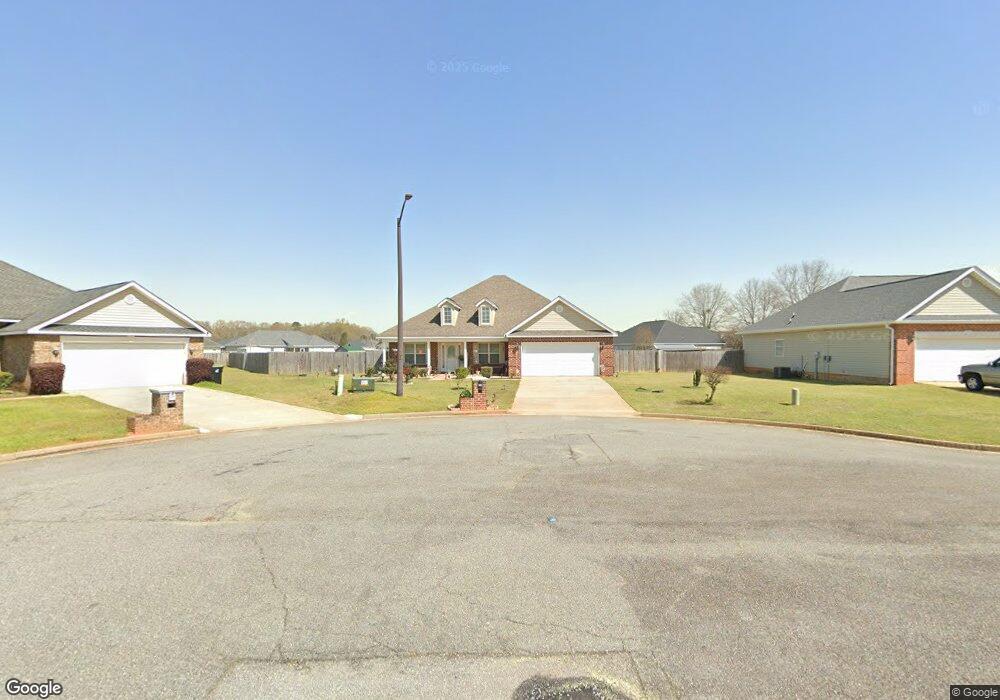
This home is located at 202 Elizabeth Dr, Byron, GA 31008 and is currently estimated at $273,243, approximately $131 per square foot. 202 Elizabeth Dr is a home located in Peach County with nearby schools including Kay Road Elementary School, Fort Valley Middle School, and Peach County High School.
Ownership History
Date
Name
Owned For
Owner Type
Purchase Details
Closed on
May 29, 2009
Sold by
Cb & T Bank Of Middle Georgia
Bought by
Robinson Rudolph J and Robinson Shalanda M
Current Estimated Value
Home Financials for this Owner
Home Financials are based on the most recent Mortgage that was taken out on this home.
Original Mortgage
$119,298
Outstanding Balance
$75,374
Interest Rate
4.77%
Mortgage Type
FHA
Estimated Equity
$197,869
Purchase Details
Closed on
Mar 18, 2009
Sold by
Suwannee Rental Group Llc
Bought by
Cb & T Bank Of Middle Georgia
Purchase Details
Closed on
Feb 21, 2007
Sold by
Bradshaw Development Llc
Bought by
Suwannee Rental Grp Llc
Home Financials for this Owner
Home Financials are based on the most recent Mortgage that was taken out on this home.
Original Mortgage
$140,302
Interest Rate
6.19%
Mortgage Type
New Conventional
Purchase Details
Closed on
Aug 10, 2005
Sold by
Cottonwood Land Corporation
Bought by
Bradshaw Development Llc
Purchase Details
Closed on
Jun 3, 2003
Bought by
Cottonwood Land Corporation
Create a Home Valuation Report for This Property
The Home Valuation Report is an in-depth analysis detailing your home's value as well as a comparison with similar homes in the area
Home Values in the Area
Average Home Value in this Area
Purchase History
| Date | Buyer | Sale Price | Title Company |
|---|---|---|---|
| Robinson Rudolph J | $121,500 | -- | |
| Cb & T Bank Of Middle Georgia | $138,000 | -- | |
| Suwannee Rental Grp Llc | $138,913 | -- | |
| Bradshaw Development Llc | -- | -- | |
| Cottonwood Land Corporation | -- | -- |
Source: Public Records
Mortgage History
| Date | Status | Borrower | Loan Amount |
|---|---|---|---|
| Open | Robinson Rudolph J | $119,298 | |
| Previous Owner | Suwannee Rental Grp Llc | $140,302 |
Source: Public Records
Tax History Compared to Growth
Tax History
| Year | Tax Paid | Tax Assessment Tax Assessment Total Assessment is a certain percentage of the fair market value that is determined by local assessors to be the total taxable value of land and additions on the property. | Land | Improvement |
|---|---|---|---|---|
| 2024 | $2,991 | $85,320 | $10,000 | $75,320 |
| 2023 | $2,938 | $83,280 | $10,000 | $73,280 |
| 2022 | $1,936 | $73,920 | $10,000 | $63,920 |
| 2021 | $1,905 | $63,000 | $10,000 | $53,000 |
| 2020 | $1,973 | $65,200 | $10,000 | $55,200 |
| 2019 | $1,933 | $63,600 | $10,000 | $53,600 |
| 2018 | $1,774 | $58,240 | $10,000 | $48,240 |
| 2017 | $1,782 | $58,240 | $10,000 | $48,240 |
| 2016 | $1,775 | $58,240 | $10,000 | $48,240 |
| 2015 | $1,777 | $58,240 | $10,000 | $48,240 |
| 2014 | $1,780 | $58,240 | $10,000 | $48,240 |
| 2013 | -- | $58,240 | $10,000 | $48,240 |
Source: Public Records
Map
Nearby Homes
- 199 Red Tail Cir
- 109 Red Tail Cir
- 107 Red Tail Cir
- 120 Hawks Place
- 120 Hawks Ridge Trace
- 152 Hawks Ridge Trace
- 117 Hawks Ridge Trace
- 127 Hawks Ridge Trace
- 219 Rowland Cir
- 167 Erin Ct
- 127 Erin Ct
- 0 Housers Mill Rd Unit 5515996
- 0 Barker Rd Unit 243030
- 0 Barker Rd Unit 14258525
- 0 Barker Rd Unit 175053
- 24C Sterling Dr
- 204 Elizabeth Dr
- 200 Elizabeth Dr
- 404 Brandon Way
- 206 Elizabeth Dr
- 105 Schroer Dr
- 0 Brandon Way Unit 88 7467155
- 0 Brandon Way Unit 88
- 0 Brandon Way Unit 8648139
- 402 Brandon Way
- 103 Schroer Dr
- 107 Schroer Dr
- 201 Schroer Dr
- 112 Elizabeth Dr
- 201 Elizabeth Dr
- 203 Elizabeth Dr
- 400 Brandon Way
- 203 Schroer Dr
- 205 Elizabeth Dr
- 409 Brandon Way
- 205 Schroer Dr