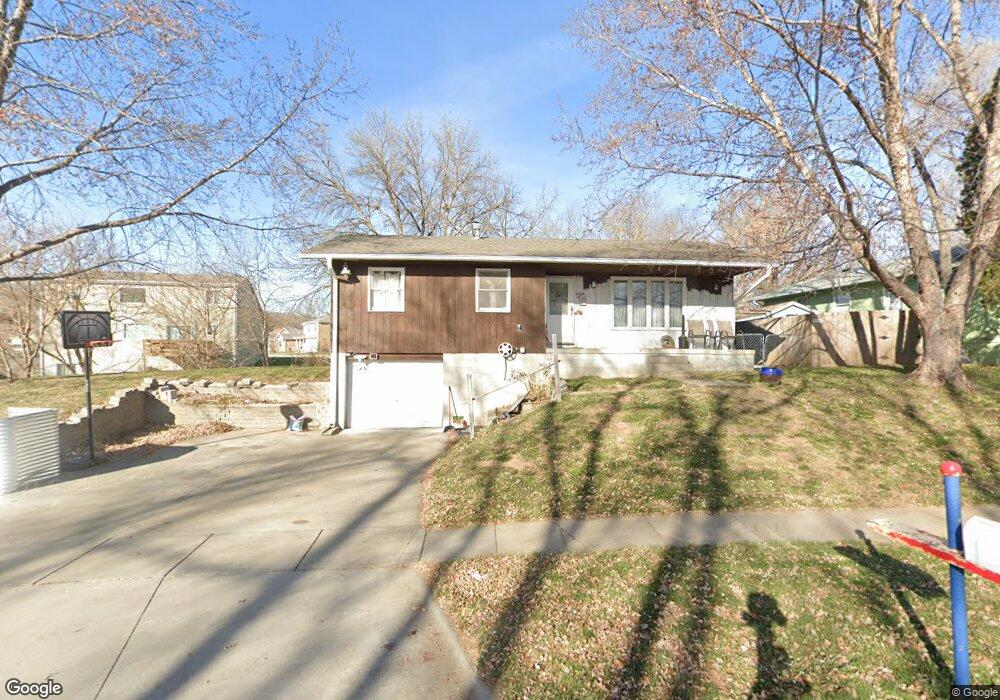
202 Fairview Dr Glenwood, IA 51534
Estimated Value: $220,000 - $275,000
3
Beds
2
Baths
1,040
Sq Ft
$235/Sq Ft
Est. Value
About This Home
This home is located at 202 Fairview Dr, Glenwood, IA 51534 and is currently estimated at $243,990, approximately $234 per square foot. 202 Fairview Dr is a home located in Mills County with nearby schools including Northeast Elementary School, West Elementary School, and Glenwood Middle School.
Ownership History
Date
Name
Owned For
Owner Type
Purchase Details
Closed on
Jun 25, 2021
Sold by
Ring Wilma L
Bought by
Ring Gary L
Current Estimated Value
Purchase Details
Closed on
Mar 23, 2012
Sold by
Ring Wilma L
Bought by
Ring Gary L and Ring Wilma L
Create a Home Valuation Report for This Property
The Home Valuation Report is an in-depth analysis detailing your home's value as well as a comparison with similar homes in the area
Home Values in the Area
Average Home Value in this Area
Purchase History
| Date | Buyer | Sale Price | Title Company |
|---|---|---|---|
| Ring Gary L | -- | None Listed On Document | |
| Ring Gary L | -- | None Listed On Document | |
| Ring Gary L | -- | None Available |
Source: Public Records
Tax History Compared to Growth
Tax History
| Year | Tax Paid | Tax Assessment Tax Assessment Total Assessment is a certain percentage of the fair market value that is determined by local assessors to be the total taxable value of land and additions on the property. | Land | Improvement |
|---|---|---|---|---|
| 2025 | $3,486 | $221,795 | $40,584 | $181,211 |
| 2024 | $3,486 | $199,541 | $40,584 | $158,957 |
| 2023 | $3,590 | $194,794 | $21,360 | $173,434 |
| 2022 | $3,502 | $161,325 | $21,360 | $139,965 |
| 2021 | $3,230 | $161,325 | $21,360 | $139,965 |
| 2020 | $3,230 | $139,792 | $21,360 | $118,432 |
| 2019 | $2,966 | $129,025 | $0 | $0 |
| 2018 | $2,906 | $129,025 | $0 | $0 |
| 2017 | $2,724 | $124,344 | $0 | $0 |
| 2016 | $2,474 | $124,344 | $0 | $0 |
| 2015 | $2,476 | $124,344 | $0 | $0 |
| 2014 | $2,468 | $124,344 | $0 | $0 |
Source: Public Records
Map
Nearby Homes
- 200 10th St
- 1113 Arbor Ln
- 1115 Arbor Ln
- 410 N Vine St
- 314 10th St
- 111 N Chestnut St
- 103 W Florence Ave
- 605 N Locust St
- 101 Heritage Ln
- 316 Louise Ave
- 608 N Locust St
- 407 N Myrtle St
- 122.46 Acres 230th St
- 910 N Locust St
- 12 Pinehurst Cir
- 311 N Grove St
- 1103 N Locust St
- 123 Hillcrest Ave
- 102 Shamrock Cir
- 56797 240th St