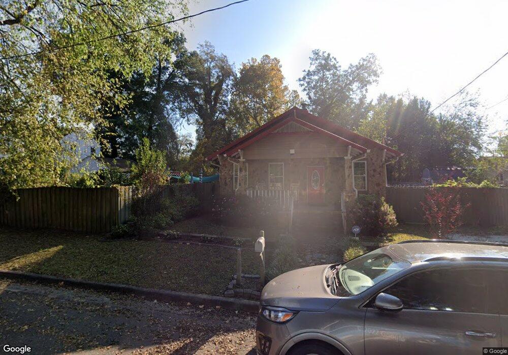
202 Forsythe St Augusta, GA 30901
Olde Town-Pinched Gut NeighborhoodEstimated Value: $139,143 - $204,000
2
Beds
2
Baths
1,080
Sq Ft
$160/Sq Ft
Est. Value
About This Home
This home is located at 202 Forsythe St, Augusta, GA 30901 and is currently estimated at $172,786, approximately $159 per square foot. 202 Forsythe St is a home located in Richmond County with nearby schools including W.S. Hornsby School, W.S. Hornsby Elementary School, and Johnson Magnet.
Ownership History
Date
Name
Owned For
Owner Type
Purchase Details
Closed on
Jun 5, 2019
Sold by
Broadwater Obreyan Q
Bought by
Broadwater Dorian A and Quirk Niall G
Current Estimated Value
Purchase Details
Closed on
Jul 2, 2007
Sold by
Broadwater Crosby
Bought by
Broadwater Dorian A and Broadwater Ombreyan Q
Purchase Details
Closed on
Jun 4, 2002
Sold by
Miller Melvin L
Bought by
Bank One National Assn
Purchase Details
Closed on
Aug 31, 1994
Sold by
Jackson Emmie R
Bought by
Miller Melvin L
Create a Home Valuation Report for This Property
The Home Valuation Report is an in-depth analysis detailing your home's value as well as a comparison with similar homes in the area
Home Values in the Area
Average Home Value in this Area
Purchase History
| Date | Buyer | Sale Price | Title Company |
|---|---|---|---|
| Broadwater Dorian A | -- | -- | |
| Broadwater Dorian A | -- | None Available | |
| Bank One National Assn | $19,600 | -- | |
| Miller Melvin L | $25,500 | -- | |
| Jackson Emmie R | -- | -- |
Source: Public Records
Tax History Compared to Growth
Tax History
| Year | Tax Paid | Tax Assessment Tax Assessment Total Assessment is a certain percentage of the fair market value that is determined by local assessors to be the total taxable value of land and additions on the property. | Land | Improvement |
|---|---|---|---|---|
| 2025 | $2,610 | $75,600 | $1,420 | $74,180 |
| 2024 | $2,610 | $59,608 | $1,420 | $58,188 |
| 2023 | $1,527 | $62,432 | $1,420 | $61,012 |
| 2022 | $1,773 | $48,769 | $1,420 | $47,349 |
| 2021 | $1,442 | $34,982 | $1,411 | $33,571 |
| 2020 | $1,425 | $34,982 | $1,411 | $33,571 |
| 2019 | $1,496 | $29,962 | $1,411 | $28,551 |
| 2018 | $1,505 | $29,962 | $1,411 | $28,551 |
| 2017 | $1,149 | $20,093 | $1,411 | $18,682 |
| 2016 | $1,140 | $20,092 | $1,411 | $18,682 |
| 2015 | $875 | $20,092 | $1,411 | $18,682 |
| 2014 | $482 | $7,267 | $1,411 | $5,856 |
Source: Public Records
Map
Nearby Homes
- 105 Ellis St
- 107 Ellis St Unit B
- 107 Ellis St Unit A
- 107 Ellis St
- 239 1st St
- 112 Broad St
- 106 Broad St
- 109 Ellis St
- 116 Broad St Unit !2L@123^1!2L@123^1
- 116 Broad St Unit C
- 116 Broad St Unit A
- 116 Broad St
- 205 Forsythe St
- 118 Broad St
- 111 Ellis St
- 241 1st St
- 24 Broad St
- 122 Broad St
- 112 Ellis St
- 22 Broad St