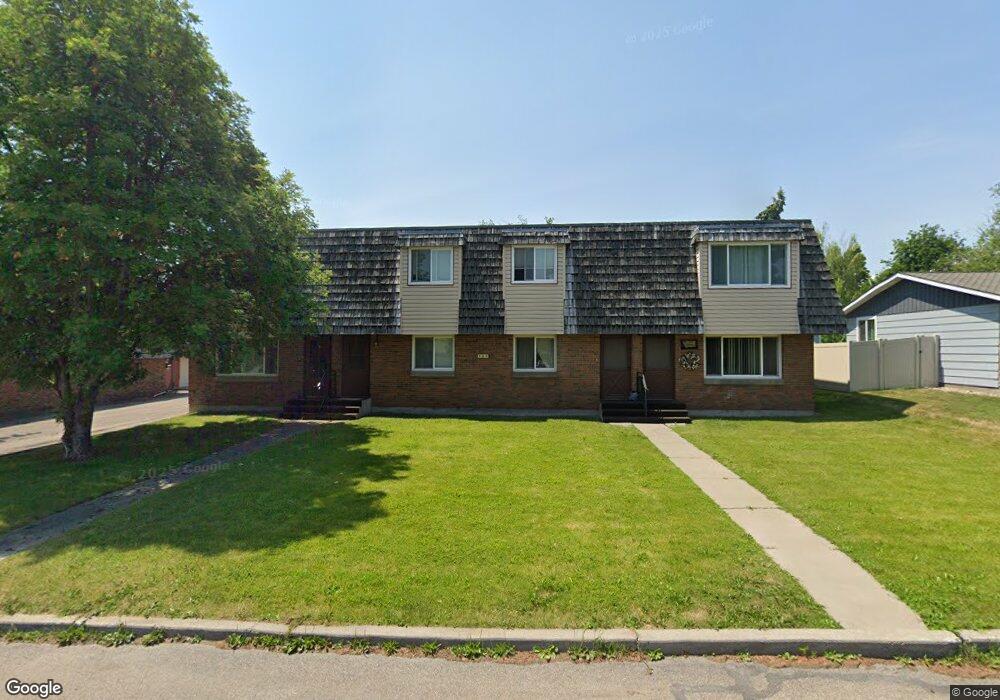
202 Garland St Kalispell, MT 59901
Estimated Value: $313,000 - $421,000
3
Beds
2
Baths
1,156
Sq Ft
$324/Sq Ft
Est. Value
About This Home
This home is located at 202 Garland St, Kalispell, MT 59901 and is currently estimated at $374,073, approximately $323 per square foot. 202 Garland St is a home located in Flathead County with nearby schools including Edgerton School, Kalispell Middle School, and Glacier High School.
Ownership History
Date
Name
Owned For
Owner Type
Purchase Details
Closed on
Jan 6, 2025
Sold by
Ramey Kelson and Ramey Katie
Bought by
Blaine Venture Properties Llc
Current Estimated Value
Home Financials for this Owner
Home Financials are based on the most recent Mortgage that was taken out on this home.
Original Mortgage
$255,000
Outstanding Balance
$247,873
Interest Rate
6.02%
Mortgage Type
Seller Take Back
Estimated Equity
$126,200
Purchase Details
Closed on
Jan 2, 2025
Sold by
Brunaugh Thomas D and Brunaugh Marlene
Bought by
Ramey Kelson and Ramey Katie
Home Financials for this Owner
Home Financials are based on the most recent Mortgage that was taken out on this home.
Original Mortgage
$255,000
Outstanding Balance
$247,873
Interest Rate
6.02%
Mortgage Type
Seller Take Back
Estimated Equity
$126,200
Create a Home Valuation Report for This Property
The Home Valuation Report is an in-depth analysis detailing your home's value as well as a comparison with similar homes in the area
Home Values in the Area
Average Home Value in this Area
Purchase History
| Date | Buyer | Sale Price | Title Company |
|---|---|---|---|
| Blaine Venture Properties Llc | -- | None Listed On Document | |
| Ramey Kelson | -- | None Listed On Document | |
| Ramey Kelson | -- | None Listed On Document |
Source: Public Records
Mortgage History
| Date | Status | Borrower | Loan Amount |
|---|---|---|---|
| Open | Ramey Kelson | $255,000 | |
| Closed | Ramey Kelson | $255,000 |
Source: Public Records
Tax History Compared to Growth
Tax History
| Year | Tax Paid | Tax Assessment Tax Assessment Total Assessment is a certain percentage of the fair market value that is determined by local assessors to be the total taxable value of land and additions on the property. | Land | Improvement |
|---|---|---|---|---|
| 2025 | $1,192 | $248,100 | $0 | $0 |
| 2024 | $1,709 | $219,400 | $0 | $0 |
| 2023 | $2,039 | $219,400 | $0 | $0 |
| 2022 | $2,033 | $165,200 | $0 | $0 |
| 2021 | $1,778 | $165,200 | $0 | $0 |
| 2020 | $1,785 | $134,800 | $0 | $0 |
| 2019 | $1,787 | $134,800 | $0 | $0 |
| 2018 | $760 | $105,600 | $0 | $0 |
| 2017 | $1,523 | $105,600 | $0 | $0 |
| 2016 | $1,280 | $93,600 | $0 | $0 |
| 2015 | $1,279 | $93,600 | $0 | $0 |
| 2014 | $1,251 | $54,643 | $0 | $0 |
Source: Public Records
Map
Nearby Homes
- 125 Sherry Ln
- 173 N Riding Rd
- 188 N Riding Rd
- 117 Northwest Ln Unit B
- 105 Sherwood Ln
- 6 Parkway Dr Unit A & B
- 56 W Northview Loop
- 163 Northland Dr
- 36 W Northview Loop
- 159 Northland Dr
- 2 & 4 Parkway Dr
- 300 Summit Ridge Dr
- 241 Glenwood Dr
- 128 Getty Dr
- 111 Westview Park Place
- 108 Hearst Dr
- 119 Barron Way
- Lot 6 Liberty St
- Lot 9 Liberty St
- Lot 7 Liberty St
- 202 Garland St Unit 1
- 202 Garland St
- 202 Garland St
- 202 Garland St Unit 2
- 204 Garland St
- 200 Garland St
- 200 Garland St
- 200 Garland St Unit 3
- 200 Garland St Unit 1
- 203 Kirsten Dr
- 205 Kirsten Dr
- 201 Kirsten Dr
- 203 Garland St
- 203 Garland St
- 206 Garland St
- 205 Garland St
- 201 Garland St
- 207 Kirsten Dr
- 126 Garland St
- 207 Garland St