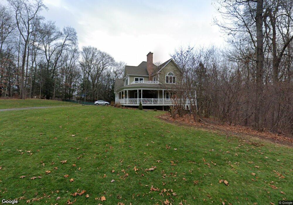
202 Hannah Ln Coventry, CT 06238
Estimated Value: $676,000 - $792,000
4
Beds
4
Baths
3,307
Sq Ft
$224/Sq Ft
Est. Value
About This Home
This home is located at 202 Hannah Ln, Coventry, CT 06238 and is currently estimated at $742,323, approximately $224 per square foot. 202 Hannah Ln is a home with nearby schools including Coventry Grammar School, George Hersey Robertson School, and Capt. Nathan Hale School.
Ownership History
Date
Name
Owned For
Owner Type
Purchase Details
Closed on
May 16, 2012
Sold by
Brewster-Earle W
Bought by
Earle Brewster-Earle W and Earle Jessica
Current Estimated Value
Purchase Details
Closed on
Mar 19, 2012
Sold by
Liberty Croft Ests Llc
Bought by
Earle W B
Create a Home Valuation Report for This Property
The Home Valuation Report is an in-depth analysis detailing your home's value as well as a comparison with similar homes in the area
Home Values in the Area
Average Home Value in this Area
Purchase History
| Date | Buyer | Sale Price | Title Company |
|---|---|---|---|
| Earle Brewster-Earle W | -- | -- | |
| Earle W B | $115,000 | -- | |
| Earle Brewster-Earle W | -- | -- | |
| Earle W B | $115,000 | -- |
Source: Public Records
Mortgage History
| Date | Status | Borrower | Loan Amount |
|---|---|---|---|
| Open | Earle W B | $381,000 | |
| Closed | Earle W B | $400,000 | |
| Closed | Earle W B | $16,544 |
Source: Public Records
Tax History
| Year | Tax Paid | Tax Assessment Tax Assessment Total Assessment is a certain percentage of the fair market value that is determined by local assessors to be the total taxable value of land and additions on the property. | Land | Improvement |
|---|---|---|---|---|
| 2025 | $12,505 | $526,300 | $92,200 | $434,100 |
| 2024 | $12,258 | $368,000 | $74,500 | $293,500 |
| 2023 | $11,680 | $368,000 | $74,500 | $293,500 |
| 2022 | $11,463 | $368,000 | $74,500 | $293,500 |
| 2021 | $11,463 | $368,000 | $74,500 | $293,500 |
| 2020 | $11,471 | $368,000 | $74,500 | $293,500 |
| 2019 | $11,180 | $347,200 | $74,500 | $272,700 |
| 2018 | $12,407 | $385,300 | $80,200 | $305,100 |
| 2017 | $12,330 | $385,300 | $80,200 | $305,100 |
| 2016 | $12,021 | $385,300 | $80,200 | $305,100 |
| 2015 | $12,021 | $385,300 | $80,200 | $305,100 |
| 2014 | $11,146 | $391,500 | $90,500 | $301,000 |
Source: Public Records
Map
Nearby Homes
- 395 Grant Hill Rd Unit Lot21
- 395 Grant Hill (Mill Race Drive) Lot #21 Rd
- 361 Dunn Rd
- 37 Wolf Hill Rd Unit Lot 40
- 37 Wolf Hill Lot (#40) Rd
- 25 Wolf Hill Rd
- 279 Mark Dr
- 64 Columbine Rd
- 106 David Dr
- 15 Elm Rd
- 499 Woodmont Dr
- 864 Boston Turnpike
- 0 Boston Turnpike Unit 24128587
- 93 Dockerel Rd
- 0 Mile Hill Rd
- 39 Josephine Way
- 21 Josephine Way
- 38 Josephine Way
- 32 Josephine Way
- 312 Merrow Rd
Your Personal Tour Guide
Ask me questions while you tour the home.