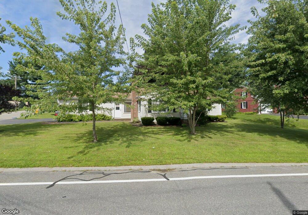
202 Maple St West Boylston, MA 01583
Estimated Value: $440,000 - $457,000
2
Beds
2
Baths
1,080
Sq Ft
$415/Sq Ft
Est. Value
About This Home
This home is located at 202 Maple St, West Boylston, MA 01583 and is currently estimated at $447,877, approximately $414 per square foot. 202 Maple St is a home located in Worcester County with nearby schools including Major Edwards Elementary School, West Boylston Junior/Senior High School, and Abby Kelley Foster Charter Public School.
Ownership History
Date
Name
Owned For
Owner Type
Purchase Details
Closed on
Feb 25, 2021
Sold by
Geneva Thomas R
Bought by
Geneva Thomas R
Current Estimated Value
Purchase Details
Closed on
Aug 13, 2014
Sold by
Geneva Margaret J
Bought by
Geneva Thomas R
Purchase Details
Closed on
Sep 29, 1999
Sold by
Sunter Betty C
Bought by
Geneva Thomas R and Geneva Margaaret J
Home Financials for this Owner
Home Financials are based on the most recent Mortgage that was taken out on this home.
Original Mortgage
$104,000
Interest Rate
7.85%
Mortgage Type
Purchase Money Mortgage
Purchase Details
Closed on
Aug 31, 1989
Sold by
Pappas Beatrice
Bought by
Sunter Betty
Create a Home Valuation Report for This Property
The Home Valuation Report is an in-depth analysis detailing your home's value as well as a comparison with similar homes in the area
Home Values in the Area
Average Home Value in this Area
Purchase History
| Date | Buyer | Sale Price | Title Company |
|---|---|---|---|
| Geneva Thomas R | -- | None Available | |
| Geneva Thomas R | -- | -- | |
| Geneva Thomas R | $130,000 | -- | |
| Sunter Betty | $124,000 | -- |
Source: Public Records
Mortgage History
| Date | Status | Borrower | Loan Amount |
|---|---|---|---|
| Previous Owner | Sunter Betty | $113,000 | |
| Previous Owner | Sunter Betty | $108,100 | |
| Previous Owner | Sunter Betty | $104,000 | |
| Previous Owner | Sunter Betty | $100,500 |
Source: Public Records
Tax History Compared to Growth
Tax History
| Year | Tax Paid | Tax Assessment Tax Assessment Total Assessment is a certain percentage of the fair market value that is determined by local assessors to be the total taxable value of land and additions on the property. | Land | Improvement |
|---|---|---|---|---|
| 2025 | $51 | $367,600 | $102,000 | $265,600 |
| 2024 | $5,028 | $340,200 | $102,000 | $238,200 |
| 2023 | $5,028 | $322,700 | $101,200 | $221,500 |
| 2022 | $4,800 | $271,500 | $101,200 | $170,300 |
| 2021 | $4,687 | $253,900 | $98,000 | $155,900 |
| 2020 | $4,563 | $248,300 | $98,000 | $150,300 |
| 2019 | $4,356 | $231,100 | $98,000 | $133,100 |
| 2018 | $4,152 | $223,100 | $98,000 | $125,100 |
| 2017 | $4,458 | $200,100 | $98,000 | $102,100 |
| 2016 | $3,666 | $198,700 | $91,400 | $107,300 |
| 2015 | $3,519 | $191,900 | $90,500 | $101,400 |
Source: Public Records
Map
Nearby Homes
- 1 Highland Ave
- 39 Davidson Rd
- 62 Maple St
- 12 Birchbrush Ln
- 54 Maple St
- 740 Burncoat St Unit B
- 156 Hillside Village Dr
- 152 Worcester St Unit 8
- 33 Meola Ave
- 39 Meola Ave
- 33 Isleboro St
- 83 Hillside Village Dr
- 1110 W Boylston St Unit A
- 97 Hillside Village Dr
- 29 Isleboro St
- 59 Santoro Rd
- 1097 W Boylston St
- 44 Dixfield St
- 156 Prospect St
- 22 Danielles Way
- 194 Maple St
- 6 Kings Mountain Dr
- 7 Kings Mountain Dr
- 207 Maple St
- 201 Maple St
- 192 Maple St
- 25 Lexington Dr
- 1 Shrewsbury St
- 14 Lexington Dr
- 190 Maple St
- 28 Lexington Dr
- 4 Valley Forge Cir
- 9 Valley Forge Cir
- 2 Shrewsbury St
- 217 Maple St
- 220 Maple St
- 21 Lexington Dr
- 3 Fort Niagara Dr
- 8 Shrewsbury St
- 187 Maple St