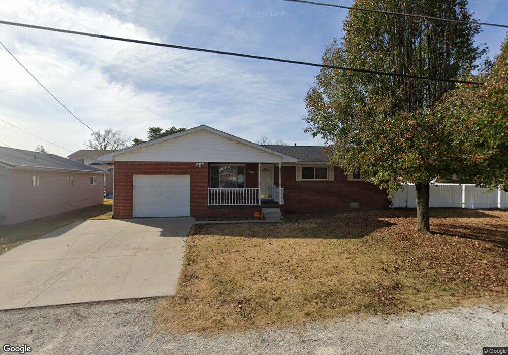
202 Michael St South Point, OH 45680
Estimated Value: $178,000 - $248,000
3
Beds
3
Baths
1,260
Sq Ft
$169/Sq Ft
Est. Value
About This Home
This home is located at 202 Michael St, South Point, OH 45680 and is currently estimated at $213,171, approximately $169 per square foot. 202 Michael St is a home located in Lawrence County with nearby schools including South Point High School.
Ownership History
Date
Name
Owned For
Owner Type
Purchase Details
Closed on
Jul 14, 2020
Sold by
Patrick Martin C and Patrick Virginia
Bought by
Brammer John W and Brammer Kylah M
Current Estimated Value
Home Financials for this Owner
Home Financials are based on the most recent Mortgage that was taken out on this home.
Original Mortgage
$160,200
Outstanding Balance
$141,060
Interest Rate
3.2%
Mortgage Type
Commercial
Estimated Equity
$72,111
Purchase Details
Closed on
Feb 23, 1994
Sold by
Mills Charles R and Mills Ruth
Bought by
Patrick Martin C and Patrick Virgi
Create a Home Valuation Report for This Property
The Home Valuation Report is an in-depth analysis detailing your home's value as well as a comparison with similar homes in the area
Home Values in the Area
Average Home Value in this Area
Purchase History
| Date | Buyer | Sale Price | Title Company |
|---|---|---|---|
| Brammer John W | $177,000 | None Available | |
| Patrick Martin C | $70,000 | -- |
Source: Public Records
Mortgage History
| Date | Status | Borrower | Loan Amount |
|---|---|---|---|
| Open | Brammer John W | $160,200 |
Source: Public Records
Tax History
| Year | Tax Paid | Tax Assessment Tax Assessment Total Assessment is a certain percentage of the fair market value that is determined by local assessors to be the total taxable value of land and additions on the property. | Land | Improvement |
|---|---|---|---|---|
| 2025 | $1,841 | $59,616 | $5,327 | $54,289 |
| 2024 | -- | $50,530 | $4,520 | $46,010 |
| 2023 | $1,736 | $50,530 | $4,520 | $46,010 |
| 2022 | $1,731 | $50,530 | $4,520 | $46,010 |
| 2021 | $1,627 | $44,610 | $3,810 | $40,800 |
| 2020 | $1,639 | $44,610 | $3,810 | $40,800 |
| 2019 | $1,082 | $44,610 | $3,810 | $40,800 |
| 2018 | $1,512 | $40,550 | $3,460 | $37,090 |
| 2017 | $1,391 | $40,550 | $3,460 | $37,090 |
| 2016 | $1,414 | $40,550 | $3,460 | $37,090 |
| 2015 | $1,300 | $34,920 | $3,460 | $31,460 |
| 2014 | $1,298 | $34,920 | $3,460 | $31,460 |
| 2013 | $1,173 | $34,920 | $3,460 | $31,460 |
Source: Public Records
Map
Nearby Homes
- 216 Michael St
- 211 Mason St
- 116 Ashland Dr
- 113 Ashland Dr
- 107 Ashland Dr
- 210 Brubaker Dr
- 114 Ashland Dr
- 106 Garden Ct
- 607 3rd St E
- 113 Nelson Ave
- 0 Orchard Dr Unit Old Farme Subdivisio
- 406 2nd St E
- 102 Park Ave
- 205 Hillview Ln
- 306 2nd St W
- 509 Sharon Ct
- 1907 Walnut St
- 295 Private Road 660 Unit 60
- 1524 Beech St
- 1523 Oak St
- 204 Michael St
- 208 Delores Ave
- 206 Michael St
- 207 Delores Ave
- 201 Michael St
- 204 Delores Ave
- 104 Michael St
- 203 Michael St
- 105 Michael St
- 205 Delores Ave
- 205 Delores Ave
- 103 Michael St
- 101 Michael St
- 207 Michael St
- 208 Michael St
- 210 Michael St
- 102 Michael St
- 203 Delores Ave
- 203 Delores Ave
- 302 Delores Ave
Your Personal Tour Guide
Ask me questions while you tour the home.