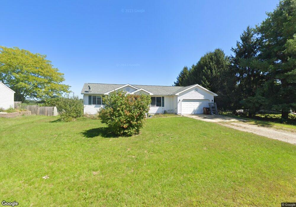
202 N Donegal St Eaton Rapids, MI 48827
Estimated Value: $193,958 - $226,000
3
Beds
2
Baths
1,078
Sq Ft
$199/Sq Ft
Est. Value
About This Home
This home is located at 202 N Donegal St, Eaton Rapids, MI 48827 and is currently estimated at $214,740, approximately $199 per square foot. 202 N Donegal St is a home located in Eaton County with nearby schools including Lockwood Elementary School, Greyhound Intermediate School, and Eaton Rapids Middle School.
Ownership History
Date
Name
Owned For
Owner Type
Purchase Details
Closed on
Dec 21, 2011
Sold by
Green Danny and Green Primrose A
Bought by
Green Danny and Green Primrose A
Current Estimated Value
Home Financials for this Owner
Home Financials are based on the most recent Mortgage that was taken out on this home.
Original Mortgage
$131,490
Interest Rate
4.25%
Mortgage Type
FHA
Create a Home Valuation Report for This Property
The Home Valuation Report is an in-depth analysis detailing your home's value as well as a comparison with similar homes in the area
Home Values in the Area
Average Home Value in this Area
Purchase History
| Date | Buyer | Sale Price | Title Company |
|---|---|---|---|
| Green Danny | -- | Netco Title |
Source: Public Records
Mortgage History
| Date | Status | Borrower | Loan Amount |
|---|---|---|---|
| Closed | Green Danny | $131,490 |
Source: Public Records
Tax History Compared to Growth
Tax History
| Year | Tax Paid | Tax Assessment Tax Assessment Total Assessment is a certain percentage of the fair market value that is determined by local assessors to be the total taxable value of land and additions on the property. | Land | Improvement |
|---|---|---|---|---|
| 2025 | $2,426 | $82,500 | $0 | $0 |
| 2024 | $1,710 | $79,600 | $0 | $0 |
| 2023 | $1,728 | $74,800 | $0 | $0 |
| 2022 | $2,349 | $65,900 | $0 | $0 |
| 2021 | $2,265 | $60,100 | $0 | $0 |
| 2020 | $2,244 | $52,600 | $0 | $0 |
| 2019 | $2,229 | $53,346 | $0 | $0 |
| 2018 | $2,177 | $50,769 | $0 | $0 |
| 2017 | $2,496 | $64,200 | $0 | $0 |
| 2016 | -- | $60,850 | $0 | $0 |
| 2015 | -- | $59,100 | $0 | $0 |
| 2014 | -- | $57,950 | $0 | $0 |
| 2013 | -- | $57,600 | $0 | $0 |
Source: Public Records
Map
Nearby Homes
- 5895 Plains Rd
- 100 S Center St
- 101 S East St
- 618 St Andrews Dr
- 618 Saint Andrews Dr
- 210 Diana St
- 215 E Knight St
- 601 Muirfield Dr
- 605 Muirfield Dr
- Integrity 1880 Plan at Inverness Homes - Integrity
- Elements 2200 Plan at Inverness Homes - Elements
- Elements 2070 Plan at Inverness Homes - Elements
- Elements 2390 Plan at Inverness Homes - Elements
- Integrity 2190 Plan at Inverness Homes - Integrity
- Integrity 2000 Plan at Inverness Homes - Integrity
- Integrity 2061 V8.1a Plan at Inverness Homes - Integrity
- Elements 1870 Plan at Inverness Homes - Elements
- Elements 2090 Plan at Inverness Homes - Elements
- Integrity 2080 Plan at Inverness Homes - Integrity
- Integrity 2085 Plan at Inverness Homes - Integrity