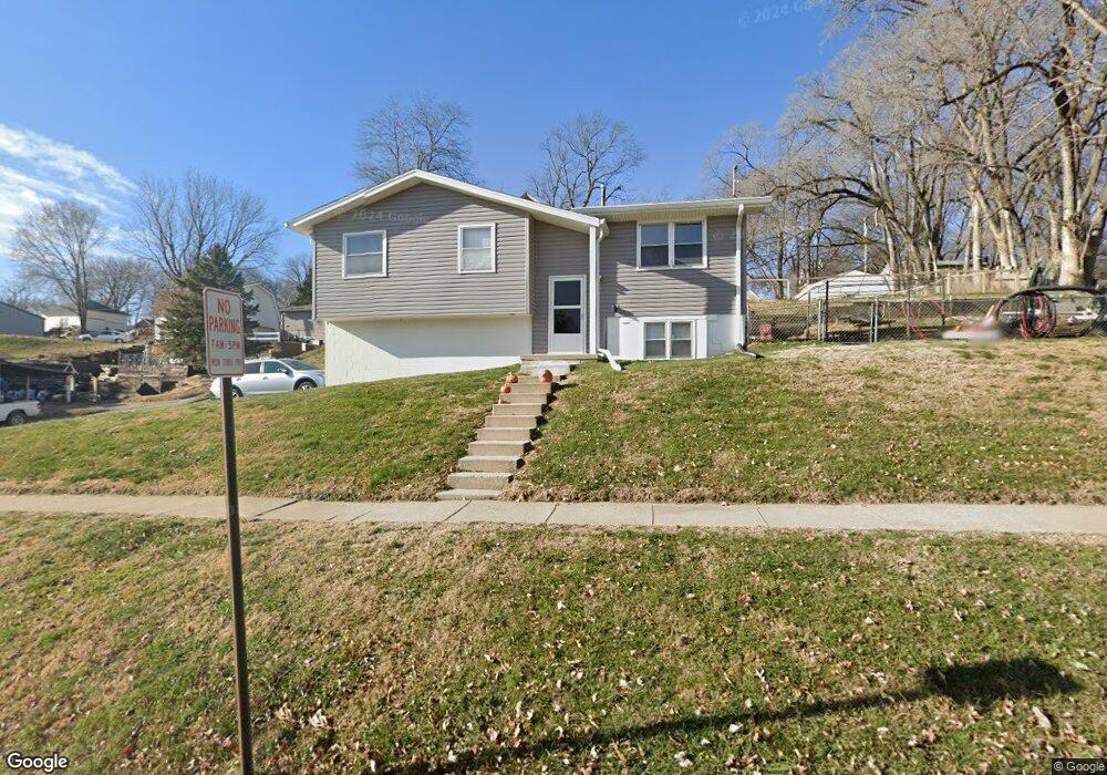
202 N Linn St Glenwood, IA 51534
Estimated Value: $192,000 - $228,000
3
Beds
1
Bath
910
Sq Ft
$226/Sq Ft
Est. Value
About This Home
This home is located at 202 N Linn St, Glenwood, IA 51534 and is currently estimated at $205,314, approximately $225 per square foot. 202 N Linn St is a home with nearby schools including Northeast Elementary School, West Elementary School, and Glenwood Middle School.
Ownership History
Date
Name
Owned For
Owner Type
Purchase Details
Closed on
May 5, 2017
Sold by
Grabow Neal E and Grabow Joni R
Bought by
Maddocks Robert B and Bunnell Jessica A
Current Estimated Value
Home Financials for this Owner
Home Financials are based on the most recent Mortgage that was taken out on this home.
Original Mortgage
$95,060
Outstanding Balance
$78,771
Interest Rate
3.97%
Mortgage Type
New Conventional
Estimated Equity
$126,543
Create a Home Valuation Report for This Property
The Home Valuation Report is an in-depth analysis detailing your home's value as well as a comparison with similar homes in the area
Home Values in the Area
Average Home Value in this Area
Purchase History
| Date | Buyer | Sale Price | Title Company |
|---|---|---|---|
| Maddocks Robert B | $98,000 | None Available |
Source: Public Records
Mortgage History
| Date | Status | Borrower | Loan Amount |
|---|---|---|---|
| Open | Maddocks Robert B | $95,060 |
Source: Public Records
Tax History Compared to Growth
Tax History
| Year | Tax Paid | Tax Assessment Tax Assessment Total Assessment is a certain percentage of the fair market value that is determined by local assessors to be the total taxable value of land and additions on the property. | Land | Improvement |
|---|---|---|---|---|
| 2024 | $2,940 | $178,549 | $32,400 | $146,149 |
| 2023 | $2,582 | $150,827 | $18,396 | $132,431 |
| 2022 | $2,516 | $124,853 | $18,396 | $106,457 |
| 2021 | $2,308 | $124,853 | $18,396 | $106,457 |
| 2020 | $2,308 | $108,475 | $18,396 | $90,079 |
| 2019 | $2,110 | $100,286 | $0 | $0 |
| 2018 | $2,062 | $100,286 | $0 | $0 |
| 2017 | $2,128 | $97,136 | $0 | $0 |
| 2016 | $1,932 | $97,136 | $0 | $0 |
| 2015 | $1,934 | $97,136 | $0 | $0 |
| 2014 | $1,928 | $97,136 | $0 | $0 |
Source: Public Records
Map
Nearby Homes
- 206 N Linn St
- 111 N Chestnut St
- 101 Heritage Ln
- 303 N Walnut St
- 410 N Vine St
- 804 Timber Ln
- 1113 Arbor Ln
- 1115 Arbor Ln
- 605 N Locust St
- 310 N Hazel St
- 608 N Locust St
- 200 10th St
- 311 N Grove St
- 202 Townsend St
- 314 10th St
- 12 Pinehurst Cir
- 316 Louise Ave
- 910 N Locust St
- 124 Glenbrook Dr
- 724 Oak Ridge Dr