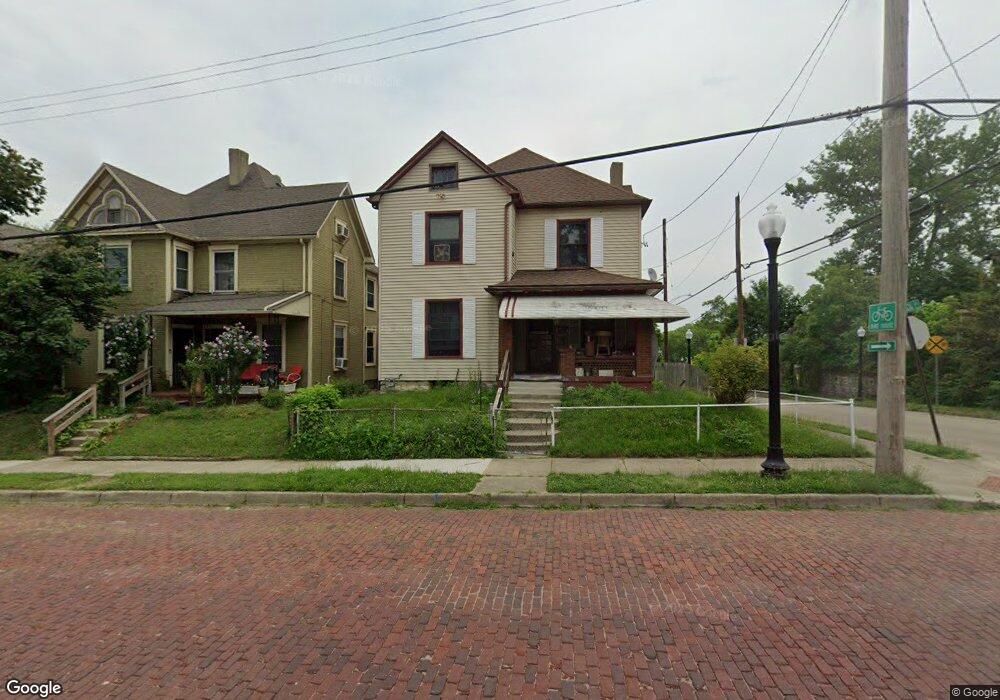
202 N Paul Laurence Dunbar St Dayton, OH 45402
Wolf Creek NeighborhoodEstimated Value: $71,000 - $98,000
3
Beds
1
Bath
1,788
Sq Ft
$49/Sq Ft
Est. Value
About This Home
This home is located at 202 N Paul Laurence Dunbar St, Dayton, OH 45402 and is currently estimated at $86,851, approximately $48 per square foot. 202 N Paul Laurence Dunbar St is a home located in Montgomery County with nearby schools including International School at Residence Park, Louise Troy Elementary, and Westwood Elementary.
Ownership History
Date
Name
Owned For
Owner Type
Purchase Details
Closed on
May 25, 2017
Sold by
Horton Will and Horton Mariyn
Bought by
Horton Joi Lynette and Horton James Christopher
Current Estimated Value
Purchase Details
Closed on
Apr 2, 2016
Sold by
Horton Marilyn J
Bought by
Horton Joi Lynette and Horton Jaems Christopher
Purchase Details
Closed on
Jan 31, 1994
Sold by
Estate Of Amanda Wortham
Bought by
Kay Geraldine
Create a Home Valuation Report for This Property
The Home Valuation Report is an in-depth analysis detailing your home's value as well as a comparison with similar homes in the area
Home Values in the Area
Average Home Value in this Area
Purchase History
| Date | Buyer | Sale Price | Title Company |
|---|---|---|---|
| Horton Joi Lynette | -- | None Available | |
| Horton Joi Lynette | -- | None Available | |
| Kay Geraldine | -- | -- |
Source: Public Records
Tax History Compared to Growth
Tax History
| Year | Tax Paid | Tax Assessment Tax Assessment Total Assessment is a certain percentage of the fair market value that is determined by local assessors to be the total taxable value of land and additions on the property. | Land | Improvement |
|---|---|---|---|---|
| 2024 | $1,506 | $23,840 | $4,100 | $19,740 |
| 2023 | $1,506 | $23,840 | $4,100 | $19,740 |
| 2022 | $1,395 | $18,620 | $3,200 | $15,420 |
| 2021 | $1,388 | $18,620 | $3,200 | $15,420 |
| 2020 | $1,385 | $18,620 | $3,200 | $15,420 |
| 2019 | $1,316 | $15,960 | $3,200 | $12,760 |
| 2018 | $1,318 | $15,960 | $3,200 | $12,760 |
| 2017 | $1,274 | $15,960 | $3,200 | $12,760 |
| 2016 | $1,338 | $15,960 | $3,200 | $12,760 |
| 2015 | $1,266 | $15,960 | $3,200 | $12,760 |
| 2014 | $1,266 | $15,960 | $3,200 | $12,760 |
| 2012 | -- | $14,320 | $3,220 | $11,100 |
Source: Public Records
Map
Nearby Homes
- 1527 W 1st St
- 1540 W 2nd St
- 149 Edison St
- 408 N Conover St
- 1568 W 2nd St
- 235 Mercer Ave
- 1151 W 2nd St
- 1005 W Third St
- 1009 W Third St
- 997 W Third St
- The Aviator Plan at The Townes at Wright Dunbar
- 66 Barnett St Unit 64
- 721 Kumler Ave
- 403 S Euclid Ave
- 401 S Euclid Ave Unit 403
- 121 Gordon Ave
- 809 Faulkner Ave
- 37 Mound St
- 51 Mound St
- 55 Mound St
- 208 S Paul Laurence Dunbar St
- 208 Paul Laurence
- 208 N Paul Laurence Dunbar St
- 128 N Paul Laurence Dunbar St
- 214 N Paul Laurence Dunbar St
- 218 N Paul Laurence Dunbar St
- 207 N Paul Laurence Dunbar St
- 131 N Paul Laurence Dunbar St
- 220 N Paul Laurence Dunbar St
- 220 N Summit St
- 211 N Paul Laurence Dunbar St
- 123 N Paul Laurence Dunbar St
- 224 N Paul Laurence Dunbar St
- 1513 W 1st St
- 219 N Paul Laurence Dunbar St
- 223 N Paul Laurence Dunbar St
- 1508 W 1st St
- 227 N Paul Laurence Dunbar St
- 1505 W 2nd St
- 1519 W 1st St