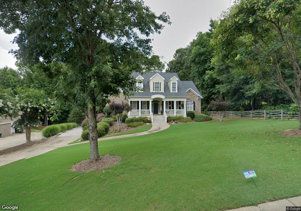
202 Newport Dr Unit 36 Peachtree City, GA 30269
Estimated Value: $923,000 - $1,273,000
5
Beds
5
Baths
4,272
Sq Ft
$251/Sq Ft
Est. Value
About This Home
This home is located at 202 Newport Dr Unit 36, Peachtree City, GA 30269 and is currently estimated at $1,070,852, approximately $250 per square foot. 202 Newport Dr Unit 36 is a home located in Fayette County with nearby schools including Kedron Elementary School, Booth Middle School, and McIntosh High School.
Ownership History
Date
Name
Owned For
Owner Type
Purchase Details
Closed on
Apr 26, 2013
Sold by
Pursley Mark E
Bought by
Buckalew Edward and Buckalew Lisa
Current Estimated Value
Home Financials for this Owner
Home Financials are based on the most recent Mortgage that was taken out on this home.
Original Mortgage
$345,000
Outstanding Balance
$245,674
Interest Rate
3.59%
Mortgage Type
New Conventional
Estimated Equity
$825,178
Purchase Details
Closed on
Aug 25, 2000
Sold by
Alpha Vi Inc
Bought by
Pursley Mark E and Pursley Ann E
Home Financials for this Owner
Home Financials are based on the most recent Mortgage that was taken out on this home.
Original Mortgage
$252,700
Interest Rate
8.24%
Mortgage Type
New Conventional
Create a Home Valuation Report for This Property
The Home Valuation Report is an in-depth analysis detailing your home's value as well as a comparison with similar homes in the area
Home Values in the Area
Average Home Value in this Area
Purchase History
| Date | Buyer | Sale Price | Title Company |
|---|---|---|---|
| Buckalew Edward | $545,000 | -- | |
| Pursley Mark E | $459,000 | -- |
Source: Public Records
Mortgage History
| Date | Status | Borrower | Loan Amount |
|---|---|---|---|
| Open | Buckalew Edward | $345,000 | |
| Previous Owner | Pursley Mark E | $252,700 |
Source: Public Records
Tax History Compared to Growth
Tax History
| Year | Tax Paid | Tax Assessment Tax Assessment Total Assessment is a certain percentage of the fair market value that is determined by local assessors to be the total taxable value of land and additions on the property. | Land | Improvement |
|---|---|---|---|---|
| 2024 | $8,696 | $373,788 | $70,000 | $303,788 |
| 2023 | $8,192 | $359,000 | $70,000 | $289,000 |
| 2022 | $8,381 | $341,680 | $57,000 | $284,680 |
| 2021 | $7,730 | $285,040 | $57,000 | $228,040 |
| 2020 | $8,330 | $270,240 | $57,000 | $213,240 |
| 2019 | $6,924 | $222,800 | $57,000 | $165,800 |
| 2018 | $7,730 | $244,560 | $57,000 | $187,560 |
| 2017 | $7,159 | $264,880 | $57,000 | $207,880 |
| 2016 | $8,250 | $249,760 | $57,000 | $192,760 |
| 2015 | $7,739 | $230,600 | $57,000 | $173,600 |
| 2014 | $7,398 | $216,760 | $57,000 | $159,760 |
| 2013 | -- | $212,920 | $0 | $0 |
Source: Public Records
Map
Nearby Homes
- 133 Sea Island Dr
- 132 Sea Island Dr
- 718 Avalon Way
- 301 Abercorn Square
- 117 N Cove Dr
- 504 Telfair Park
- 512 Las Brasis Ct
- 102 Passage Point
- 206 Las Brasis Ct
- 100 Smokerise Trace
- 404 Las Brasis Ct
- 109 Peninsula Dr
- 103 Ardenlee Dr
- 203 Birkhill
- 134 Mellington Ln
- 308 Dalston Way
- 230 Smokerise Trace
- 112 Bridgewater Dr
- 235 Smokerise Trace
- 107 Rolling Green
- 202 Newport Dr
- 204 Newport Dr
- 102 Regents Square
- 100 Regents Square
- 206 Newport Dr
- 206 Aurora Way
- 104 Regents Square
- 203 Newport Dr
- 207 Aurora Way
- 300 Coronado Dr
- 204 Aurora Way Unit 25
- 204 Aurora Way
- 205 Newport Dr
- 208 Newport Dr
- 205 Aurora Way Unit 28
- 205 Aurora Way
- 0 Aurora Way Unit 7089959
- 0 Aurora Way Unit 7179491
- 0 Aurora Way Unit 7360659
- 0 Aurora Way Unit 7447945