Estimated Value: $108,029 - $136,000
3
Beds
1
Bath
1,011
Sq Ft
$126/Sq Ft
Est. Value
About This Home
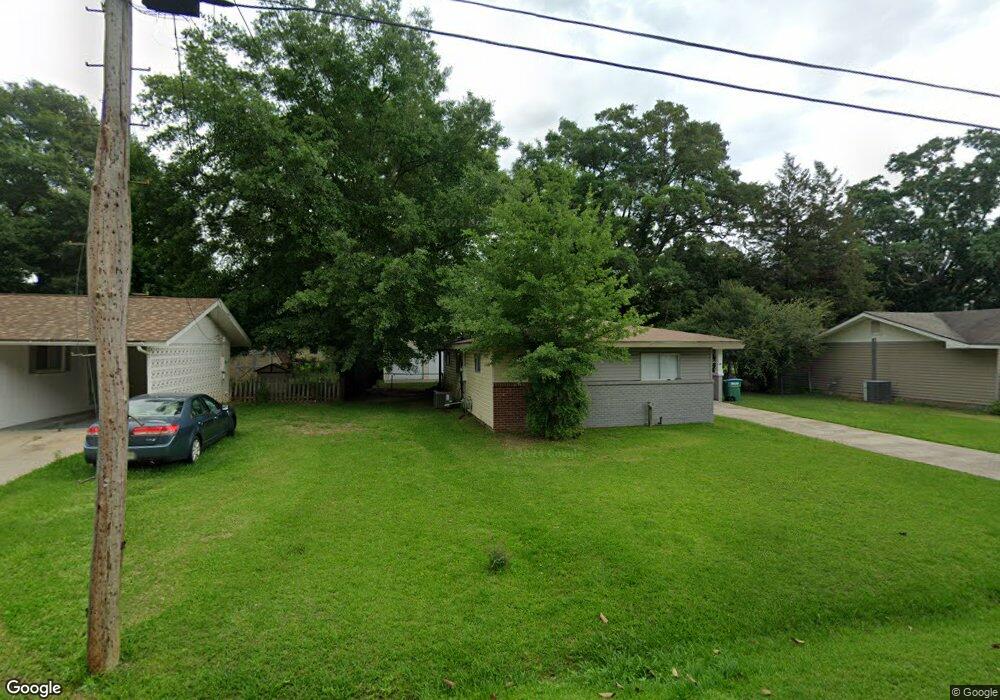
This home is located at 202 North St, Petal, MS 39465 and is currently estimated at $127,007, approximately $125 per square foot. 202 North St is a home located in Forrest County with nearby schools including Petal Primary School, Petal Elementary School, and Petal Middle School.
Ownership History
Date
Name
Owned For
Owner Type
Purchase Details
Closed on
Mar 22, 2018
Sold by
Jaynes Ryan A and Jaynes Bonita N
Bought by
Davis Brooks M
Current Estimated Value
Home Financials for this Owner
Home Financials are based on the most recent Mortgage that was taken out on this home.
Original Mortgage
$74,277
Outstanding Balance
$63,139
Interest Rate
4.5%
Mortgage Type
FHA
Estimated Equity
$63,868
Purchase Details
Closed on
Aug 4, 2010
Sold by
Deutsche Bank Trust Company
Bought by
Jaynes Ryan A and Jaynes Bonita N
Create a Home Valuation Report for This Property
The Home Valuation Report is an in-depth analysis detailing your home's value as well as a comparison with similar homes in the area
Home Values in the Area
Average Home Value in this Area
Purchase History
| Date | Buyer | Sale Price | Title Company |
|---|---|---|---|
| Davis Brooks M | -- | -- | |
| Jaynes Ryan A | -- | -- |
Source: Public Records
Mortgage History
| Date | Status | Borrower | Loan Amount |
|---|---|---|---|
| Open | Davis Brooks M | $74,277 |
Source: Public Records
Tax History
| Year | Tax Paid | Tax Assessment Tax Assessment Total Assessment is a certain percentage of the fair market value that is determined by local assessors to be the total taxable value of land and additions on the property. | Land | Improvement |
|---|---|---|---|---|
| 2025 | $832 | $6,104 | $0 | $0 |
| 2024 | $832 | $5,070 | $0 | $0 |
| 2023 | $690 | $50,700 | $0 | $0 |
| 2022 | $1,303 | $7,606 | $0 | $0 |
| 2021 | $1,310 | $7,606 | $0 | $0 |
| 2020 | $655 | $7,387 | $0 | $0 |
| 2019 | $1,277 | $7,387 | $0 | $0 |
| 2018 | $655 | $4,924 | $0 | $0 |
| 2017 | $664 | $4,924 | $0 | $0 |
| 2016 | $623 | $4,698 | $0 | $0 |
| 2015 | -- | $46,984 | $0 | $0 |
| 2014 | -- | $4,698 | $0 | $0 |
Source: Public Records
Map
Nearby Homes
- 208 North St
- 104 Centre Cir
- 522 Old Richton Rd
- 12+/- Ac Evelyn Gandy Pkwy
- 000 Crossroads Place
- 533 Old Richton Rd
- 5.5 +/- Evelyn Gandy Pkwy
- 1123 Evelyn Gandy Pkwy
- 112 E 1st Ave
- 126 Wilson Dr
- 000 Valley Dr
- 221 N Main St
- 0000 N Main St
- 100 Albert St
- 900 Old Richton Rd
- 102 Smith St
- Lot 254 Petal Dr
- 725 Hillcrest Loop
- 115 Smith St
- 303 Petal Dr
Your Personal Tour Guide
Ask me questions while you tour the home.