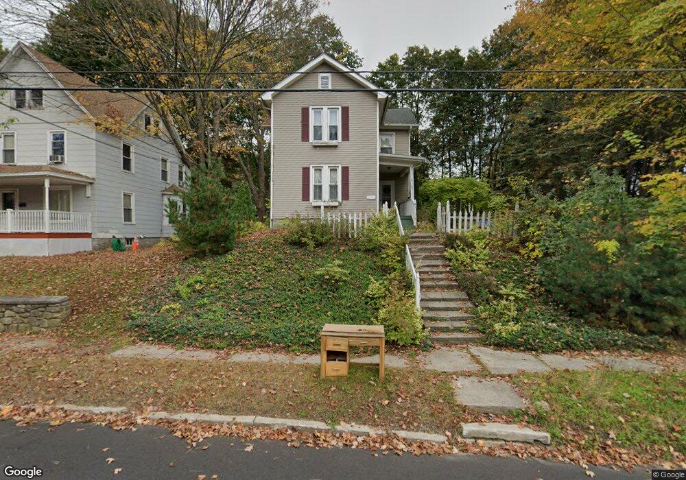
202 Oak St Winsted, CT 06098
Estimated Value: $215,000 - $248,000
3
Beds
2
Baths
1,444
Sq Ft
$156/Sq Ft
Est. Value
About This Home
This home is located at 202 Oak St, Winsted, CT 06098 and is currently estimated at $225,905, approximately $156 per square foot. 202 Oak St is a home located in Litchfield County with nearby schools including Explorations Charter School, St Anthony School, and The Gilbert School.
Ownership History
Date
Name
Owned For
Owner Type
Purchase Details
Closed on
Jan 29, 2001
Sold by
Webster Bk
Bought by
Barber Deborah
Current Estimated Value
Home Financials for this Owner
Home Financials are based on the most recent Mortgage that was taken out on this home.
Original Mortgage
$59,850
Outstanding Balance
$21,842
Interest Rate
7.39%
Estimated Equity
$204,063
Purchase Details
Closed on
Mar 29, 1996
Sold by
Perillo Mark C and Mckitis-Perillo Suanne
Bought by
Backhaus Ruth A
Create a Home Valuation Report for This Property
The Home Valuation Report is an in-depth analysis detailing your home's value as well as a comparison with similar homes in the area
Home Values in the Area
Average Home Value in this Area
Purchase History
| Date | Buyer | Sale Price | Title Company |
|---|---|---|---|
| Barber Deborah | $66,500 | -- | |
| Barber Deborah | $66,500 | -- | |
| Backhaus Ruth A | $83,500 | -- | |
| Backhaus Ruth A | $83,500 | -- |
Source: Public Records
Mortgage History
| Date | Status | Borrower | Loan Amount |
|---|---|---|---|
| Open | Backhaus Ruth A | $59,850 | |
| Closed | Backhaus Ruth A | $59,850 |
Source: Public Records
Tax History Compared to Growth
Tax History
| Year | Tax Paid | Tax Assessment Tax Assessment Total Assessment is a certain percentage of the fair market value that is determined by local assessors to be the total taxable value of land and additions on the property. | Land | Improvement |
|---|---|---|---|---|
| 2025 | $2,426 | $83,160 | $21,840 | $61,320 |
| 2024 | $2,265 | $83,160 | $21,840 | $61,320 |
| 2023 | $2,195 | $83,160 | $21,840 | $61,320 |
| 2022 | $2,538 | $75,670 | $15,820 | $59,850 |
| 2021 | $2,538 | $75,670 | $15,820 | $59,850 |
| 2020 | $2,538 | $75,670 | $15,820 | $59,850 |
| 2019 | $2,538 | $75,670 | $15,820 | $59,850 |
| 2018 | $2,538 | $75,670 | $15,820 | $59,850 |
| 2017 | $2,406 | $71,750 | $15,820 | $55,930 |
| 2016 | $2,406 | $71,750 | $15,820 | $55,930 |
| 2015 | $2,346 | $71,750 | $15,820 | $55,930 |
| 2014 | $2,290 | $71,750 | $15,820 | $55,930 |
Source: Public Records
Map
Nearby Homes