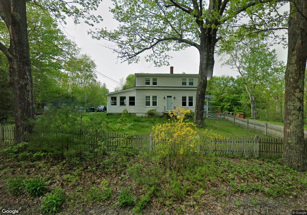
202 Pownal Rd Freeport, ME 04032
Estimated Value: $539,810 - $730,000
3
Beds
2
Baths
1,526
Sq Ft
$386/Sq Ft
Est. Value
About This Home
This home is located at 202 Pownal Rd, Freeport, ME 04032 and is currently estimated at $588,453, approximately $385 per square foot. 202 Pownal Rd is a home with nearby schools including Morse Street School, Mast Landing School, and Freeport Middle School.
Ownership History
Date
Name
Owned For
Owner Type
Purchase Details
Closed on
Aug 26, 2015
Sold by
Haldeman Christy A
Bought by
Haldeman John G
Current Estimated Value
Purchase Details
Closed on
May 19, 2005
Sold by
Haldeman John G and Haldeman Christy A
Bought by
Chase Custom Home & Fin Inc
Create a Home Valuation Report for This Property
The Home Valuation Report is an in-depth analysis detailing your home's value as well as a comparison with similar homes in the area
Home Values in the Area
Average Home Value in this Area
Purchase History
| Date | Buyer | Sale Price | Title Company |
|---|---|---|---|
| Haldeman John G | -- | -- | |
| Chase Custom Home & Fin Inc | -- | -- |
Source: Public Records
Tax History Compared to Growth
Tax History
| Year | Tax Paid | Tax Assessment Tax Assessment Total Assessment is a certain percentage of the fair market value that is determined by local assessors to be the total taxable value of land and additions on the property. | Land | Improvement |
|---|---|---|---|---|
| 2024 | $4,410 | $330,300 | $160,200 | $170,100 |
| 2023 | $4,066 | $295,700 | $145,700 | $150,000 |
| 2022 | $3,847 | $281,800 | $131,800 | $150,000 |
| 2021 | $3,762 | $281,800 | $131,800 | $150,000 |
| 2020 | $3,650 | $260,700 | $122,100 | $138,600 |
| 2019 | $3,488 | $243,900 | $115,200 | $128,700 |
| 2018 | $3,412 | $226,700 | $107,500 | $119,200 |
| 2017 | $3,461 | $231,500 | $117,900 | $113,600 |
| 2016 | $3,388 | $214,400 | $109,100 | $105,300 |
| 2015 | $3,298 | $196,300 | $102,800 | $93,500 |
| 2014 | $3,102 | $196,300 | $102,800 | $93,500 |
| 2013 | $3,100 | $195,600 | $98,000 | $97,600 |
Source: Public Records
Map
Nearby Homes
- 304 Pownal Rd
- 10 Durham Rd
- 15 Percy St
- 42 Durham Rd
- 8 Statler Ln
- 212 Main St
- 1612 U S Route 1
- 4 Harper's Trail
- 11 Orchard Hill Rd
- 143 Bragdon Rd
- 137 Durham Rd
- 26 Harvest Ridge Rd Unit 24
- 162 Merrill Rd
- 1260 Us Route 1
- 15 Tinkers Way
- 31 Sequoia Dr
- 0 Prout Rd
- 15 Sequoia Dr
- 42A Wardtown Rd
- 31 Allen Range Rd
- 200 Pownal Rd
- 0 Leighs Way Unit Map21Lot92 1579774
- 198 Pownal Rd
- 222 Pownal Rd
- 171 Pownal Rd
- 2 Strawberry Patch Ln
- 153 Pownal Rd
- 172 Pownal Rd
- 7 Leighs Way
- 181 Pownal Rd
- 6 Strawberry Patch Ln
- 1 Strawberry Patch Ln
- 2 Leighs Way
- 260 Pownal Rd
- 9 Strawberry Patch Ln
- 11 Strawberry Patch Ln
- 137 Pownal Rd
- 158 Pownal Rd
- 23 Hedgehog Mountain Rd
- 15 Strawberry Patch Ln