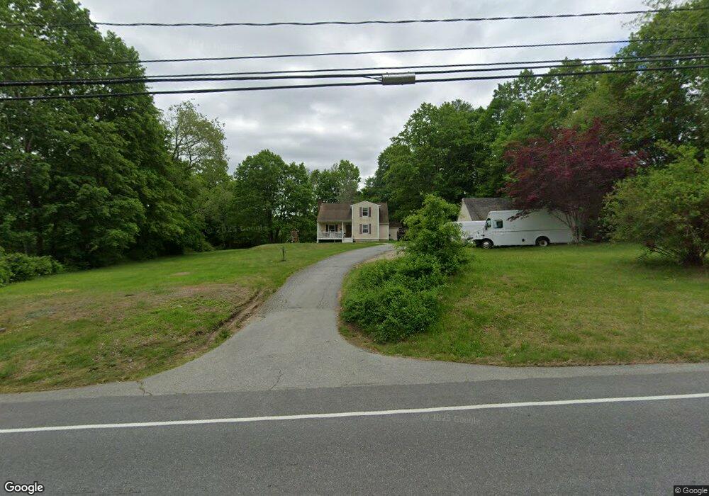
202 Route 165 Preston, CT 06365
Estimated Value: $374,827 - $487,000
3
Beds
2
Baths
1,925
Sq Ft
$223/Sq Ft
Est. Value
About This Home
This home is located at 202 Route 165, Preston, CT 06365 and is currently estimated at $428,457, approximately $222 per square foot. 202 Route 165 is a home located in New London County with nearby schools including Integrated Day Charter School, St. Joseph School, and St. Patrick Cathedral School.
Ownership History
Date
Name
Owned For
Owner Type
Purchase Details
Closed on
Jun 30, 1999
Sold by
Thomsen Mernan H
Bought by
Patterson William L and Patterson Joanne C
Current Estimated Value
Home Financials for this Owner
Home Financials are based on the most recent Mortgage that was taken out on this home.
Original Mortgage
$139,740
Outstanding Balance
$37,999
Interest Rate
7.19%
Estimated Equity
$390,458
Create a Home Valuation Report for This Property
The Home Valuation Report is an in-depth analysis detailing your home's value as well as a comparison with similar homes in the area
Home Values in the Area
Average Home Value in this Area
Purchase History
| Date | Buyer | Sale Price | Title Company |
|---|---|---|---|
| Patterson William L | $137,000 | -- |
Source: Public Records
Mortgage History
| Date | Status | Borrower | Loan Amount |
|---|---|---|---|
| Open | Patterson William L | $139,740 |
Source: Public Records
Tax History Compared to Growth
Tax History
| Year | Tax Paid | Tax Assessment Tax Assessment Total Assessment is a certain percentage of the fair market value that is determined by local assessors to be the total taxable value of land and additions on the property. | Land | Improvement |
|---|---|---|---|---|
| 2024 | $4,427 | $189,420 | $53,830 | $135,590 |
| 2023 | $4,347 | $189,420 | $53,830 | $135,590 |
| 2022 | $3,527 | $126,500 | $44,300 | $82,200 |
| 2021 | $3,408 | $126,500 | $44,300 | $82,200 |
| 2020 | $3,403 | $126,500 | $44,300 | $82,200 |
| 2019 | $3,343 | $126,500 | $44,300 | $82,200 |
| 2018 | $3,293 | $126,500 | $44,300 | $82,200 |
| 2017 | $3,096 | $129,000 | $45,700 | $83,300 |
| 2016 | $3,064 | $129,000 | $45,700 | $83,300 |
| 2015 | $2,967 | $129,000 | $45,700 | $83,300 |
| 2014 | $2,985 | $129,000 | $45,700 | $83,300 |
Source: Public Records
Map
Nearby Homes
- 203 Old Jewett City Rd
- 6 Stanton Ln
- 4 Wilderness Acres
- 63 Route 165
- 59 Long Society Rd
- 17 Daniel St
- 79 Roosevelt Ave
- 381 Route 164
- 168 Corning Rd
- 296 Hamilton Ave Unit 7
- 296 Hamilton Ave Unit 30
- 57 NW Corner Rd
- 39 Doolittle Rd
- 625 N Main St Unit 627
- 313 Central Ave
- 287 Central Ave
- 17 Sylvester St
- 29 Mckay St
- 67 Corning Rd Unit 3
- 67 Corning Rd Unit 22