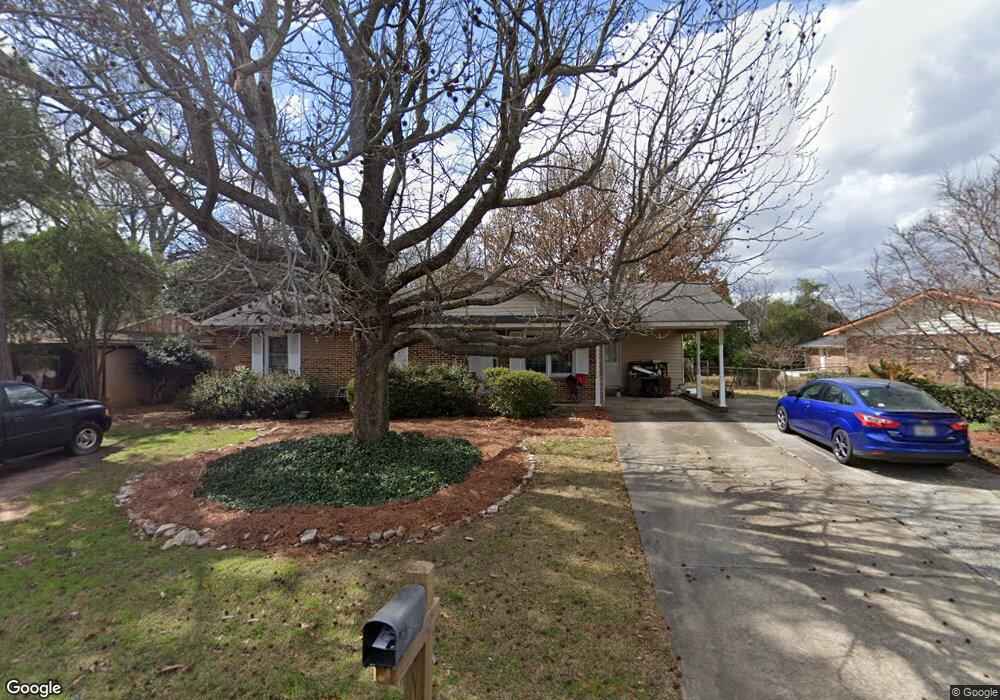
202 Rusty Rd Warner Robins, GA 31088
Estimated Value: $177,000 - $194,433
3
Beds
3
Baths
1,784
Sq Ft
$103/Sq Ft
Est. Value
About This Home
This home is located at 202 Rusty Rd, Warner Robins, GA 31088 and is currently estimated at $184,608, approximately $103 per square foot. 202 Rusty Rd is a home located in Houston County with nearby schools including Russell Elementary School, Warner Robins Middle School, and Warner Robins High School.
Ownership History
Date
Name
Owned For
Owner Type
Purchase Details
Closed on
Oct 20, 1992
Sold by
Roeder Dorothy P
Bought by
Randles Richard A and Cynthia A*
Current Estimated Value
Purchase Details
Closed on
Apr 17, 1978
Sold by
Girvan Roger J
Bought by
Roeder Dorothy P
Purchase Details
Closed on
Apr 10, 1975
Sold by
Ty-Son Dev Co Inc
Bought by
Girvan Roger J
Purchase Details
Closed on
Feb 26, 1973
Sold by
Williams Eugene
Bought by
Ty-Son Dev Co Inc
Purchase Details
Closed on
Dec 14, 1967
Bought by
Williams Eugene
Create a Home Valuation Report for This Property
The Home Valuation Report is an in-depth analysis detailing your home's value as well as a comparison with similar homes in the area
Home Values in the Area
Average Home Value in this Area
Purchase History
| Date | Buyer | Sale Price | Title Company |
|---|---|---|---|
| Randles Richard A | $49,600 | -- | |
| Roeder Dorothy P | $4,100 | -- | |
| Girvan Roger J | $2,600 | -- | |
| Ty-Son Dev Co Inc | $5,000 | -- | |
| Williams Eugene | -- | -- |
Source: Public Records
Tax History
| Year | Tax Paid | Tax Assessment Tax Assessment Total Assessment is a certain percentage of the fair market value that is determined by local assessors to be the total taxable value of land and additions on the property. | Land | Improvement |
|---|---|---|---|---|
| 2024 | $2,012 | $61,480 | $8,000 | $53,480 |
| 2023 | $1,551 | $47,040 | $8,000 | $39,040 |
| 2022 | $877 | $38,120 | $5,200 | $32,920 |
| 2021 | $749 | $32,400 | $5,200 | $27,200 |
| 2020 | $746 | $32,120 | $5,200 | $26,920 |
| 2019 | $746 | $32,120 | $5,200 | $26,920 |
| 2018 | $746 | $32,120 | $5,200 | $26,920 |
| 2017 | $747 | $32,120 | $5,200 | $26,920 |
| 2016 | $748 | $32,120 | $5,200 | $26,920 |
| 2015 | -- | $34,320 | $5,200 | $29,120 |
| 2014 | -- | $34,320 | $5,200 | $29,120 |
| 2013 | -- | $34,320 | $5,200 | $29,120 |
Source: Public Records
Map
Nearby Homes
- 77 Oliver Dr
- 82 Oliver Dr
- 223 Randy Cir
- 211 Palomino Ln
- 205 Sonja Dr
- 213 Self St
- 1850 Russell Pkwy
- 0 Russell Pkwy Unit 10656199
- 305 Bonnie Dr
- 201 Belmont Dr
- 119 Colonial Rd
- 107 Woodfield Dr
- 505 Ashby Way
- 510 Arrowhead Trail
- 100 Belmont Dr
- 118 Fox Glove Ct
- 116 Fox Glove Ct
- 25 & 26 Lot
- 104 Ridgedale Dr
- 108 Woodsdale Dr
- 204 Rusty Rd
- 120 Cheryl Blvd
- 206 Rusty Rd
- 203 Randy Cir
- 73 Oliver Dr
- 201 Randy Cir
- 205 Randy Cir
- 74 Oliver Dr
- 123 Rusty Rd
- 208 Rusty Rd
- 102 Cathy Ct
- 75 Oliver Dr
- 75 Oliver Dr Unit 207 Forest Hill Dr
- 207 Randy Cir
- 209 Rusty Rd
- 119 Cheryl Blvd
- 1239 Russell Pkwy Unit Ste D
- 1239 Russell Pkwy Unit D
- 1239 Russell Pkwy
- 76 Oliver Dr
Your Personal Tour Guide
Ask me questions while you tour the home.