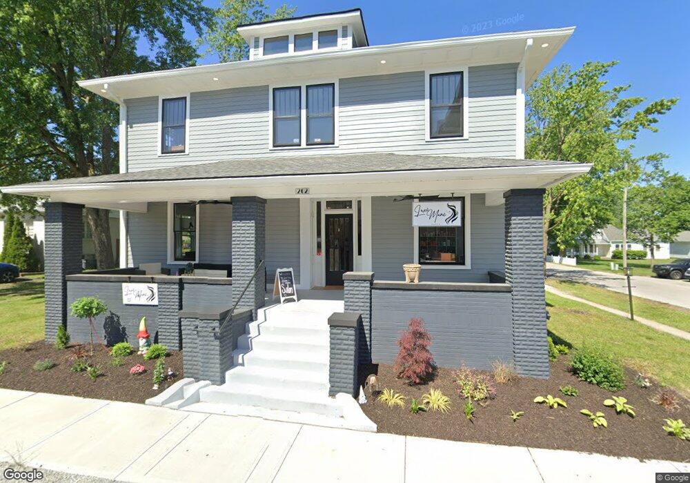
202 S Main St Whitestown, IN 46075
Estimated Value: $359,000 - $406,000
4
Beds
1
Bath
1,792
Sq Ft
$215/Sq Ft
Est. Value
About This Home
This home is located at 202 S Main St, Whitestown, IN 46075 and is currently estimated at $384,754, approximately $214 per square foot. 202 S Main St is a home located in Boone County with nearby schools including Perry Worth Elementary School, Lebanon Middle School, and Lebanon Senior High School.
Ownership History
Date
Name
Owned For
Owner Type
Purchase Details
Closed on
Mar 6, 2023
Sold by
Campbell Charles
Bought by
R & Jc Rental Llc
Current Estimated Value
Create a Home Valuation Report for This Property
The Home Valuation Report is an in-depth analysis detailing your home's value as well as a comparison with similar homes in the area
Home Values in the Area
Average Home Value in this Area
Purchase History
| Date | Buyer | Sale Price | Title Company |
|---|---|---|---|
| R & Jc Rental Llc | $360,000 | Meridian Title Corporation |
Source: Public Records
Tax History Compared to Growth
Tax History
| Year | Tax Paid | Tax Assessment Tax Assessment Total Assessment is a certain percentage of the fair market value that is determined by local assessors to be the total taxable value of land and additions on the property. | Land | Improvement |
|---|---|---|---|---|
| 2025 | $9,530 | $370,100 | $12,200 | $357,900 |
| 2024 | $9,530 | $366,400 | $12,200 | $354,200 |
| 2023 | $9,025 | $335,800 | $12,200 | $323,600 |
| 2022 | $2,839 | $233,900 | $12,200 | $221,700 |
| 2021 | $2,047 | $181,000 | $12,200 | $168,800 |
| 2020 | $1,906 | $170,700 | $12,200 | $158,500 |
| 2019 | $1,669 | $163,900 | $12,200 | $151,700 |
| 2018 | $1,526 | $157,100 | $12,200 | $144,900 |
| 2017 | $1,467 | $156,400 | $12,200 | $144,200 |
| 2016 | $1,649 | $144,400 | $12,200 | $132,200 |
| 2014 | $1,342 | $132,600 | $12,200 | $120,400 |
| 2013 | $1,326 | $132,600 | $12,200 | $120,400 |
Source: Public Records
Map
Nearby Homes
- 207 S Buck St
- 7 Harrison Ave
- 2 Harrison St
- 3347 Churchill Ln
- 307 W Pierce St
- Hendricks Plan at Haven at Whitestown
- Waveland Plan at Haven at Whitestown
- Dawson Plan at Haven at Whitestown
- Sutcliffe Plan at Haven at Whitestown
- Hampton Plan at Haven at Whitestown
- Addison Plan at Haven at Whitestown
- Buckner Plan at Haven at Whitestown
- Sheffield Plan at Haven at Whitestown
- Payton Plan at Haven at Whitestown
- 3406 Preakness St
- 2892 Maricopa Blvd
- 3374 Paisley Pointe
- 6856 Seattle Slew Dr
- 6695 Sugar Creek Ln
- 6433 Wasco Dr