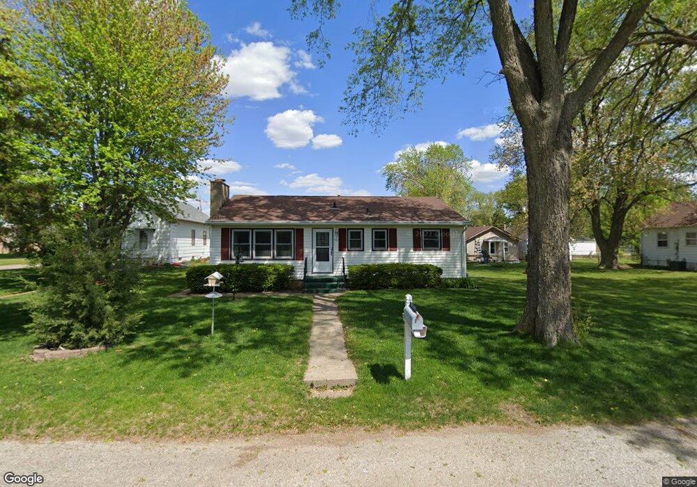
202 Saint John Ave Waterloo, IA 50703
Estimated Value: $100,000 - $137,403
2
Beds
1
Bath
1,092
Sq Ft
$110/Sq Ft
Est. Value
About This Home
This home is located at 202 Saint John Ave, Waterloo, IA 50703 and is currently estimated at $119,601, approximately $109 per square foot. 202 Saint John Ave is a home located in Black Hawk County with nearby schools including Lincoln Elementary School, George Washington Carver Academy, and East High School.
Ownership History
Date
Name
Owned For
Owner Type
Purchase Details
Closed on
Oct 4, 2011
Sold by
Estate Of John Bossom and Bossom David
Bought by
Smith Joesph
Current Estimated Value
Home Financials for this Owner
Home Financials are based on the most recent Mortgage that was taken out on this home.
Original Mortgage
$94,054
Outstanding Balance
$63,975
Interest Rate
4.12%
Mortgage Type
FHA
Estimated Equity
$55,626
Create a Home Valuation Report for This Property
The Home Valuation Report is an in-depth analysis detailing your home's value as well as a comparison with similar homes in the area
Home Values in the Area
Average Home Value in this Area
Purchase History
| Date | Buyer | Sale Price | Title Company |
|---|---|---|---|
| Smith Joesph | $96,500 | None Available |
Source: Public Records
Mortgage History
| Date | Status | Borrower | Loan Amount |
|---|---|---|---|
| Open | Smith Joesph | $94,054 |
Source: Public Records
Tax History Compared to Growth
Tax History
| Year | Tax Paid | Tax Assessment Tax Assessment Total Assessment is a certain percentage of the fair market value that is determined by local assessors to be the total taxable value of land and additions on the property. | Land | Improvement |
|---|---|---|---|---|
| 2025 | $2,350 | $126,890 | $11,160 | $115,730 |
| 2024 | $2,350 | $118,570 | $11,160 | $107,410 |
| 2023 | $1,764 | $118,570 | $11,160 | $107,410 |
| 2022 | $1,656 | $89,220 | $11,160 | $78,060 |
| 2021 | $1,608 | $86,410 | $11,160 | $75,250 |
| 2020 | $1,578 | $79,580 | $9,700 | $69,880 |
| 2019 | $1,578 | $79,580 | $9,700 | $69,880 |
| 2018 | $1,820 | $90,330 | $9,700 | $80,630 |
| 2017 | $1,878 | $90,330 | $9,700 | $80,630 |
| 2016 | $1,852 | $90,330 | $9,700 | $80,630 |
| 2015 | $1,852 | $90,330 | $9,700 | $80,630 |
| 2014 | $1,762 | $84,950 | $9,700 | $75,250 |
Source: Public Records
Map
Nearby Homes
- 1128 Newton St
- 1035 Newton St
- 1021 Kern St
- 848 Kern St
- 231 Mckay Ave Unit 235
- 708 Newton St
- 713 Riehl St
- 618 Kern St
- 545 W Parker St
- 1018 Fairview Ave
- 542 Kern St
- 1920 Cottonwood Ln
- 503 W Dale St
- 320 Riehl St
- 742 Cloverdale Ave
- 516 Upton Ave
- 0.791 Acres W Louise St
- 914 Lincoln St
- 725 Lincoln St
- 2.29 Acres Ansborough Ave
- 208 Saint John Ave
- 128 Saint John Ave
- 124 Saint John Ave
- 118 St John Ave
- 605 Leonard Ave
- 118 Saint John Ave
- 609 Leonard Ave
- 601 Leonard Ave
- 525 Leonard Ave
- 521 Leonard Ave
- 1120 W Parker St
- 1124 W Parker St
- 1116 W Parker St
- 1110 W Parker St
- 1208 W Parker St
- 1210 W Parker St
- 1200 W Parker St
- 1106 W Parker St
- 1100 W Parker St
- 1218 W Parker St