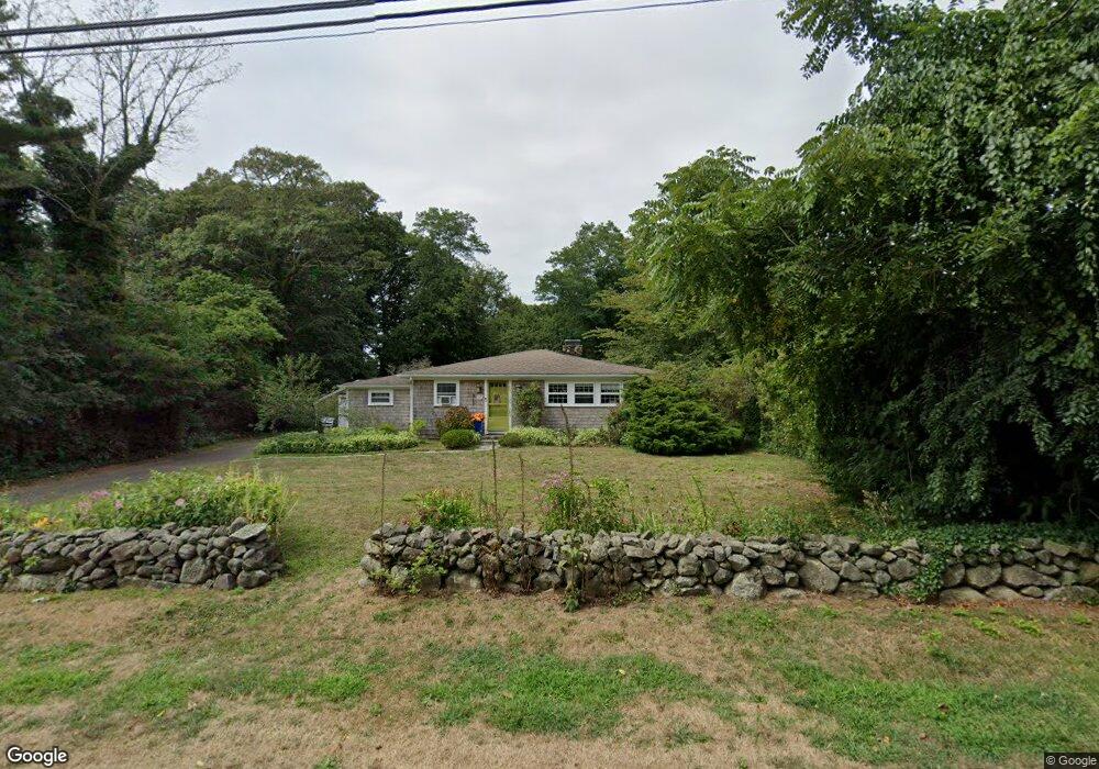
202 Tonset Rd Orleans, MA 02653
Estimated Value: $671,865 - $918,000
3
Beds
1
Bath
1,224
Sq Ft
$651/Sq Ft
Est. Value
About This Home
This home is located at 202 Tonset Rd, Orleans, MA 02653 and is currently estimated at $797,216, approximately $651 per square foot. 202 Tonset Rd is a home located in Barnstable County with nearby schools including Orleans Elementary School, Nauset Regional Middle School, and Nauset Regional High School.
Ownership History
Date
Name
Owned For
Owner Type
Purchase Details
Closed on
Apr 3, 1992
Sold by
Beggs Barbara H
Bought by
Sampson Gerard F and Sampson Symanski-Sampson P
Current Estimated Value
Home Financials for this Owner
Home Financials are based on the most recent Mortgage that was taken out on this home.
Original Mortgage
$25,000
Interest Rate
8.73%
Mortgage Type
Purchase Money Mortgage
Create a Home Valuation Report for This Property
The Home Valuation Report is an in-depth analysis detailing your home's value as well as a comparison with similar homes in the area
Home Values in the Area
Average Home Value in this Area
Purchase History
| Date | Buyer | Sale Price | Title Company |
|---|---|---|---|
| Sampson Gerard F | $95,000 | -- |
Source: Public Records
Mortgage History
| Date | Status | Borrower | Loan Amount |
|---|---|---|---|
| Open | Sampson Gerard F | $39,000 | |
| Closed | Sampson Gerard F | $25,000 |
Source: Public Records
Tax History Compared to Growth
Tax History
| Year | Tax Paid | Tax Assessment Tax Assessment Total Assessment is a certain percentage of the fair market value that is determined by local assessors to be the total taxable value of land and additions on the property. | Land | Improvement |
|---|---|---|---|---|
| 2025 | $3,307 | $530,000 | $271,900 | $258,100 |
| 2024 | $3,279 | $511,500 | $266,500 | $245,000 |
| 2023 | $2,999 | $481,400 | $246,800 | $234,600 |
| 2022 | $3,180 | $441,700 | $280,500 | $161,200 |
| 2021 | $3,102 | $395,700 | $260,300 | $135,400 |
| 2020 | $2,972 | $393,100 | $260,300 | $132,800 |
| 2019 | $2,767 | $373,900 | $243,700 | $130,200 |
| 2018 | $2,411 | $363,700 | $239,000 | $124,700 |
| 2017 | $2,271 | $358,800 | $239,000 | $119,800 |
| 2016 | $2,348 | $363,500 | $246,100 | $117,400 |
| 2015 | $2,282 | $355,400 | $241,300 | $114,100 |
Source: Public Records
Map
Nearby Homes
- 320 State Hwy
- 53 Great Oak Rd
- 150 Old State Hwy Unit Compound
- 18 Cole Place
- 216 Main St
- 20 Kittiwake Ln
- 785 State Hwy Unit 9
- 343 Tonset Rd
- 13 S Orleans Rd Unit 28
- 46 Freeman Ln
- 25 Twin Rocks Dr
- 3 Reilly Run
- 5 Reilly Run
- 2 Reilly Run
- 44 Tonset Rd
- 1061 State Hwy Unit 4
- 1061 State Hwy Unit 1061
- 19 Monument Rd
- 20 White Pines Dr
- 32 Locust Rd