202 Tweed Rd Limestone, TN 37681
Estimated payment $874/month
Highlights
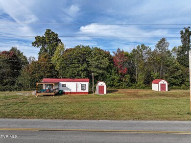
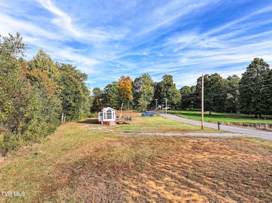
- Pasture Views
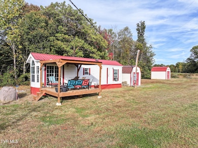
- Shed
- Level Lot
- No HOA
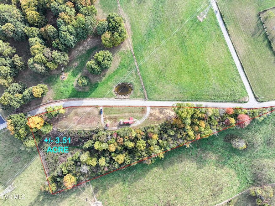
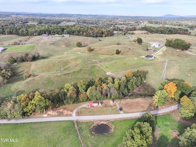
About This Lot
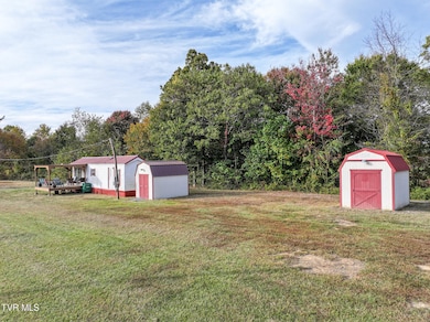
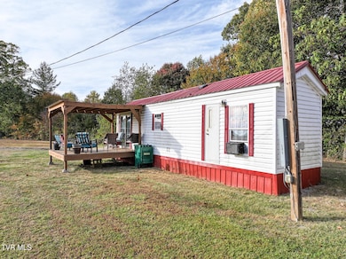
Beautiful tract of land offering 3.51 acres in Limestone with a well located on the property, electricity established, and landscaped environment making this property equipped with essential move-in ready amenities. This lot is cleared and level with wooded area towards the back of the property allowing for easy access directly off the road. Septic permit available in documents. Seller is also willing to include a Park Model Home currently located on the property for an additional $30,000. The Park Model Home is considered personal property and is not included in the real estate sale price. All information taken from a third-party source (courthouse/tax records) and to be verified by the buyer/buyers agent.

Property Details
Property Type
- Land
Lot Details
- 3.51 Acre Lot
- Lot Dimensions are 1065 x 304 x 1007
- Level Lot
Property Views
- Pasture
- Mountain
Schools
- West View Elementary And Middle School
- David Crockett High School
Utilities
- Well
- Septic Tank
Listing and Financial Details
- Assessor Parcel Number 081 08515
Community Details
Overview
- No Home Owners Association
Recreation
- Shed
Map
Tax History
| Year | Tax Paid | Tax Assessment Tax Assessment Total Assessment is a certain percentage of the fair market value that is determined by local assessors to be the total taxable value of land and additions on the property. | Land | Improvement |
|---|---|---|---|---|
| 2025 | $469 | $27,900 | $18,350 | $9,550 |
| 2024 | $469 | $27,400 | $18,350 | $9,050 |
| 2022 | $346 | $16,100 | $11,450 | $4,650 |
| 2021 | $346 | $16,100 | $11,450 | $4,650 |
| 2020 | $246 | $16,100 | $11,450 | $4,650 |
| 2019 | $272 | $11,450 | $11,450 | $0 |
| 2018 | $272 | $11,450 | $11,450 | $0 |
| 2017 | $272 | $11,450 | $11,450 | $0 |
| 2016 | $272 | $11,450 | $11,450 | $0 |
| 2015 | $227 | $11,450 | $11,450 | $0 |
| 2014 | $227 | $11,450 | $11,450 | $0 |
Property History
| Date | Event | Price | List to Sale | Price per Sq Ft |
|---|---|---|---|---|
| 10/28/2025 10/28/25 | For Sale | $155,000 | -- | -- |
Purchase History
| Date | Type | Sale Price | Title Company |
|---|---|---|---|
| Warranty Deed | $60,000 | Ecu Title & Escrow | |
| Quit Claim Deed | -- | -- | |
| Warranty Deed | $14,000 | -- | |
| Warranty Deed | $4,600 | -- |
Mortgage History
| Date | Status | Loan Amount | Loan Type |
|---|---|---|---|
| Open | $54,000 | New Conventional |
Source: Tennessee/Virginia Regional MLS
MLS Number: 9987660
APN: 081-085.15
Disclaimer: Certain information contained herein is derived from information provided by parties other than Homes.com. All information provided is deemed reliable, but is not guaranteed to be accurate and should be independently verified.
![]() IDX information is provided exclusively for personal, non-commercial use, and may not be used for any purpose other than to identify prospective properties consumers may be interested in purchasing. Some or all of the listings displayed may not belong to the firm whose website is being visited
IDX information is provided exclusively for personal, non-commercial use, and may not be used for any purpose other than to identify prospective properties consumers may be interested in purchasing. Some or all of the listings displayed may not belong to the firm whose website is being visited
Listing information is deemed reliable, but not guaranteed.
- 375 Bill West Rd
- 578 Telford School Rd
- 489 Bill West Rd
- 475 Bill West Rd
- 2459 Old State Route 34
- 2153 Old State Route 34
- 2094 Old State Route 34
- 2074 Old State Route 34
- 120 Hensley Loop
- 381 Newt Good Rd
- 108 Hensley Loop
- 180 Glaze Rd
- 145 Lc McKee Rd
- 626 Conklin Rd
- 345 Mount Wesley Rd
- 2793 Old State Route 34
- 161 Jay Barnett Rd
- 173 Telford New Victory Rd
- 639 Bailey Bridge Rd
- 238 Miller Rd
- 115 Oak Timbers Rd
- 183 Old State Route 34
- 241 Sweetgrass Ln
- 1121 Meadow Creek Ln
- 693 Barley Loop
- 420 W Jackson Blvd
- 973 Tn-81 Unit 973-10
- 1017 Allison Dr
- 93 Chucks Aly
- 185 Chucks Aly
- 310 Ruby Rose Ridge
- 132 Cottonwood Dr
- 3908 Old Jonesboro Rd Unit 1
- 3300 Boones Creek Village Ct
- 113 S Main Ave
- 705 N Main Ave
- 6920 E Andrew Johnson Hwy Unit 12
- 148 Green Pond Rd
- 146 Green Pond Rd Unit 4
- 3006 Vicksburg Rd
Ask me questions while you tour the home.