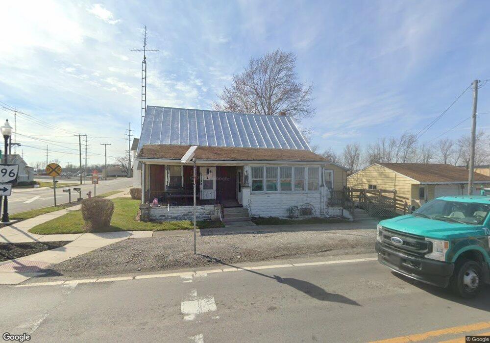
202 W Main St Beaverdam, OH 45808
Estimated Value: $113,411 - $145,000
4
Beds
1
Bath
1,762
Sq Ft
$71/Sq Ft
Est. Value
About This Home
This home is located at 202 W Main St, Beaverdam, OH 45808 and is currently estimated at $125,353, approximately $71 per square foot. 202 W Main St is a home located in Allen County with nearby schools including Bluffton Elementary School, Bluffton Middle School, and Bluffton High School.
Ownership History
Date
Name
Owned For
Owner Type
Purchase Details
Closed on
Apr 4, 1994
Sold by
Hudson Delilah B
Bought by
Palte Robert L and Annie Mae
Current Estimated Value
Purchase Details
Closed on
Sep 1, 1982
Bought by
Hudson Delilah B
Create a Home Valuation Report for This Property
The Home Valuation Report is an in-depth analysis detailing your home's value as well as a comparison with similar homes in the area
Home Values in the Area
Average Home Value in this Area
Purchase History
| Date | Buyer | Sale Price | Title Company |
|---|---|---|---|
| Palte Robert L | $38,000 | -- | |
| Hudson Delilah B | $9,000 | -- |
Source: Public Records
Tax History Compared to Growth
Tax History
| Year | Tax Paid | Tax Assessment Tax Assessment Total Assessment is a certain percentage of the fair market value that is determined by local assessors to be the total taxable value of land and additions on the property. | Land | Improvement |
|---|---|---|---|---|
| 2024 | $944 | $27,970 | $4,660 | $23,310 |
| 2023 | $982 | $26,640 | $4,450 | $22,190 |
| 2022 | $968 | $26,640 | $4,450 | $22,190 |
| 2021 | $1,000 | $26,640 | $4,450 | $22,190 |
| 2020 | $838 | $19,990 | $4,270 | $15,720 |
| 2019 | $838 | $19,990 | $4,270 | $15,720 |
| 2018 | $778 | $19,990 | $4,270 | $15,720 |
| 2017 | $707 | $16,840 | $4,270 | $12,570 |
| 2016 | $677 | $16,840 | $4,270 | $12,570 |
| 2015 | $866 | $16,840 | $4,270 | $12,570 |
| 2014 | $866 | $20,790 | $4,270 | $16,520 |
| 2013 | $792 | $20,790 | $4,270 | $16,520 |
Source: Public Records
Map
Nearby Homes
- 6601 N Napoleon Rd
- 108 E Main St
- 207 W Prospect St
- 5025 N Cool Rd
- 6476 Mickelson Ln
- 000 Napoleon Rd
- 4700 Herr Rd
- 7957 Hillville Rd
- 0 Lincoln Hwy
- 000 Lincoln Hwy
- 9290 Lincoln Hwy
- 00000 Ohio 696
- 000 Ohio 696
- 0000 Ohio 696
- 8305 Hillville Rd
- 4619 N Thayer Rd
- 0 N Dixie Hwy Unit 308796
- 0 N Dixie Hwy Unit 300253
- 8900 N Dixie Hwy
- 8160 Columbus Grove-Bluffton Rd
- 204 W Main St
- 121 !Dnp! Residential!27222
- 209 W Main St
- 111 E Main St
- 111 E Main St
- 306 W Main St
- 208 W Pearl St
- 208 W Pearl St
- 204 W Pearl St
- 210 W Pearl St
- 308 W Main St
- 110 W Pearl St
- 212 W Pearl St
- 310 W Main St
- 106 W Pearl St
- 214 W Pearl St
- 101 E Main St
- 102 W Pearl St
- 102 W Pearl St
- 308 N Napoleon Rd