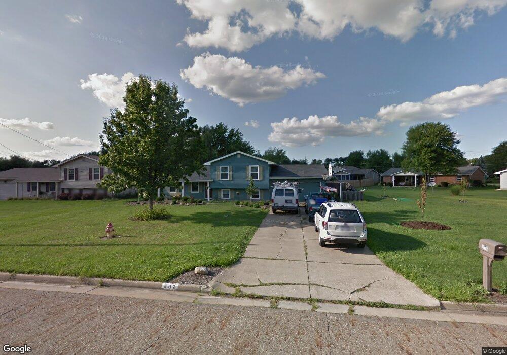
202 Waggaman Cir Youngstown, OH 44512
Estimated Value: $209,469 - $238,000
3
Beds
2
Baths
1,560
Sq Ft
$144/Sq Ft
Est. Value
About This Home
This home is located at 202 Waggaman Cir, Youngstown, OH 44512 and is currently estimated at $225,367, approximately $144 per square foot. 202 Waggaman Cir is a home located in Mahoning County with nearby schools including Stadium Drive Elementary School, Boardman Center Middle School, and Boardman High School.
Ownership History
Date
Name
Owned For
Owner Type
Purchase Details
Closed on
Mar 28, 2004
Sold by
Curry James R and Curry Nancy A
Bought by
Zack Michael J
Current Estimated Value
Home Financials for this Owner
Home Financials are based on the most recent Mortgage that was taken out on this home.
Original Mortgage
$124,591
Interest Rate
5.65%
Mortgage Type
FHA
Purchase Details
Closed on
May 14, 1980
Bought by
Curry James R and Curry Nancy A
Create a Home Valuation Report for This Property
The Home Valuation Report is an in-depth analysis detailing your home's value as well as a comparison with similar homes in the area
Home Values in the Area
Average Home Value in this Area
Purchase History
| Date | Buyer | Sale Price | Title Company |
|---|---|---|---|
| Zack Michael J | $126,000 | -- | |
| Curry James R | -- | -- |
Source: Public Records
Mortgage History
| Date | Status | Borrower | Loan Amount |
|---|---|---|---|
| Previous Owner | Zack Michael J | $124,591 |
Source: Public Records
Tax History Compared to Growth
Tax History
| Year | Tax Paid | Tax Assessment Tax Assessment Total Assessment is a certain percentage of the fair market value that is determined by local assessors to be the total taxable value of land and additions on the property. | Land | Improvement |
|---|---|---|---|---|
| 2024 | $2,787 | $54,540 | $13,300 | $41,240 |
| 2023 | $2,750 | $54,540 | $13,300 | $41,240 |
| 2022 | $3,176 | $46,000 | $13,290 | $32,710 |
| 2021 | $3,026 | $46,000 | $13,290 | $32,710 |
| 2020 | $3,162 | $47,810 | $13,290 | $34,520 |
| 2019 | $2,837 | $37,940 | $10,550 | $27,390 |
| 2018 | $2,451 | $37,940 | $10,550 | $27,390 |
| 2017 | $2,426 | $37,940 | $10,550 | $27,390 |
| 2016 | $2,291 | $35,460 | $10,550 | $24,910 |
| 2015 | $2,246 | $35,460 | $10,550 | $24,910 |
| 2014 | $2,252 | $35,460 | $10,550 | $24,910 |
| 2013 | $2,224 | $35,460 | $10,550 | $24,910 |
Source: Public Records
Map
Nearby Homes
- 8502 Glenwood Ave
- 470 Garver Dr
- 153 Creston Dr
- 9144 Sharrott Rd
- 74 Carter Cir
- 9264 Sharrott Rd Unit 1004
- 9264 Sharrott Rd Unit 1001
- 9264 Sharrott Rd Unit 104
- 9264 Sharrott Rd Unit 1002
- Rosewood Plan at Courtyards at Stonegate
- 0 W Western Reserve Rd Unit 5146459
- 1555 W Western Reserve Rd
- Lot 43 Berklee Dr
- Lot 36 Berklee Dr
- Lot 44 Berklee Dr
- Lot 37 Berklee Dr
- 150 Cedars Dr
- 8218 Maramont Dr Unit B
- 107 Berklee Dr
- 123 Mayflower Dr
- 206 Waggaman Cir
- 8526 Glenwood Ave
- 8534 Glenwood Ave
- 8518 Glenwood Ave
- 209 Waggaman Cir
- 210 Waggaman Cir
- 8538 Glenwood Ave
- 8510 Glenwood Ave
- 213 Waggaman Cir
- 205 Waggaman Cir
- 217 Waggaman Cir
- 214 Waggaman Cir
- 230 Waggaman Cir
- 8546 Glenwood Ave
- 221 Waggaman Cir
- 226 Waggaman Cir
- 218 Waggaman Cir
- 8550 Glenwood Ave
- 186 Runnemede Dr
- 8566 Glenwood Ave Unit 2