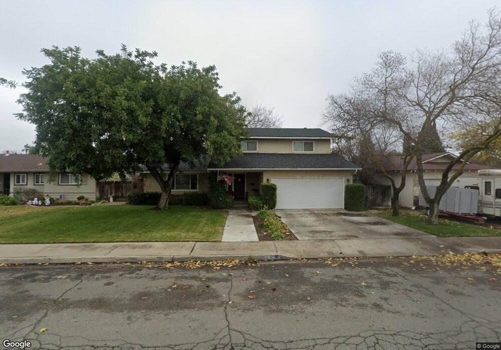
2020 Annhurst Ave Turlock, CA 95382
Estimated Value: $413,000 - $500,390
4
Beds
3
Baths
1,920
Sq Ft
$244/Sq Ft
Est. Value
About This Home
This home is located at 2020 Annhurst Ave, Turlock, CA 95382 and is currently estimated at $469,098, approximately $244 per square foot. 2020 Annhurst Ave is a home located in Stanislaus County with nearby schools including Crowell Elementary School, Marvin A. Dutcher Middle School, and Turlock Junior High School.
Ownership History
Date
Name
Owned For
Owner Type
Purchase Details
Closed on
May 23, 2016
Sold by
Deboer Donald Louis
Bought by
Monroe Robert D and Monroe Tamara D
Current Estimated Value
Home Financials for this Owner
Home Financials are based on the most recent Mortgage that was taken out on this home.
Original Mortgage
$175,000
Outstanding Balance
$139,312
Interest Rate
3.66%
Mortgage Type
New Conventional
Estimated Equity
$329,786
Purchase Details
Closed on
Jul 5, 2001
Sold by
Deboer Donald Louis
Bought by
Deboer Donald Louis and Deboer Marlene C
Home Financials for this Owner
Home Financials are based on the most recent Mortgage that was taken out on this home.
Original Mortgage
$100,000
Interest Rate
7.24%
Mortgage Type
Credit Line Revolving
Create a Home Valuation Report for This Property
The Home Valuation Report is an in-depth analysis detailing your home's value as well as a comparison with similar homes in the area
Purchase History
| Date | Buyer | Sale Price | Title Company |
|---|---|---|---|
| Monroe Robert D | $200,000 | First American Title Company | |
| Deboer Donald Louis | -- | Stewart Title |
Source: Public Records
Mortgage History
| Date | Status | Borrower | Loan Amount |
|---|---|---|---|
| Open | Monroe Robert D | $175,000 | |
| Previous Owner | Deboer Donald Louis | $100,000 |
Source: Public Records
Tax History
| Year | Tax Paid | Tax Assessment Tax Assessment Total Assessment is a certain percentage of the fair market value that is determined by local assessors to be the total taxable value of land and additions on the property. | Land | Improvement |
|---|---|---|---|---|
| 2025 | $3,239 | $301,861 | $130,214 | $171,647 |
| 2024 | $3,179 | $295,943 | $127,661 | $168,282 |
| 2023 | $3,174 | $290,141 | $125,158 | $164,983 |
| 2022 | $3,134 | $284,453 | $122,704 | $161,749 |
| 2021 | $3,088 | $278,877 | $120,299 | $158,578 |
| 2020 | $3,067 | $276,018 | $119,066 | $156,952 |
| 2019 | $3,015 | $270,607 | $116,732 | $153,875 |
| 2018 | $3,013 | $265,302 | $114,444 | $150,858 |
| 2017 | $2,942 | $260,100 | $112,200 | $147,900 |
| 2016 | $2,793 | $259,212 | $70,295 | $188,917 |
| 2015 | $2,770 | $255,320 | $69,240 | $186,080 |
| 2014 | -- | $250,319 | $67,884 | $182,435 |
Source: Public Records
Map
Nearby Homes
- 200 Drexel Ave
- 2405 Bucknell St
- 100 Pedras Rd
- 1733 Geer Rd
- 1650 N Olive Ave
- 680 Sherri Way
- 2720 Brooks Ct
- 240 W Tuolumne Rd
- 1535 Springville Way
- 1366 Geer Rd
- 1880 Donnelly Park Dr
- 348 Wayside Dr
- 494 Wayside Dr
- 1740 Colorado Ave
- 2261 Peace Way
- 861 Wayside Dr
- 125 Hedstrom Rd
- 425 20th Century Blvd Unit E-1
- 425 20th Century Blvd Unit A13
- 1921 Carleton Dr
- 2040 Annhurst Ave
- 2000 Annhurst Ave
- 2025 Xavier Ave
- 2060 Annhurst Ave
- 1980 Annhurst Ave
- 2005 Xavier Ave
- 2045 Xavier Ave
- 2025 Annhurst Ave
- 2005 Annhurst Ave
- 1985 Xavier Ave
- 2065 Xavier Ave
- 2045 Annhurst Ave
- 2080 Annhurst Ave
- 1960 Annhurst Ave
- 2065 Annhurst Ave
- 1965 Xavier Ave
- 2085 Xavier Ave
- 1965 Annhurst Ave
- 2100 Annhurst Ave
- 1940 Annhurst Ave
Your Personal Tour Guide
Ask me questions while you tour the home.