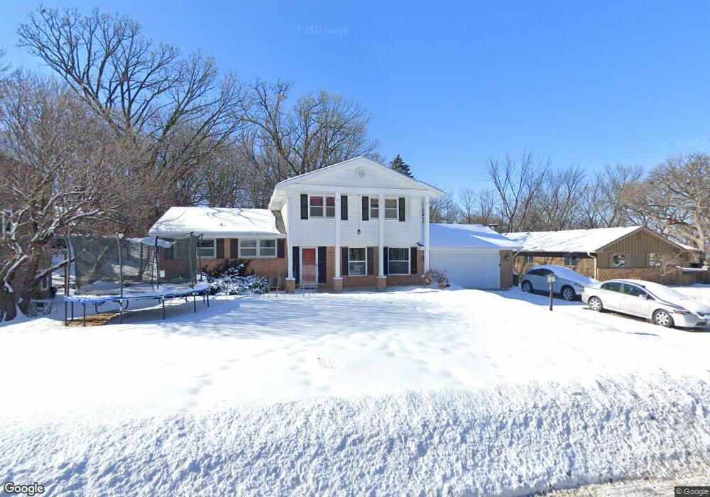
2020 Big Oak Dr Burnsville, MN 55337
Estimated Value: $402,000 - $434,000
4
Beds
4
Baths
2,377
Sq Ft
$176/Sq Ft
Est. Value
About This Home
This home is located at 2020 Big Oak Dr, Burnsville, MN 55337 and is currently estimated at $418,383, approximately $176 per square foot. 2020 Big Oak Dr is a home located in Dakota County with nearby schools including Vista View Elementary School, Joseph Nicollet Middle School, and Burnsville High School.
Ownership History
Date
Name
Owned For
Owner Type
Purchase Details
Closed on
Oct 9, 2015
Sold by
Duininck Pauline K
Bought by
Agyapong Prince and Agyapong Joana
Current Estimated Value
Home Financials for this Owner
Home Financials are based on the most recent Mortgage that was taken out on this home.
Original Mortgage
$240,537
Outstanding Balance
$188,413
Interest Rate
3.75%
Mortgage Type
FHA
Estimated Equity
$229,970
Purchase Details
Closed on
Jul 2, 2012
Sold by
Duininck Larry
Bought by
Pauline K Duininck Revocable Trust
Purchase Details
Closed on
Aug 31, 2004
Sold by
Mann Sherr L and Mann Chuck
Bought by
Dlanick Paula and Vollmar Ellen
Purchase Details
Closed on
Jun 17, 1999
Sold by
Haberlack Mike A and Haberlack Cheryl A
Bought by
Mann Sherri L
Create a Home Valuation Report for This Property
The Home Valuation Report is an in-depth analysis detailing your home's value as well as a comparison with similar homes in the area
Home Values in the Area
Average Home Value in this Area
Purchase History
| Date | Buyer | Sale Price | Title Company |
|---|---|---|---|
| Agyapong Prince | $245,000 | Liberty Title | |
| Pauline K Duininck Revocable Trust | -- | None Available | |
| Dlanick Paula | $277,500 | -- | |
| Mann Sherri L | $219,900 | -- |
Source: Public Records
Mortgage History
| Date | Status | Borrower | Loan Amount |
|---|---|---|---|
| Open | Agyapong Prince | $240,537 |
Source: Public Records
Tax History Compared to Growth
Tax History
| Year | Tax Paid | Tax Assessment Tax Assessment Total Assessment is a certain percentage of the fair market value that is determined by local assessors to be the total taxable value of land and additions on the property. | Land | Improvement |
|---|---|---|---|---|
| 2024 | $4,192 | $398,000 | $107,600 | $290,400 |
| 2023 | $4,192 | $399,300 | $107,700 | $291,600 |
| 2022 | $3,464 | $396,900 | $107,500 | $289,400 |
| 2021 | $3,430 | $327,900 | $93,400 | $234,500 |
| 2020 | $3,418 | $309,300 | $89,000 | $220,300 |
| 2019 | $3,445 | $297,900 | $82,600 | $215,300 |
| 2018 | $3,354 | $286,300 | $78,600 | $207,700 |
| 2017 | $3,130 | $271,700 | $74,900 | $196,800 |
| 2016 | $3,167 | $251,300 | $71,300 | $180,000 |
| 2015 | $3,146 | $229,483 | $64,897 | $164,586 |
| 2014 | -- | $241,200 | $68,000 | $173,200 |
| 2013 | -- | $224,400 | $62,200 | $162,200 |
Source: Public Records
Map
Nearby Homes
- 13100 Thomas Ave S
- 13303 Morgan Ave S
- 13147 Thomas Ave S
- 13208 Upton Ave S
- 2729 Terrace Dr
- 2708 Williams Dr
- 13212 Fremont Ave S
- 2704 W 135th St
- 13236 Fremont Ave S
- 1009 Knob Hill Rd
- XXXX Woodhill Rd
- 3220 Harmony Cir
- 1200 W 136th St
- 1701 W 138th St
- 13817 Thomas Ave S
- 521 Timberland Dr
- 1724 W 140th St
- 13036 Judicial Rd
- 2104 W 140th St
- 1905 W 140th St