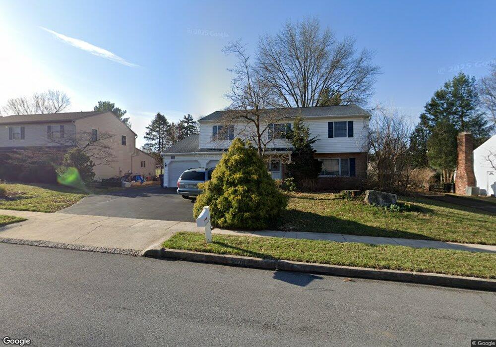
2020 Buckman Ave Reading, PA 19610
Whitfield NeighborhoodEstimated Value: $397,000 - $420,000
5
Beds
3
Baths
2,225
Sq Ft
$184/Sq Ft
Est. Value
About This Home
This home is located at 2020 Buckman Ave, Reading, PA 19610 and is currently estimated at $409,582, approximately $184 per square foot. 2020 Buckman Ave is a home located in Berks County with nearby schools including Spring Ridge Elementary School, Wilson West Middle School, and Wilson High School.
Ownership History
Date
Name
Owned For
Owner Type
Purchase Details
Closed on
Jul 3, 2001
Sold by
Zorbas Hristos and Zorbas Anna
Bought by
Hill Jeffrey P and Hill Karen L
Current Estimated Value
Home Financials for this Owner
Home Financials are based on the most recent Mortgage that was taken out on this home.
Original Mortgage
$109,900
Outstanding Balance
$42,537
Interest Rate
7.2%
Estimated Equity
$367,045
Create a Home Valuation Report for This Property
The Home Valuation Report is an in-depth analysis detailing your home's value as well as a comparison with similar homes in the area
Home Values in the Area
Average Home Value in this Area
Purchase History
| Date | Buyer | Sale Price | Title Company |
|---|---|---|---|
| Hill Jeffrey P | $159,900 | -- |
Source: Public Records
Mortgage History
| Date | Status | Borrower | Loan Amount |
|---|---|---|---|
| Open | Hill Jeffrey P | $109,900 |
Source: Public Records
Tax History Compared to Growth
Tax History
| Year | Tax Paid | Tax Assessment Tax Assessment Total Assessment is a certain percentage of the fair market value that is determined by local assessors to be the total taxable value of land and additions on the property. | Land | Improvement |
|---|---|---|---|---|
| 2025 | $2,542 | $141,900 | $24,200 | $117,700 |
| 2024 | $6,071 | $141,900 | $24,200 | $117,700 |
| 2023 | $5,785 | $141,900 | $24,200 | $117,700 |
| 2022 | $5,643 | $141,900 | $24,200 | $117,700 |
| 2021 | $5,444 | $141,900 | $24,200 | $117,700 |
| 2020 | $5,444 | $141,900 | $24,200 | $117,700 |
| 2019 | $5,290 | $141,900 | $24,200 | $117,700 |
| 2018 | $5,244 | $141,900 | $24,200 | $117,700 |
| 2017 | $5,156 | $141,900 | $24,200 | $117,700 |
| 2016 | $1,778 | $141,900 | $24,200 | $117,700 |
| 2015 | $1,778 | $141,900 | $24,200 | $117,700 |
| 2014 | $1,778 | $141,900 | $24,200 | $117,700 |
Source: Public Records
Map
Nearby Homes
- 802 Apple Dr
- 2035 Franklin Place
- 1914 Andre Ct
- 2900 State Hill Rd Unit I12
- 2912 State Hill Rd Unit B-2
- 301 Warwick Dr
- 191 Hawthorne Ct Unit 191A
- 121 Grandview Blvd
- 125 Grandview Blvd
- 118 Laurel Ct Unit 118B
- 179 Hawthorne Ct Unit 179A
- 120 Laurel Ct Unit 120A
- 101 Robert Rd
- 150 Laurel Ct Unit 150A
- 204 Springmont Dr
- 61 Grandview Blvd
- 12 Vista Rd
- 2021 Noble St
- 2408 Noble St
- 137 Hickory Ln
- 2018 Buckman Ave
- 2022 Buckman Ave
- 2101 Rosewood Ct
- 2021 Buckman Ave
- 2016 Buckman Ave
- 2019 Buckman Ave
- 2100 Buckman Ave
- 2100 Rosewood Ct
- 2023 Buckman Ave
- 2017 Buckman Ave
- 2103 Rosewood Ct
- 2014 Buckman Ave
- 2102 Buckman Ave
- 2018 Cypress Ln
- 2015 Buckman Ave
- 803 Burkey Dr
- 2102 Rosewood Ct
- 2020 Cypress Ln
- 2101 Buckman Ave
- 2016 Cypress Ln
