Estimated Value: $279,000 - $312,000
4
Beds
2
Baths
1,738
Sq Ft
$168/Sq Ft
Est. Value
About This Home
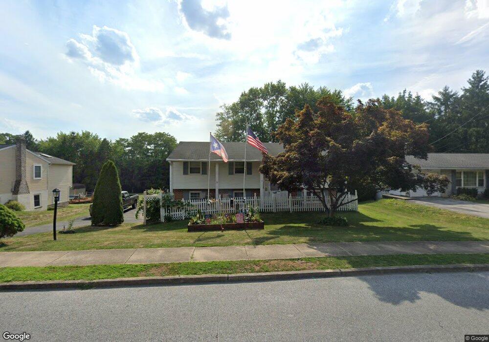
This home is located at 2020 Derry Rd, York, PA 17408 and is currently estimated at $292,268, approximately $168 per square foot. 2020 Derry Rd is a home located in York County with nearby schools including West York Area High School, York Adventist Christian School, and Christian School of York.
Ownership History
Date
Name
Owned For
Owner Type
Purchase Details
Closed on
Sep 26, 2001
Sold by
Barshinger Michael E and Barshinger Debra S
Bought by
Millan Edison and Millan Susan
Current Estimated Value
Home Financials for this Owner
Home Financials are based on the most recent Mortgage that was taken out on this home.
Original Mortgage
$118,960
Outstanding Balance
$46,565
Interest Rate
6.89%
Estimated Equity
$245,703
Create a Home Valuation Report for This Property
The Home Valuation Report is an in-depth analysis detailing your home's value as well as a comparison with similar homes in the area
Home Values in the Area
Average Home Value in this Area
Purchase History
| Date | Buyer | Sale Price | Title Company |
|---|---|---|---|
| Millan Edison | $119,900 | -- |
Source: Public Records
Mortgage History
| Date | Status | Borrower | Loan Amount |
|---|---|---|---|
| Open | Millan Edison | $118,960 |
Source: Public Records
Tax History
| Year | Tax Paid | Tax Assessment Tax Assessment Total Assessment is a certain percentage of the fair market value that is determined by local assessors to be the total taxable value of land and additions on the property. | Land | Improvement |
|---|---|---|---|---|
| 2025 | $4,429 | $131,330 | $46,040 | $85,290 |
| 2024 | $4,317 | $131,330 | $46,040 | $85,290 |
| 2023 | $4,317 | $131,330 | $46,040 | $85,290 |
| 2022 | $4,317 | $131,330 | $46,040 | $85,290 |
| 2021 | $4,186 | $131,330 | $46,040 | $85,290 |
| 2020 | $4,186 | $131,330 | $46,040 | $85,290 |
| 2019 | $4,107 | $131,330 | $46,040 | $85,290 |
| 2018 | $4,074 | $131,330 | $46,040 | $85,290 |
| 2017 | $3,949 | $131,330 | $46,040 | $85,290 |
| 2016 | $0 | $131,330 | $46,040 | $85,290 |
| 2015 | -- | $131,330 | $46,040 | $85,290 |
| 2014 | -- | $131,330 | $46,040 | $85,290 |
Source: Public Records
Map
Nearby Homes
- 2589 Audlyn Dr
- 2729 Sparrow Dr
- 2686 Sunset Ln
- 1835 Michelle Dr
- 2508 Manor Rd
- 107 Summer House Ln
- 2765 Northvue Ln
- 1769 Rainbow Cir
- 2636 Sedgewick Ave
- 1383 Wellington Dr Unit B2
- 0 Carlisle Rd
- 2228 Heather Rd
- 2506 Willapa Dr
- 2707 Emig Mill Rd
- 2333 Loucks Rd
- 2633 Grandview Park Dr Unit 39
- 3121 Pineview Dr
- 1837 Downing St
- 0 Baker Rd Unit PAYK2023686
- 2337 Wedgewood Way
Your Personal Tour Guide
Ask me questions while you tour the home.