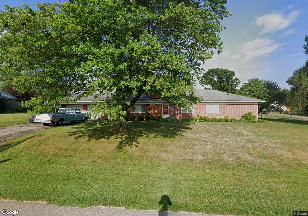
2020 Evanor Ln Cincinnati, OH 45244
Dry Run NeighborhoodEstimated Value: $353,000 - $449,000
3
Beds
3
Baths
2,148
Sq Ft
$181/Sq Ft
Est. Value
About This Home
This home is located at 2020 Evanor Ln, Cincinnati, OH 45244 and is currently estimated at $389,386, approximately $181 per square foot. 2020 Evanor Ln is a home located in Hamilton County with nearby schools including Wilson Elementary School, Nagel Middle School, and Turpin High School.
Ownership History
Date
Name
Owned For
Owner Type
Purchase Details
Closed on
Jul 2, 2013
Sold by
Wetterer Nancy S
Bought by
Wetterer Nancy S and Nancy S Wetterer Trust
Current Estimated Value
Purchase Details
Closed on
Jun 20, 2006
Sold by
Wetterer Robert P and Wetterer Nancy S
Bought by
Wetterer Nancy S
Purchase Details
Closed on
Aug 11, 1994
Sold by
Hartmann Dennis P
Bought by
Wetterer Nancy S and Wetterer Robert P
Create a Home Valuation Report for This Property
The Home Valuation Report is an in-depth analysis detailing your home's value as well as a comparison with similar homes in the area
Home Values in the Area
Average Home Value in this Area
Purchase History
| Date | Buyer | Sale Price | Title Company |
|---|---|---|---|
| Wetterer Nancy S | -- | Attorney | |
| Wetterer Nancy S | -- | Classic Title Agency | |
| Wetterer Nancy S | -- | -- |
Source: Public Records
Tax History Compared to Growth
Tax History
| Year | Tax Paid | Tax Assessment Tax Assessment Total Assessment is a certain percentage of the fair market value that is determined by local assessors to be the total taxable value of land and additions on the property. | Land | Improvement |
|---|---|---|---|---|
| 2024 | $6,283 | $99,012 | $17,910 | $81,102 |
| 2023 | $5,898 | $99,012 | $17,910 | $81,102 |
| 2022 | $4,686 | $69,938 | $16,279 | $53,659 |
| 2021 | $4,659 | $69,938 | $16,279 | $53,659 |
| 2020 | $4,607 | $69,938 | $16,279 | $53,659 |
| 2019 | $4,144 | $56,858 | $13,234 | $43,624 |
| 2018 | $3,888 | $56,858 | $13,234 | $43,624 |
| 2017 | $3,715 | $56,858 | $13,234 | $43,624 |
| 2016 | $3,826 | $56,631 | $13,234 | $43,397 |
| 2015 | $3,683 | $56,631 | $13,234 | $43,397 |
| 2014 | $3,679 | $56,631 | $13,234 | $43,397 |
| 2013 | $3,492 | $56,631 | $13,234 | $43,397 |
Source: Public Records
Map
Nearby Homes
- 2083 Forestcrest Way
- L Clough Pike
- 7660 Clough Pike
- 7652 Clough Pike
- 8032 Lancelot Dr
- 2193 Forestlake Dr
- 2117 Berrypatch Dr
- 8069 Ashgrove Dr
- 1786 Woodpine Ln
- 1791 Rusticwood Ln
- 1682 Yellowglen Dr
- 7827 State Rd
- 8190 Riovista Dr
- 2067 Knightsbridge Dr
- 8022 Stonegate Dr
- 8413 Summitridge Dr
- 2161 Knightsbridge Dr
- Devonshire II Plan at Clough Chase
- Remington Plan at Clough Chase
- Tacoma Plan at Clough Chase
- 7990 Clough Pike
- 2021 Evanor Ln
- 7952 Clough Pike
- 2003 Forestcrest Way
- 1988 Sandcliff Dr
- 2048 Evanor Ln
- 2039 Evanor Ln
- 2011 Forestcrest Way
- 1987 Sandcliff Dr
- 8005 Clough Pike
- 7946 Clough Pike
- 2047 Evanor Ln
- 1976 Sandcliff Dr
- 2058 Evanor Ln
- 8009 Clough Pike
- 2017 Forestcrest Way
- 1973 Sandcliff Dr
- 2004 Forestcrest Way
- 2057 Evanor Ln
- 1964 Sandcliff Dr