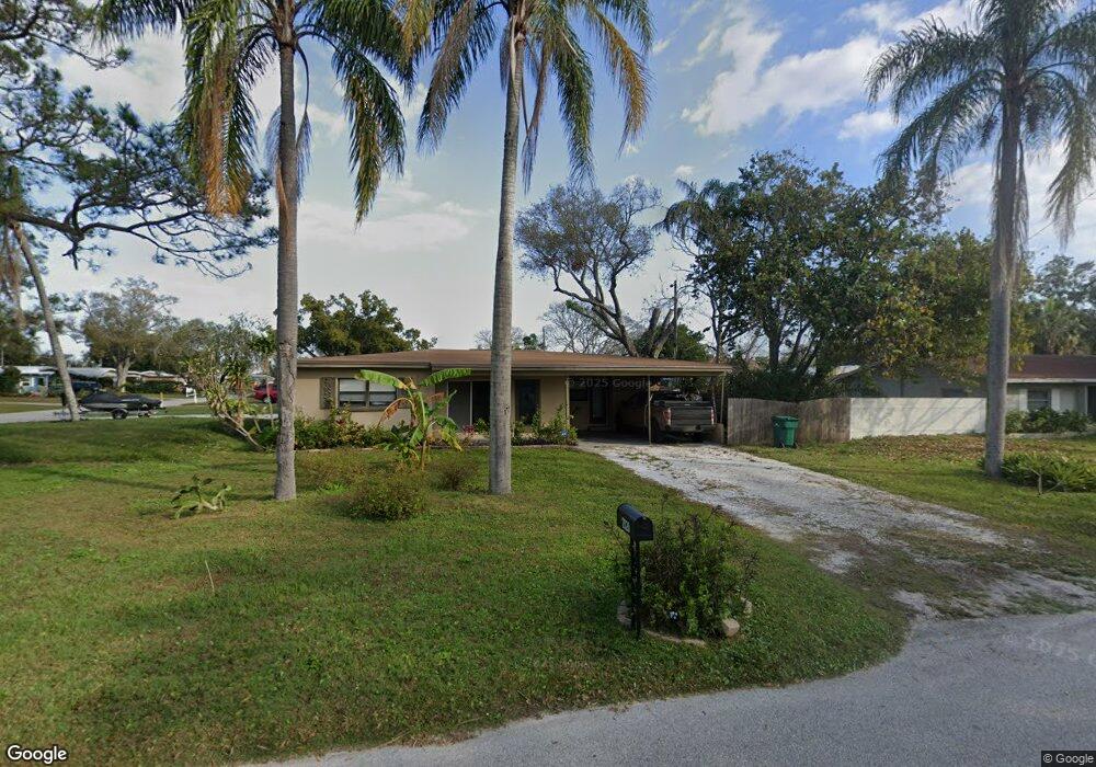
2020 Healy Dr Clearwater, FL 33763
Estimated Value: $286,000 - $295,873
2
Beds
2
Baths
1,442
Sq Ft
$201/Sq Ft
Est. Value
About This Home
This home is located at 2020 Healy Dr, Clearwater, FL 33763 and is currently estimated at $289,468, approximately $200 per square foot. 2020 Healy Dr is a home located in Pinellas County with nearby schools including Leila Davis Elementary School, Safety Harbor Middle School, and Dunedin High School.
Ownership History
Date
Name
Owned For
Owner Type
Purchase Details
Closed on
Mar 18, 2016
Sold by
Massotto Matthew T
Bought by
Beasecker Dawna Jean
Current Estimated Value
Purchase Details
Closed on
Feb 8, 2005
Sold by
Mieras Claudia Ann
Bought by
Massotto Matthew T
Home Financials for this Owner
Home Financials are based on the most recent Mortgage that was taken out on this home.
Original Mortgage
$110,000
Interest Rate
5.69%
Mortgage Type
Purchase Money Mortgage
Purchase Details
Closed on
Apr 29, 1995
Sold by
Mieras Tracy Jo
Bought by
Mieras Claudia Ann
Create a Home Valuation Report for This Property
The Home Valuation Report is an in-depth analysis detailing your home's value as well as a comparison with similar homes in the area
Home Values in the Area
Average Home Value in this Area
Purchase History
| Date | Buyer | Sale Price | Title Company |
|---|---|---|---|
| Beasecker Dawna Jean | $128,000 | Security Title Company | |
| Massotto Matthew T | $110,000 | Fidelity Natl Title Ins Co | |
| Mieras Claudia Ann | -- | -- |
Source: Public Records
Mortgage History
| Date | Status | Borrower | Loan Amount |
|---|---|---|---|
| Previous Owner | Massotto Matthew T | $110,000 |
Source: Public Records
Tax History Compared to Growth
Tax History
| Year | Tax Paid | Tax Assessment Tax Assessment Total Assessment is a certain percentage of the fair market value that is determined by local assessors to be the total taxable value of land and additions on the property. | Land | Improvement |
|---|---|---|---|---|
| 2024 | $3,732 | $260,951 | $163,303 | $97,648 |
| 2023 | $3,732 | $249,936 | $159,843 | $90,093 |
| 2022 | $3,403 | $217,791 | $151,545 | $66,246 |
| 2021 | $3,073 | $163,756 | $0 | $0 |
| 2020 | $2,772 | $134,981 | $0 | $0 |
| 2019 | $2,622 | $125,301 | $60,623 | $64,678 |
| 2018 | $2,597 | $128,962 | $0 | $0 |
| 2017 | $2,333 | $107,473 | $0 | $0 |
| 2016 | $648 | $55,871 | $0 | $0 |
| 2015 | $587 | $48,684 | $0 | $0 |
| 2014 | $625 | $51,045 | $0 | $0 |
Source: Public Records
Map
Nearby Homes
- 2124 Catalina Dr N
- 2153 Catalina Dr N
- 2161 N Hercules Ave
- 2060 Butternut Cir W
- 1960 Union St Unit 41
- 1960 Union St Unit 34
- 1960 Union St Unit 19
- 1960 Union St Unit 25
- 2200 Capri Dr
- 1942 Alton Dr
- 2069 San Sebastian Way N
- 2079 Charter Oaks Dr
- 1965 Allard Dr
- 2068 San Marino Way N
- 2128 Karan Way
- 1954 Los Lomas Dr
- 2117 Briarway Dr
- 2016 Gayle Place
- 2026 San Sebastian Way S
- 2120 Little Brook Ln
- 2125 Catalina Dr N
- 2030 Healy Dr
- 2124 Riviera Dr
- 2129 Catalina Dr N
- 2026 Lake Citrus Dr
- 2017 Healy Dr
- 2128 Riviera Dr
- 2008 Healy Dr
- 2015 Healy Dr
- 2133 Catalina Dr N
- 2128 Catalina Dr N
- 2132 Riviera Dr
- 2009 Healy Dr
- 2137 Catalina Dr N
- 2132 Catalina Dr N
- 2020 Lake Citrus Dr
- 2016 Lake Citrus Dr
- 2005 Healy Dr
- 2136 Riviera Dr
- 2121 N Hercules Ave