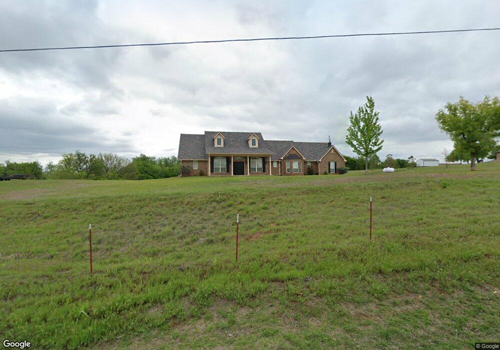
2020 N Cemetery Rd Unit 1220 Tuttle, OK 73089
Estimated Value: $313,000 - $2,001,000
3
Beds
2
Baths
2,300
Sq Ft
$392/Sq Ft
Est. Value
About This Home
This home is located at 2020 N Cemetery Rd Unit 1220, Tuttle, OK 73089 and is currently estimated at $900,733, approximately $391 per square foot. 2020 N Cemetery Rd Unit 1220 is a home located in Grady County with nearby schools including Tuttle Elementary School, Tuttle Intermediate School, and Tuttle Middle School.
Ownership History
Date
Name
Owned For
Owner Type
Purchase Details
Closed on
Mar 22, 2019
Sold by
Buzin Stephen H and Buzin Carla D
Bought by
Hardesty Martin Dale and Hardesty Sharon Ann
Current Estimated Value
Home Financials for this Owner
Home Financials are based on the most recent Mortgage that was taken out on this home.
Original Mortgage
$1,400,000
Outstanding Balance
$1,071,253
Interest Rate
4.4%
Mortgage Type
Future Advance Clause Open End Mortgage
Estimated Equity
-$170,520
Purchase Details
Closed on
Mar 21, 2014
Sold by
Thomson Scott D and Thomson Stacey L
Bought by
Buzin Carla D and Buzin Stephen
Create a Home Valuation Report for This Property
The Home Valuation Report is an in-depth analysis detailing your home's value as well as a comparison with similar homes in the area
Home Values in the Area
Average Home Value in this Area
Purchase History
| Date | Buyer | Sale Price | Title Company |
|---|---|---|---|
| Hardesty Martin Dale | $1,300,000 | Washita Valley Abstract Co | |
| Buzin Carla D | -- | None Available |
Source: Public Records
Mortgage History
| Date | Status | Borrower | Loan Amount |
|---|---|---|---|
| Open | Hardesty Martin Dale | $1,400,000 |
Source: Public Records
Tax History Compared to Growth
Tax History
| Year | Tax Paid | Tax Assessment Tax Assessment Total Assessment is a certain percentage of the fair market value that is determined by local assessors to be the total taxable value of land and additions on the property. | Land | Improvement |
|---|---|---|---|---|
| 2024 | $2,565 | $23,043 | $5,242 | $17,801 |
| 2023 | $2,565 | $22,372 | $6,055 | $16,317 |
| 2022 | $2,421 | $21,720 | $6,468 | $15,252 |
| 2021 | $2,451 | $21,929 | $6,468 | $15,461 |
| 2020 | $2,578 | $22,823 | $6,116 | $16,707 |
| 2019 | $963 | $9,493 | $4,004 | $5,489 |
| 2018 | $967 | $9,493 | $4,004 | $5,489 |
| 2017 | $929 | $9,493 | $4,004 | $5,489 |
| 2016 | $939 | $9,493 | $4,004 | $5,489 |
| 2015 | $931 | $9,493 | $4,004 | $5,489 |
| 2014 | $931 | $9,493 | $4,004 | $5,489 |
Source: Public Records
Map
Nearby Homes
- 807 Colbert St
- 4113 Sambar St
- 1418 Buckhorn Place
- 4121 Sambar St
- 1432 Buckhorn Place
- 1401 Deer Ridge Run
- 1409 Deer Ridge Run
- 1417 Deer Ridge Run
- 1425 Deer Ridge Run
- 4053 Hart St
- 4140 Sambar St
- 834 Tall Pines Dr
- 5600 E Tyler Dr
- 0 Frisco Rd
- 4125 Caribou St
- Galatians Plan at Deer Ridge Run
- 1127 Deer Ridge
- 4220 Caribou St
- 1137 Jaden Blvd
- 1136 Jozie Way
- 2020 N Cemetery Rd
- 3007 E Silver City Ridge
- 3105 E Silver City Ridge
- 2910 E Silver City Ridge
- 2800 E Silver City Ridge
- 3505 E Silver City Ridge
- 2802 E Silver City Ridge
- 2128 N Cemetery Rd Unit 1229
- 2098 N Cemetery Rd Unit 1327
- 2093 N Cemetery Rd Unit 1231
- 2133 N Gregory Rd
- 3803 E Silver City Ridge
- 1235 Prairie Meadow Ln
- 1235 Prairie Meadow Ln
- 3997 E Silver City Ridge
- 3605 Prairie Creek Dr
- 1217 Prairie Meadow Ln
- 3600 Prairie Creek Dr
- 1232 Prairie Meadow Ln
- 1807 Riviera Dr