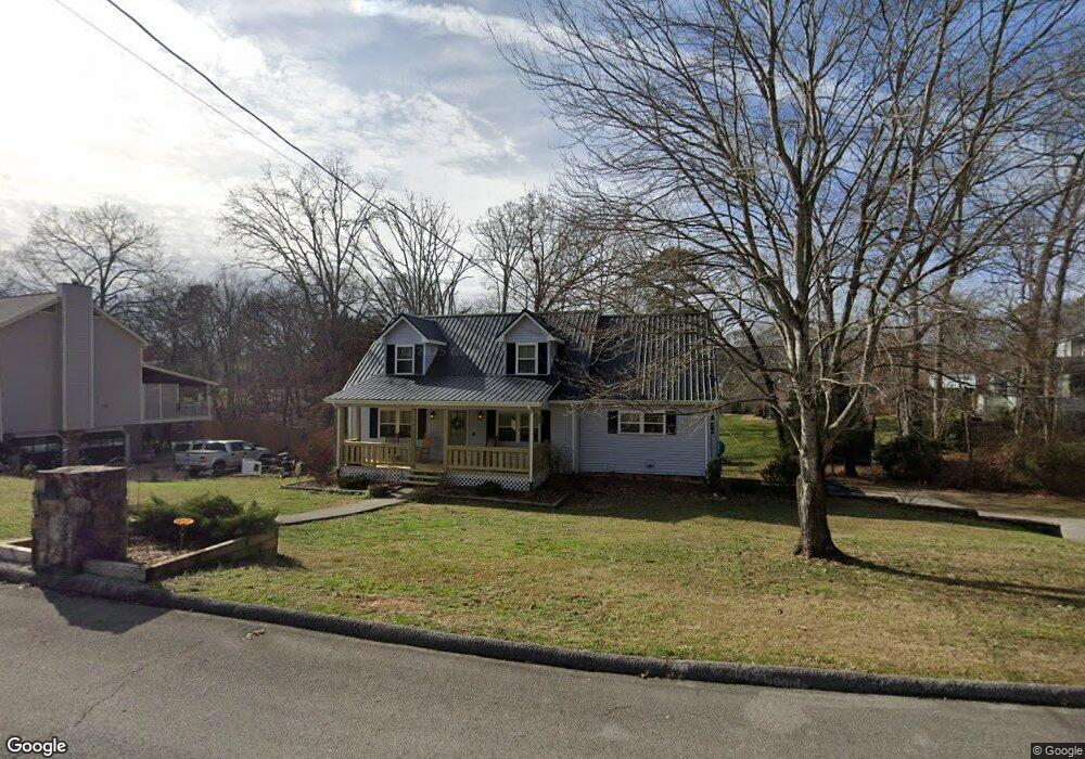
2020 Port Royal Dr Unit 241 Soddy Daisy, TN 37379
Estimated Value: $377,000 - $437,000
--
Bed
3
Baths
1,796
Sq Ft
$225/Sq Ft
Est. Value
About This Home
This home is located at 2020 Port Royal Dr Unit 241, Soddy Daisy, TN 37379 and is currently estimated at $404,355, approximately $225 per square foot. 2020 Port Royal Dr Unit 241 is a home located in Hamilton County with nearby schools including McConnell Elementary School and Loftis Middle School.
Ownership History
Date
Name
Owned For
Owner Type
Purchase Details
Closed on
Sep 22, 2020
Sold by
Johanneson Kevin Thorleif and Johanneson Julle
Bought by
Martin Amber Nicola
Current Estimated Value
Home Financials for this Owner
Home Financials are based on the most recent Mortgage that was taken out on this home.
Original Mortgage
$252,525
Outstanding Balance
$224,099
Interest Rate
2.9%
Mortgage Type
New Conventional
Estimated Equity
$180,256
Purchase Details
Closed on
Nov 12, 2013
Sold by
Jones Ronnie S and Jones Margie H
Bought by
Johanneson Kevin Thorleif and Johanneson Julie
Home Financials for this Owner
Home Financials are based on the most recent Mortgage that was taken out on this home.
Original Mortgage
$182,361
Interest Rate
4.23%
Mortgage Type
FHA
Purchase Details
Closed on
Jan 10, 1997
Sold by
Johnson Christopher H and Johnson Cherie L
Bought by
Jones Ronnie S and Jones Margie H
Create a Home Valuation Report for This Property
The Home Valuation Report is an in-depth analysis detailing your home's value as well as a comparison with similar homes in the area
Home Values in the Area
Average Home Value in this Area
Purchase History
| Date | Buyer | Sale Price | Title Company |
|---|---|---|---|
| Martin Amber Nicola | $250,000 | Chattanooga Title | |
| Johanneson Kevin Thorleif | $186,000 | First Choice Title Inc | |
| Jones Ronnie S | $115,000 | -- |
Source: Public Records
Mortgage History
| Date | Status | Borrower | Loan Amount |
|---|---|---|---|
| Open | Martin Amber Nicola | $252,525 | |
| Previous Owner | Johanneson Kevin Thorleif | $182,361 |
Source: Public Records
Tax History Compared to Growth
Tax History
| Year | Tax Paid | Tax Assessment Tax Assessment Total Assessment is a certain percentage of the fair market value that is determined by local assessors to be the total taxable value of land and additions on the property. | Land | Improvement |
|---|---|---|---|---|
| 2024 | $1,389 | $62,075 | $0 | $0 |
| 2023 | $1,398 | $62,075 | $0 | $0 |
| 2022 | $1,398 | $62,075 | $0 | $0 |
| 2021 | $1,398 | $62,075 | $0 | $0 |
| 2020 | $1,387 | $49,850 | $0 | $0 |
| 2019 | $1,387 | $49,850 | $0 | $0 |
| 2018 | $1,387 | $49,850 | $0 | $0 |
| 2017 | $1,387 | $49,850 | $0 | $0 |
| 2016 | $1,214 | $0 | $0 | $0 |
| 2015 | $1,214 | $43,575 | $0 | $0 |
| 2014 | $1,214 | $0 | $0 | $0 |
Source: Public Records
Map
Nearby Homes
- 2028 Port Royal Dr
- 1915 Port Royal Dr
- 2107 Port Royal Dr
- 2125 Port Royal Dr
- 8900 Wellthor Cir
- 2119 Collins Ln
- 2221 Chimney Hills Dr
- 1988 Warwickshire Dr
- 2207 Driftwood Rd
- 0 Warwickshire Dr
- 2316 Lakesite Dr
- 8901 Dalton Ln
- 11111 Hixson Pike
- 1806 Dallas Lake Rd
- 1814 Dallas Lake Rd
- 9416 Thrasher Trail
- 2109 Millard Rd
- 2548 Chimney Lake Cir
- 1818 Millard Rd
- 2607 Chimney Lake Cir
- 2020 Port Royal Dr
- 2022 Port Royal Dr
- 1924 Port Royal Dr
- 1924 Port Royal Dr Unit 342
- 2000 Port Royal Dr
- 2000 Port Royal Dr Unit 342
- 1922 Port Royal Dr
- 8001 Freeport Dr
- 2024 Port Royal Dr
- 1920 Port Royal Dr
- 2015 Port Royal Dr
- 8003 Freeport Dr
- 8003 Freeport Dr Unit 241
- 1918 Port Royal Dr
- 2027 Port Royal Dr
- 2026 Port Royal Dr
- 2026 Port Royal Dr Unit 241
- 8002 Freeport Dr
- 1914 Port Royal Dr
- 1914 Port Royal Dr Unit 3