Estimated Value: $71,688 - $96,000
2
Beds
1
Bath
704
Sq Ft
$119/Sq Ft
Est. Value
About This Home
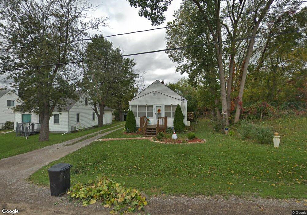
This home is located at 2020 Pound Dr, Flint, MI 48532 and is currently estimated at $83,922, approximately $119 per square foot. 2020 Pound Dr is a home located in Genesee County with nearby schools including Carman-Ainsworth High School, Genesee STEM Academy, and St. Paul Lutheran School.
Ownership History
Date
Name
Owned For
Owner Type
Purchase Details
Closed on
Apr 4, 2024
Sold by
Bennett Kathleen
Bought by
Bennett Kathleen and Dongarra James
Current Estimated Value
Purchase Details
Closed on
Nov 3, 2020
Sold by
Brannon Terry L and Brannon James E
Bought by
Bennett Kathleen
Purchase Details
Closed on
Aug 16, 2017
Sold by
Brannon James E and Brannon Mary A
Bought by
Brannon James E and Brannon Mary A
Create a Home Valuation Report for This Property
The Home Valuation Report is an in-depth analysis detailing your home's value as well as a comparison with similar homes in the area
Home Values in the Area
Average Home Value in this Area
Purchase History
| Date | Buyer | Sale Price | Title Company |
|---|---|---|---|
| Bennett Kathleen | -- | Michigan Land Title | |
| Bennett Kathleen | $60,000 | Select Title Company | |
| Brannon James E | -- | None Available |
Source: Public Records
Tax History Compared to Growth
Tax History
| Year | Tax Paid | Tax Assessment Tax Assessment Total Assessment is a certain percentage of the fair market value that is determined by local assessors to be the total taxable value of land and additions on the property. | Land | Improvement |
|---|---|---|---|---|
| 2025 | $789 | $32,000 | $0 | $0 |
| 2024 | $335 | $27,500 | $0 | $0 |
| 2023 | $320 | $25,200 | $0 | $0 |
| 2022 | $406 | $18,200 | $0 | $0 |
| 2021 | $695 | $15,400 | $0 | $0 |
| 2020 | $287 | $14,300 | $0 | $0 |
| 2019 | $283 | $12,700 | $0 | $0 |
| 2018 | $647 | $13,300 | $0 | $0 |
| 2017 | $627 | $13,300 | $0 | $0 |
| 2016 | $643 | $13,300 | $0 | $0 |
| 2015 | $479 | $12,300 | $0 | $0 |
| 2014 | $284 | $11,900 | $0 | $0 |
| 2012 | -- | $14,000 | $14,000 | $0 |
Source: Public Records
Map
Nearby Homes
- 1540 Pound Dr
- 18.41 Taft Rd
- 3277 Whitney Ave
- 1600 Houran St
- 3321 Hogarth Ave
- 1574 Houran St
- 1260 Gilbert St
- 10 Acres T A Mansour Blvd
- VL Clairmont St
- 3320 Timberview St
- 3493 Ridgecliffe Dr
- 3288 Tall Oaks Ct
- 4474 Corunna Rd
- 3522 Ridgecliffe Dr
- 4480 Corunna Rd
- 0 Charter Dr Unit 50153638
- 2468 Ketzler Dr
- 3477 Ridgecliffe Dr
- 2470 Tandy Dr
- 959 Tacken St
- 2022 Pound Dr
- 2030 Pound Dr
- 2035 Lambden Rd
- 2040 Pound Dr
- 2016 Lambden Rd
- 2041 Lambden Rd
- 2020 Lambden Rd
- 2032 Lambden Rd
- 4044 Corunna Rd
- 1626 Pound Dr
- 2050 Pound Dr
- 0 Corunna Lambden Algonac Unit 50000032
- 2036 Lambden Rd
- 2040 Lambden Rd
- 4056 Brown St
- 4024 Brown St
- 2031 Algonac Dr
- 4074 Corunna Rd
- 2046 Lambden Rd
- 2015 Algonac Dr