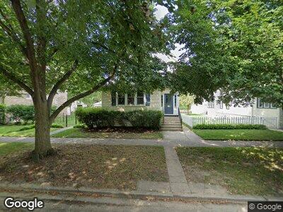
2020 Pratt Ct Evanston, IL 60201
Northeast Evanston NeighborhoodEstimated Value: $1,009,037 - $1,234,000
5
Beds
2
Baths
2,866
Sq Ft
$397/Sq Ft
Est. Value
About This Home
This home is located at 2020 Pratt Ct, Evanston, IL 60201 and is currently estimated at $1,136,509, approximately $396 per square foot. 2020 Pratt Ct is a home with nearby schools including Dewey Elementary School, Washington Elementary School, and Nichols Middle School.
Ownership History
Date
Name
Owned For
Owner Type
Purchase Details
Closed on
Feb 24, 2020
Sold by
Lisinski Gregory J and Margaret R Ketterer Living Tru
Bought by
Lisinski Gregory J and Gregory J Lisinksi Living Trus
Current Estimated Value
Home Financials for this Owner
Home Financials are based on the most recent Mortgage that was taken out on this home.
Original Mortgage
$297,000
Interest Rate
3.87%
Mortgage Type
New Conventional
Purchase Details
Closed on
Nov 5, 2018
Sold by
Lisinski Gregory J and Ketterer Margaret R
Bought by
Lisinski Gregory J and Gregory J Lisinski Living Trust
Home Financials for this Owner
Home Financials are based on the most recent Mortgage that was taken out on this home.
Original Mortgage
$200,000
Interest Rate
5%
Mortgage Type
New Conventional
Create a Home Valuation Report for This Property
The Home Valuation Report is an in-depth analysis detailing your home's value as well as a comparison with similar homes in the area
Home Values in the Area
Average Home Value in this Area
Purchase History
| Date | Buyer | Sale Price | Title Company |
|---|---|---|---|
| Lisinski Gregory J | -- | Fidelity National Title | |
| Lisinski Gregory J | -- | First American Title |
Source: Public Records
Mortgage History
| Date | Status | Borrower | Loan Amount |
|---|---|---|---|
| Closed | Lisinski Gregory J | $297,000 | |
| Closed | Lisinski Gregory J | $200,000 | |
| Closed | Lisinski Gregory J | $322,700 | |
| Closed | Lisinski Gregory J | $337,500 |
Source: Public Records
Tax History Compared to Growth
Tax History
| Year | Tax Paid | Tax Assessment Tax Assessment Total Assessment is a certain percentage of the fair market value that is determined by local assessors to be the total taxable value of land and additions on the property. | Land | Improvement |
|---|---|---|---|---|
| 2024 | $18,547 | $86,000 | $14,250 | $71,750 |
| 2023 | $18,547 | $86,000 | $14,250 | $71,750 |
| 2022 | $18,547 | $86,000 | $14,250 | $71,750 |
| 2021 | $16,329 | $68,193 | $9,405 | $58,788 |
| 2020 | $17,855 | $68,193 | $9,405 | $58,788 |
| 2019 | $16,035 | $74,610 | $9,405 | $65,205 |
| 2018 | $17,263 | $69,193 | $7,980 | $61,213 |
| 2017 | $16,841 | $69,193 | $7,980 | $61,213 |
| 2016 | $16,428 | $69,193 | $7,980 | $61,213 |
| 2015 | $14,357 | $58,043 | $6,840 | $51,203 |
| 2014 | $14,246 | $58,043 | $6,840 | $51,203 |
| 2013 | $14,378 | $58,043 | $6,840 | $51,203 |
Source: Public Records
Map
Nearby Homes
- 2024 Maple Ave
- 1105 Leonard Place
- 1915 Asbury Ave
- 1889 Maple Ave Unit E5
- 1909 Asbury Ave
- 2026 Green Bay Rd
- 2025 Sherman Ave Unit 401
- 1945 Wesley Ave
- 1862 Sherman Ave Unit 7SE
- 1935 Sherman Ave Unit 2N
- 1935 Sherman Ave Unit 1N
- 1830 Ridge Ave Unit P16
- 1833 Asbury Ave
- 1923 Sherman Ave Unit 1N
- 1864 Sherman Ave Unit 5NW
- 1860 Sherman Ave Unit 7NE
- 2036 Orrington Ave
- 709 Foster St
- 1942 Orrington Ave
- 730 Noyes St Unit K3