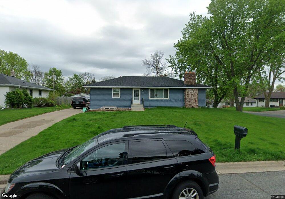
2020 Upper 45th St E Inver Grove Heights, MN 55077
Estimated Value: $325,000 - $375,000
3
Beds
2
Baths
1,400
Sq Ft
$253/Sq Ft
Est. Value
About This Home
This home is located at 2020 Upper 45th St E, Inver Grove Heights, MN 55077 and is currently estimated at $354,035, approximately $252 per square foot. 2020 Upper 45th St E is a home located in Dakota County with nearby schools including Hilltop Elementary School, Inver Grove Heights Middle School, and Simley Senior High School.
Ownership History
Date
Name
Owned For
Owner Type
Purchase Details
Closed on
Sep 23, 2009
Sold by
Strandmark Mary E
Bought by
Mackeznie Shane M
Current Estimated Value
Create a Home Valuation Report for This Property
The Home Valuation Report is an in-depth analysis detailing your home's value as well as a comparison with similar homes in the area
Home Values in the Area
Average Home Value in this Area
Purchase History
| Date | Buyer | Sale Price | Title Company |
|---|---|---|---|
| Mackeznie Shane M | $183,125 | -- |
Source: Public Records
Tax History Compared to Growth
Tax History
| Year | Tax Paid | Tax Assessment Tax Assessment Total Assessment is a certain percentage of the fair market value that is determined by local assessors to be the total taxable value of land and additions on the property. | Land | Improvement |
|---|---|---|---|---|
| 2024 | $4,024 | $313,300 | $82,800 | $230,500 |
| 2023 | $4,024 | $313,700 | $80,700 | $233,000 |
| 2022 | $2,840 | $312,900 | $80,600 | $232,300 |
| 2021 | $2,862 | $266,500 | $70,100 | $196,400 |
| 2020 | $3,150 | $264,000 | $66,800 | $197,200 |
| 2019 | $3,391 | $246,300 | $63,600 | $182,700 |
| 2018 | $2,598 | $231,800 | $60,600 | $171,200 |
| 2017 | $2,647 | $225,100 | $57,700 | $167,400 |
| 2016 | $2,378 | $205,000 | $55,000 | $150,000 |
| 2015 | $2,265 | $185,665 | $48,663 | $137,002 |
| 2014 | -- | $167,353 | $46,006 | $121,347 |
| 2013 | -- | $144,899 | $41,796 | $103,103 |
Source: Public Records
Map
Nearby Homes
- 4611 Blaine Ave Unit 1308
- 4552 Blaylock Way
- 4815 Babcock Trail Unit 3010
- 4825 Babcock Trail Unit 2005
- 4745 Blaine Ave Unit 509
- 4614 Bloomberg Ln
- 210 19th Ave S
- 4852 Bisset Ln Unit 9504
- 2233 Gilbert Ln
- 354 12th Ave S
- 1706 2nd St N
- 456 10th Ave S
- 140 12th Ave S
- 450 10th Ave S
- 308 10th Ave S
- 257 15th Ave N
- 101 11th Ave N
- 1923 Fox Ridge Dr Unit B
- 118 11th Ave N
- 804 8th Ave S
- 2050 Upper 45th St E
- 4550 Bacon Ave
- 4549 Bacon Ave
- 2080 Upper 45th St E
- 4529 Bacon Ave
- 2025 Upper 45th St E
- 4559 Bacon Ave
- 4620 Bacon Ct
- 4580 Bacon Ave
- 2055 Upper 45th St E
- 4515 Bacon Ave
- 4573 Bacon Ave
- 4525 Barbara Ave
- 2075 Upper 45th St E
- 4546 August Way
- 4503 Bacon Ave
- 4555 Barbara Ave
- 4591 Bacon Ave
- 4528 August Way
- 4558 August Way