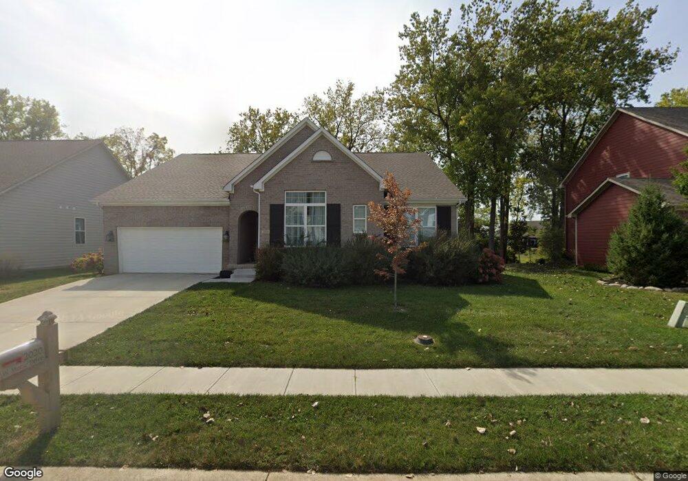
2020 W Morse Dr Cicero, IN 46034
Estimated Value: $464,101 - $516,000
3
Beds
3
Baths
2,398
Sq Ft
$203/Sq Ft
Est. Value
About This Home
This home is located at 2020 W Morse Dr, Cicero, IN 46034 and is currently estimated at $487,525, approximately $203 per square foot. 2020 W Morse Dr is a home located in Hamilton County with nearby schools including Hamilton Heights Primary School, Hamilton Heights Elementary School, and Hamilton Heights Middle School.
Ownership History
Date
Name
Owned For
Owner Type
Purchase Details
Closed on
Nov 21, 2019
Sold by
Silverthorne Homes
Bought by
Olney Christopher and Olney Charity
Current Estimated Value
Home Financials for this Owner
Home Financials are based on the most recent Mortgage that was taken out on this home.
Original Mortgage
$224,853
Outstanding Balance
$197,416
Interest Rate
3.5%
Mortgage Type
New Conventional
Estimated Equity
$290,109
Purchase Details
Closed on
Aug 1, 2019
Sold by
Mlw Llc
Bought by
Silverthorne Homes
Create a Home Valuation Report for This Property
The Home Valuation Report is an in-depth analysis detailing your home's value as well as a comparison with similar homes in the area
Home Values in the Area
Average Home Value in this Area
Purchase History
| Date | Buyer | Sale Price | Title Company |
|---|---|---|---|
| Olney Christopher | -- | Enterprise Title | |
| Silverthorne Homes | -- | None Available |
Source: Public Records
Mortgage History
| Date | Status | Borrower | Loan Amount |
|---|---|---|---|
| Open | Olney Christopher | $224,853 |
Source: Public Records
Tax History Compared to Growth
Tax History
| Year | Tax Paid | Tax Assessment Tax Assessment Total Assessment is a certain percentage of the fair market value that is determined by local assessors to be the total taxable value of land and additions on the property. | Land | Improvement |
|---|---|---|---|---|
| 2024 | $3,974 | $459,600 | $39,600 | $420,000 |
| 2023 | $3,974 | $397,400 | $39,600 | $357,800 |
| 2022 | $3,539 | $353,900 | $39,600 | $314,300 |
| 2021 | $3,264 | $326,400 | $39,600 | $286,800 |
| 2020 | $3,294 | $329,400 | $39,600 | $289,800 |
| 2019 | $0 | $600 | $600 | $0 |
| 2018 | $12 | $600 | $600 | $0 |
| 2017 | $12 | $600 | $600 | $0 |
| 2016 | $12 | $600 | $600 | $0 |
| 2014 | $13 | $600 | $600 | $0 |
| 2013 | $13 | $600 | $600 | $0 |
Source: Public Records
Map
Nearby Homes
- 34 Hovden Dr
- 104 Perlican Dr
- 14 Morse Ct
- 15 Morse Ct
- 131 Batteese Dr
- 31 Bluewater Dr
- 130 Overston Ct
- 826 N Lanyard Dr
- 815 Morse Landing Dr
- 221 Common Loon Blvd
- 18 Point Ln
- 100 Confidential Dr
- 24 Karner Blue Ct
- 47 Karner Blue Ct
- 23 Karner Blue Ct
- 27 Karner Blue Ct
- 25 Karner Blue Ct
- 1180 Shoreline Cir
- 47 Lively Place
- 1306 N Catamaran Cir
- 2020 Eagles Ridge Dr
- 2010 W Morse Dr
- 2010 Eagles Ridge Dr
- 1070 W Morse Dr
- 183 Lander Bluff Ct
- 163 Lander Bluff Ct
- 2000 W Morse Dr
- 1095 Eagles Ridge Dr
- 1000 Eagles Ridge Dr
- 1060 W Morse Dr
- 143 Lander Bluff Ct
- 2000 Eagles Ridge Dr
- 1055 W Morse Dr
- 123 Lander Bluff Ct
- 1050 W Morse Dr
- 223 Alvor Ct
- 1045 W Morse Dr
- 103 Lander Bluff Ct
- 1090 Eagles Ridge Dr
- 2015 W Morse Dr