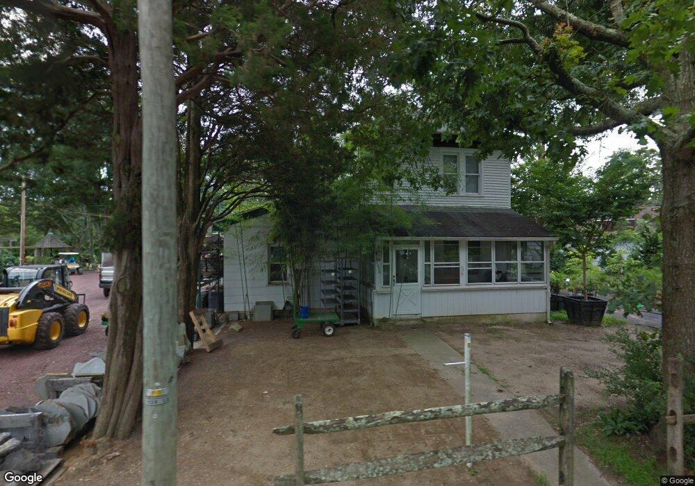
2020 West Ave Linwood, NJ 08221
Estimated Value: $735,000
--
Bed
--
Bath
2,104
Sq Ft
$349/Sq Ft
Est. Value
About This Home
This home is located at 2020 West Ave, Linwood, NJ 08221 and is currently estimated at $735,000, approximately $349 per square foot. 2020 West Ave is a home located in Atlantic County with nearby schools including Seaview Elementary School, Belhaven Middle School, and Mainland Regional High School.
Ownership History
Date
Name
Owned For
Owner Type
Purchase Details
Closed on
Nov 13, 2019
Sold by
Big Foot Properties Llc
Bought by
2020 West Properties Llc
Current Estimated Value
Home Financials for this Owner
Home Financials are based on the most recent Mortgage that was taken out on this home.
Original Mortgage
$800,000
Interest Rate
3.6%
Mortgage Type
Purchase Money Mortgage
Purchase Details
Closed on
Jul 28, 2009
Sold by
Lang Robert A
Bought by
Bigfoot Properties Llc
Purchase Details
Closed on
Apr 3, 2009
Sold by
Alfred & Edith Land Irrevocable Trust and Lang Robert A
Bought by
Lang Robert A
Create a Home Valuation Report for This Property
The Home Valuation Report is an in-depth analysis detailing your home's value as well as a comparison with similar homes in the area
Home Values in the Area
Average Home Value in this Area
Purchase History
| Date | Buyer | Sale Price | Title Company |
|---|---|---|---|
| 2020 West Properties Llc | $700,000 | Foundation Title Llc | |
| Bigfoot Properties Llc | -- | None Available | |
| Lang Robert A | -- | None Available |
Source: Public Records
Mortgage History
| Date | Status | Borrower | Loan Amount |
|---|---|---|---|
| Closed | 2020 West Properties Llc | $800,000 |
Source: Public Records
Tax History Compared to Growth
Tax History
| Year | Tax Paid | Tax Assessment Tax Assessment Total Assessment is a certain percentage of the fair market value that is determined by local assessors to be the total taxable value of land and additions on the property. | Land | Improvement |
|---|---|---|---|---|
| 2025 | $19,884 | $521,200 | $400,000 | $121,200 |
| 2024 | $19,884 | $521,200 | $400,000 | $121,200 |
| 2023 | $18,961 | $521,200 | $400,000 | $121,200 |
| 2022 | $18,961 | $521,200 | $400,000 | $121,200 |
| 2021 | $18,794 | $521,200 | $400,000 | $121,200 |
| 2020 | $18,534 | $521,200 | $400,000 | $121,200 |
| 2019 | $18,138 | $521,200 | $400,000 | $121,200 |
| 2018 | $23,617 | $694,200 | $500,000 | $194,200 |
| 2017 | $23,145 | $694,200 | $500,000 | $194,200 |
| 2016 | $22,367 | $694,200 | $500,000 | $194,200 |
| 2015 | $22,388 | $694,200 | $500,000 | $194,200 |
| 2014 | $21,520 | $694,200 | $500,000 | $194,200 |
Source: Public Records
Map
Nearby Homes
- 26 Creek Ln
- 493 Sara Ann Ct
- 513 Garfield Ave
- 1714 New Rd
- 405 Frances Ave
- 5A Cedar Hollow
- 334 W Ocean Heights Ave #112 Ave
- 334 W Ocean Heights #112 Ave Unit 112
- 105 Garden Ct
- 118 Kirklin Ave
- 536 W Ocean Heights Ave
- 1930 Shore Rd
- 209 Belhaven Ave
- 10 Sunset Ave
- 18 Berkley Ave
- 18 Berkley St
- 203 Rosemarie Dr
- 182 Blackman Rd
- 110 E Seaview Ave
- 116 W Ocean Ave
- 2031 West Ave
- 2019 West Ave
- 2015 West Ave
- 2021 New Rd
- 603 Cedar Hill Ln
- 2033 West Ave
- 2013 West Ave
- 601 Cedar Hill Ln Unit 601
- 2048 West Ave
- 2020 New Rd
- 2030 New Rd
- 2030 New Rd
- 2020 New Rd Unit 1
- 2020 New Rd Unit A
- 499 Sara Ann Ct
- 2021 West Ave
- 2007 West Ave
- 2037 West Ave
- 2037 West Ave
- 2047 West Ave