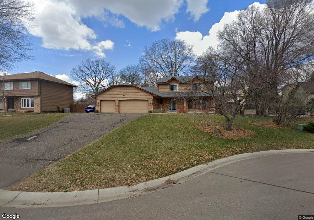
2021 127th Ave NW Coon Rapids, MN 55448
Estimated Value: $451,000 - $507,996
4
Beds
4
Baths
3,510
Sq Ft
$137/Sq Ft
Est. Value
About This Home
This home is located at 2021 127th Ave NW, Coon Rapids, MN 55448 and is currently estimated at $480,749, approximately $136 per square foot. 2021 127th Ave NW is a home located in Anoka County with nearby schools including Lucile Bruner Elementary School, Morris Bye Elementary School, and Laughlin Junior/Senior High School.
Ownership History
Date
Name
Owned For
Owner Type
Purchase Details
Closed on
Nov 18, 2019
Sold by
Smisson Rick
Bought by
Thao Leimeang
Current Estimated Value
Home Financials for this Owner
Home Financials are based on the most recent Mortgage that was taken out on this home.
Original Mortgage
$323,980
Outstanding Balance
$285,019
Interest Rate
3.6%
Mortgage Type
New Conventional
Estimated Equity
$195,730
Purchase Details
Closed on
Sep 18, 2015
Sold by
Thorstenson Elaine Elaine
Bought by
Smisson Rick Rick
Home Financials for this Owner
Home Financials are based on the most recent Mortgage that was taken out on this home.
Original Mortgage
$283,176
Interest Rate
4%
Mortgage Type
FHA
Create a Home Valuation Report for This Property
The Home Valuation Report is an in-depth analysis detailing your home's value as well as a comparison with similar homes in the area
Home Values in the Area
Average Home Value in this Area
Purchase History
| Date | Buyer | Sale Price | Title Company |
|---|---|---|---|
| Thao Leimeang | $334,000 | Titlesmart Inc | |
| Smisson Rick Rick | $288,400 | -- | |
| Smisson Rick | $288,400 | Trademark Title Services Inc |
Source: Public Records
Mortgage History
| Date | Status | Borrower | Loan Amount |
|---|---|---|---|
| Open | Thao Leimeang | $323,980 | |
| Previous Owner | Smisson Rick | $283,176 |
Source: Public Records
Tax History Compared to Growth
Tax History
| Year | Tax Paid | Tax Assessment Tax Assessment Total Assessment is a certain percentage of the fair market value that is determined by local assessors to be the total taxable value of land and additions on the property. | Land | Improvement |
|---|---|---|---|---|
| 2025 | $4,998 | $478,000 | $94,500 | $383,500 |
| 2024 | $4,998 | $464,800 | $91,400 | $373,400 |
| 2023 | $4,598 | $455,800 | $75,600 | $380,200 |
| 2022 | $4,295 | $463,700 | $75,600 | $388,100 |
| 2021 | $4,188 | $383,600 | $58,800 | $324,800 |
| 2020 | $4,052 | $366,000 | $58,800 | $307,200 |
| 2019 | $3,941 | $340,700 | $58,800 | $281,900 |
| 2018 | $3,864 | $322,400 | $0 | $0 |
| 2017 | $3,802 | $306,800 | $0 | $0 |
| 2016 | $3,854 | $293,800 | $0 | $0 |
| 2015 | $3,747 | $293,800 | $52,500 | $241,300 |
| 2014 | -- | $249,700 | $37,200 | $212,500 |
Source: Public Records
Map
Nearby Homes
- 1930 127th Cir NW
- 2147 125th Ln NW
- 12760 Raven St NW
- 12888 Nightingale St NW
- 2068 124th Ln NW
- 12759 Ibis St NW
- 12554 Grouse St NW
- 12365 Jay St NW
- 1593 126th Ln NW
- 1520 129th Ave NW
- 1450 126th Ln NW
- 12463 Drake St NW
- 1687 131st Ln NW
- 1727 121st Ln NW
- 2675 128th Ave NW
- 1776 133rd Ave NW
- 13182 Crane St NW
- 13416 Swallow St NW
- 1234 128th Cir NW
- 13182 Zion St NW
- 2031 127th Ave NW
- 1959 127th Ave NW
- 2022 127th Ln NW
- 1968 127th Ln NW
- 2032 127th Ln NW
- 1951 127th Ave NW
- 2030 127th Ave NW
- 1958 127th Ln NW
- 2073 127th Ave NW
- 2013 127th Ln NW
- 2052 127th Ln NW
- 2023 127th Ln NW
- 1948 127th Ln NW
- 2033 127th Ln NW
- 1965 127th Ln NW
- 2060 127th Ave NW
- 1955 127th Ln NW
- 2062 127th Ln NW
- 2070 127th Ave NW
- 1934 127th Cir NW