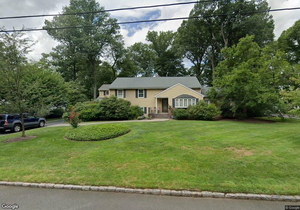
2021 Brookside Dr Scotch Plains, NJ 07076
Estimated Value: $878,795 - $1,342,000
--
Bed
--
Bath
2,688
Sq Ft
$439/Sq Ft
Est. Value
About This Home
This home is located at 2021 Brookside Dr, Scotch Plains, NJ 07076 and is currently estimated at $1,179,199, approximately $438 per square foot. 2021 Brookside Dr is a home located in Union County with nearby schools including William J. McGinn Elementary School, Terrill Middle School, and Scotch Plains-Fanwood High School.
Ownership History
Date
Name
Owned For
Owner Type
Purchase Details
Closed on
Jun 12, 2013
Sold by
Bokert Rita D
Bought by
Bokert Rita D
Current Estimated Value
Purchase Details
Closed on
Jul 20, 2011
Sold by
Bokert Leonard J and Bokert Rita D
Bought by
Bokert Leonard J and Bokert Rita D
Create a Home Valuation Report for This Property
The Home Valuation Report is an in-depth analysis detailing your home's value as well as a comparison with similar homes in the area
Home Values in the Area
Average Home Value in this Area
Purchase History
| Date | Buyer | Sale Price | Title Company |
|---|---|---|---|
| Bokert Rita D | -- | None Available | |
| Bokert Leonard J | -- | None Available |
Source: Public Records
Tax History Compared to Growth
Tax History
| Year | Tax Paid | Tax Assessment Tax Assessment Total Assessment is a certain percentage of the fair market value that is determined by local assessors to be the total taxable value of land and additions on the property. | Land | Improvement |
|---|---|---|---|---|
| 2025 | $21,888 | $186,000 | $53,600 | $132,400 |
| 2024 | $21,243 | $186,000 | $53,600 | $132,400 |
| 2023 | $21,243 | $186,000 | $53,600 | $132,400 |
| 2022 | $20,990 | $186,000 | $53,600 | $132,400 |
| 2021 | $20,955 | $186,000 | $53,600 | $132,400 |
| 2020 | $20,854 | $186,000 | $53,600 | $132,400 |
| 2019 | $20,700 | $186,000 | $53,600 | $132,400 |
| 2018 | $20,352 | $186,000 | $53,600 | $132,400 |
| 2017 | $19,900 | $186,000 | $53,600 | $132,400 |
| 2016 | $19,517 | $186,000 | $53,600 | $132,400 |
| 2015 | $19,197 | $186,000 | $53,600 | $132,400 |
| 2014 | $18,565 | $186,000 | $53,600 | $132,400 |
Source: Public Records
Map
Nearby Homes
- 2 Brookside Ct
- 2154 W Broad St
- 1933 W Broad St
- 119 Lamberts Mill Rd
- 1933 Mary Ellen Ln
- 1466 Lamberts Mill Rd
- 314 Highgate Ave
- 2116 Newark Ave
- 2 Dutch Ln
- 57 Rambling Dr
- 187 King St
- 525 Edgar Rd
- 524 Edgar Rd
- 2212 Shady Ln
- 5 Robin Rd
- 614 Dorian Rd
- 2 Unami Ln
- 120 S Martine Ave
- 2314 Longfellow Ave
- 1380 Terrill Rd
- 2031 Brookside Dr
- 2011 Brookside Dr
- 1430 Graymill Dr
- 1438 Graymill Dr
- 1446 Graymill Dr
- 2001 Brookside Dr
- 2041 Brookside Dr
- 2022 Brookside Dr
- 2032 Brookside Dr
- 2012 Brookside Dr
- 1454 Graymill Dr
- 1414 Graymill Dr
- 2042 Brookside Dr
- 1991 Brookside Dr
- 2002 Brookside Dr
- 1431 Graymill Dr
- 1439 Graymill Dr
- 1423 Graymill Dr
- 1406 Graymill Dr
- 1415 Graymill Dr