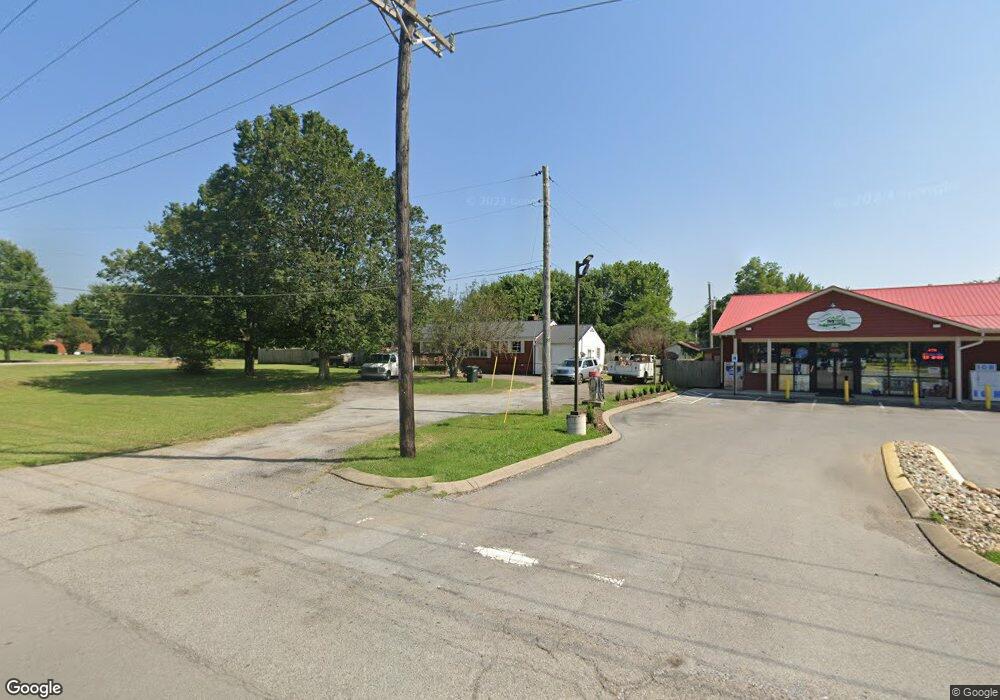
2021 Highway 70 W Dickson, TN 37055
Estimated Value: $285,000 - $363,000
4
Beds
2
Baths
1,776
Sq Ft
$183/Sq Ft
Est. Value
About This Home
This home is located at 2021 Highway 70 W, Dickson, TN 37055 and is currently estimated at $325,161, approximately $183 per square foot. 2021 Highway 70 W is a home located in Dickson County with nearby schools including Dickson Elementary School, Dickson Middle School, and Dickson County High School.
Ownership History
Date
Name
Owned For
Owner Type
Purchase Details
Closed on
Jul 28, 2015
Sold by
Murphy Larry Dale
Bought by
Patel Janak
Current Estimated Value
Purchase Details
Closed on
Jan 8, 2001
Sold by
Daniel Noah Alicia
Bought by
Murphy Larry D and Murphy Shauna L
Purchase Details
Closed on
Dec 29, 1994
Sold by
Fry Loraine
Bought by
Daniel Noah
Purchase Details
Closed on
May 4, 1970
Bought by
Fry Fry A and Fry Loraine
Create a Home Valuation Report for This Property
The Home Valuation Report is an in-depth analysis detailing your home's value as well as a comparison with similar homes in the area
Home Values in the Area
Average Home Value in this Area
Purchase History
| Date | Buyer | Sale Price | Title Company |
|---|---|---|---|
| Patel Janak | $75,000 | -- | |
| Murphy Larry D | $60,000 | -- | |
| Daniel Noah | $24,000 | -- | |
| Fry Fry A | -- | -- |
Source: Public Records
Tax History Compared to Growth
Tax History
| Year | Tax Paid | Tax Assessment Tax Assessment Total Assessment is a certain percentage of the fair market value that is determined by local assessors to be the total taxable value of land and additions on the property. | Land | Improvement |
|---|---|---|---|---|
| 2025 | -- | $58,775 | $0 | $0 |
| 2024 | -- | $58,775 | $9,850 | $48,925 |
| 2023 | $1,366 | $43,750 | $7,950 | $35,800 |
| 2022 | $1,366 | $43,750 | $7,950 | $35,800 |
| 2021 | $1,366 | $43,750 | $7,950 | $35,800 |
| 2020 | $1,366 | $43,750 | $7,950 | $35,800 |
| 2019 | $1,366 | $43,750 | $7,950 | $35,800 |
| 2018 | $998 | $27,350 | $7,625 | $19,725 |
| 2017 | $998 | $27,350 | $7,625 | $19,725 |
| 2016 | $998 | $27,350 | $7,625 | $19,725 |
| 2015 | $940 | $24,225 | $7,625 | $16,600 |
| 2014 | $957 | $24,675 | $8,075 | $16,600 |
Source: Public Records
Map
Nearby Homes
- 2020 Highway 70 W
- 1014 Post Oak Dr
- 119 Silver Leaf Cir
- 0 White Oak Dr
- 202 Parkway W
- 3002 Highway 70 W
- 104 Westmeade Dr
- 103 C Oak Park Dr
- 829 Furnace Hollow Rd
- 0 Furnace Hollow Rd Unit RTC3001315
- 0 Furnace Hollow Rd Unit RTC3001314
- 0 Furnace Hollow Rd Unit RTC3001313
- 0 Furnace Hollow Rd Unit RTC3001312
- 0 Furnace Hollow Rd Unit RTC3001310
- 0 Furnace Hollow Rd Unit RTC3001307
- 0 Furnace Hollow Rd Unit RTC2940727
- 0 Furnace Hollow Rd
- 0 W First St
- 117 Dewey Dr
- 0 W Walnut St
- 2024 Highway 70 W
- 1106 Redmon Cir
- 102 Silver Leaf Cir
- 2026 Highway 70 W
- 2035 Highway 70 W
- 12 Silver Leaf Cir
- 104 Silver Leaf Cir
- 145 Silver Leaf Cir
- 143 Silver Leaf Cir
- 106 Red Oak Cir
- 106 Silver Leaf Cir
- 103 Silver Leaf Cir
- 104 Red Oak Cir
- 2011 Highway 70 W
- 108 Red Oak Cir
- 102 Red Oak Cir
- 110 Silver Leaf Cir
- 140 Silver Leaf Cir
- 2043 Highway 70 W
- 139 Silver Leaf Cir
