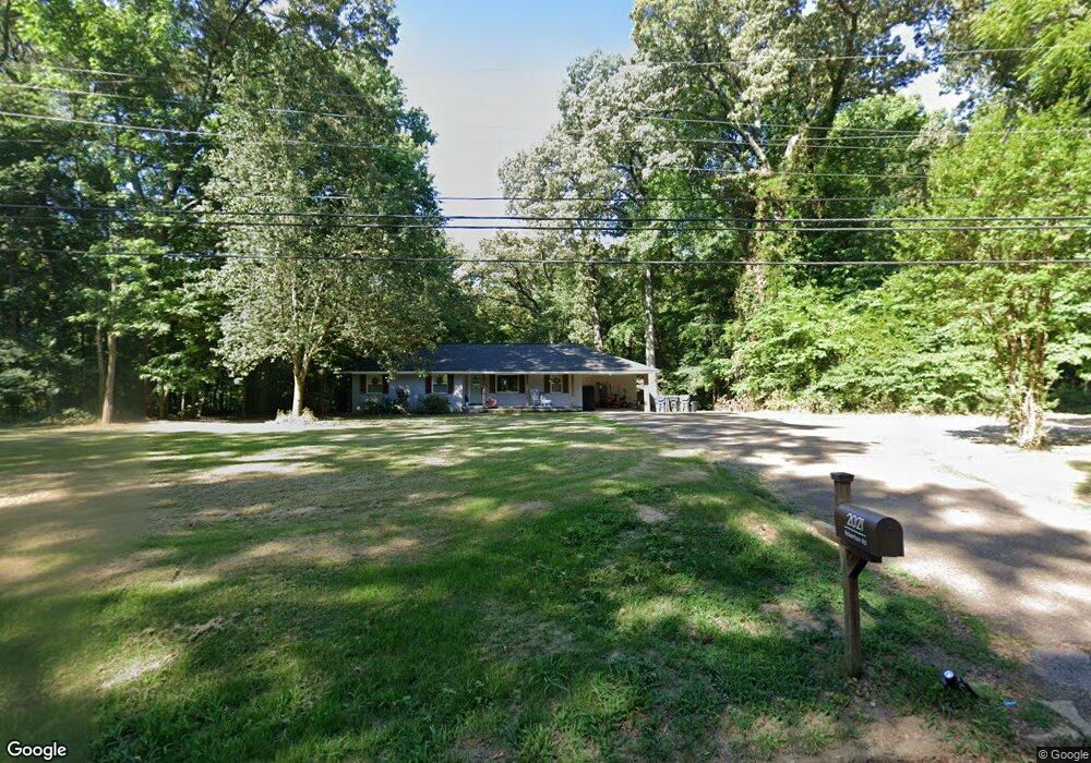
2021 Robertson Rd Hernando, MS 38632
Estimated Value: $261,000 - $281,000
3
Beds
2
Baths
1,800
Sq Ft
$150/Sq Ft
Est. Value
About This Home
This home is located at 2021 Robertson Rd, Hernando, MS 38632 and is currently estimated at $269,463, approximately $149 per square foot. 2021 Robertson Rd is a home located in DeSoto County with nearby schools including Oak Grove Central Elementary School, Hernando Elementary School, and Hernando Hills Elementary.
Ownership History
Date
Name
Owned For
Owner Type
Purchase Details
Closed on
Jan 6, 2022
Sold by
Brandon Mccrary Michael
Bought by
Wallace Meghan and Wallace William
Current Estimated Value
Home Financials for this Owner
Home Financials are based on the most recent Mortgage that was taken out on this home.
Original Mortgage
$245,284
Outstanding Balance
$224,201
Interest Rate
3.11%
Mortgage Type
New Conventional
Estimated Equity
$45,262
Purchase Details
Closed on
Oct 11, 2011
Sold by
Federal National Mortgage Association
Bought by
Mccrary Mike
Create a Home Valuation Report for This Property
The Home Valuation Report is an in-depth analysis detailing your home's value as well as a comparison with similar homes in the area
Home Values in the Area
Average Home Value in this Area
Purchase History
| Date | Buyer | Sale Price | Title Company |
|---|---|---|---|
| Wallace Meghan | -- | Perfect Title | |
| Mccrary Mike | -- | Landcastle Title |
Source: Public Records
Mortgage History
| Date | Status | Borrower | Loan Amount |
|---|---|---|---|
| Open | Wallace Meghan | $245,284 |
Source: Public Records
Tax History
| Year | Tax Paid | Tax Assessment Tax Assessment Total Assessment is a certain percentage of the fair market value that is determined by local assessors to be the total taxable value of land and additions on the property. | Land | Improvement |
|---|---|---|---|---|
| 2025 | $1,681 | $14,433 | $3,200 | $11,233 |
| 2024 | $1,529 | $11,017 | $3,200 | $7,817 |
| 2023 | $1,529 | $11,017 | $0 | $0 |
| 2022 | $1,529 | $11,017 | $3,200 | $7,817 |
| 2021 | $1,529 | $11,017 | $3,200 | $7,817 |
| 2020 | $1,442 | $10,392 | $0 | $0 |
| 2019 | $1,442 | $10,392 | $3,200 | $7,192 |
| 2017 | $1,413 | $17,066 | $10,133 | $6,933 |
| 2016 | $1,354 | $10,133 | $3,200 | $6,933 |
| 2015 | $1,354 | $17,066 | $10,133 | $6,933 |
| 2014 | $1,322 | $10,133 | $0 | $0 |
| 2013 | $1,322 | $15,199 | $0 | $0 |
Source: Public Records
Map
Nearby Homes
- 1770 Robertson Place Dr
- 1767 Robertson Place Dr
- 2035 Highway 51 S
- 1207 Howell Way
- 509 Howell Way
- 120 N Parkway St
- 270 Gaslight Cove
- 521 Abey Ln
- 136 N Parkway St
- 5 W Commerce St
- 187 Cross Creek Dr
- 1123 Peggy Cove
- 69 Lake Pointe Dr
- 1107 Sabrina Dr
- 470 Beacon Hill Dr
- 1038 W Oak Grove Rd
- 1280 S Lake Dr
- 2122 Scott Meadows Ln
- 2134 Scott Meadows Ln
- 1231 Cross Creek Dr E
- 2045 W Robinson St
- 1966 Robertson Rd
- 2085 Robertson Rd
- 1970 Hawthorne Dr
- 677 Harrow Cove
- 1955 Hawthorne Dr
- 1958 Robertson Rd
- 665 Harrow Cove
- 1956 Hawthorne Dr
- 689 Harrow Cove
- 1925 Hawthorne Dr
- 1950 Hawthorne Dr
- 1926 Robertson Rd
- 2090 Robertson Rd
- 2090 Robinson Rd
- 2125 Robertson Rd
- 1905 Hawthorne Dr
- 1930 Hawthorne Dr
- 23 Hawthorne Dr
- 16 Hawthorne Dr
Your Personal Tour Guide
Ask me questions while you tour the home.