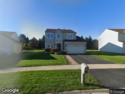
2021 Royal Ln Aurora, IL 60503
Far Southeast NeighborhoodEstimated Value: $407,000 - $461,000
--
Bed
--
Bath
1,070
Sq Ft
$398/Sq Ft
Est. Value
About This Home
This home is located at 2021 Royal Ln, Aurora, IL 60503 and is currently estimated at $426,212, approximately $398 per square foot. 2021 Royal Ln is a home located in Kendall County with nearby schools including The Wheatlands Elementary School, Bednarcik Jr. High School, and Oswego East High School.
Ownership History
Date
Name
Owned For
Owner Type
Purchase Details
Closed on
Sep 29, 1999
Sold by
Sfllc Wheatland
Bought by
Wheaton Wayne
Current Estimated Value
Home Financials for this Owner
Home Financials are based on the most recent Mortgage that was taken out on this home.
Original Mortgage
$133,635
Interest Rate
7.35%
Create a Home Valuation Report for This Property
The Home Valuation Report is an in-depth analysis detailing your home's value as well as a comparison with similar homes in the area
Home Values in the Area
Average Home Value in this Area
Purchase History
| Date | Buyer | Sale Price | Title Company |
|---|---|---|---|
| Wheaton Wayne | $168,000 | Chicago Title Insurance Co |
Source: Public Records
Mortgage History
| Date | Status | Borrower | Loan Amount |
|---|---|---|---|
| Open | Wheaton Wayne F | $83,500 | |
| Closed | Wheaton Wayne | $131,500 | |
| Closed | Wheaton Wayne | $34,500 | |
| Closed | Wheaton Wayne | $133,635 |
Source: Public Records
Tax History Compared to Growth
Tax History
| Year | Tax Paid | Tax Assessment Tax Assessment Total Assessment is a certain percentage of the fair market value that is determined by local assessors to be the total taxable value of land and additions on the property. | Land | Improvement |
|---|---|---|---|---|
| 2023 | $9,233 | $104,552 | $26,514 | $78,038 |
| 2022 | $9,233 | $97,712 | $24,779 | $72,933 |
| 2021 | $8,921 | $91,320 | $23,158 | $68,162 |
| 2020 | $8,838 | $89,529 | $22,704 | $66,825 |
| 2019 | $8,903 | $88,219 | $22,704 | $65,515 |
| 2018 | $8,345 | $80,898 | $20,820 | $60,078 |
| 2017 | $8,093 | $74,560 | $19,189 | $55,371 |
| 2016 | $7,759 | $70,673 | $18,189 | $52,484 |
| 2015 | $7,485 | $65,438 | $16,842 | $48,596 |
| 2014 | -- | $61,734 | $15,889 | $45,845 |
| 2013 | -- | $62,357 | $16,049 | $46,308 |
Source: Public Records
Map
Nearby Homes
- 1932 Royal Ln
- 1874 Wisteria Dr Unit 333
- 1913 Misty Ridge Ln Unit 5
- 1917 Turtle Creek Ct
- 2355 Avalon Ct
- 3326 Fulshear Cir
- 3328 Fulshear Cir
- 3408 Fulshear Cir
- 2270 Twilight Dr Unit 2270
- 2278 Twilight Dr
- 2410 Oakfield Ct
- 2013 Eastwick Ln
- 2197 Wilson Creek Cir Unit 3
- 1919 Indian Hill Ln Unit 4035
- 2495 Hafenrichter Rd
- 1799 Indian Hill Ln Unit 4113
- 1741 Fredericksburg Ln
- 2397 Sunrise Cir Unit 35129
- 629 Lincoln Station Dr Unit 1503
- 2262 Shiloh Dr Unit 2
- 2021 Royal Ln
- 2013 Royal Ln
- 2029 Royal Ln
- 2005 Royal Ln
- 2028 Royal Ln
- 2012 Royal Ln
- 1997 Royal Ln
- 1996 Royal Ln
- 2014 Congrove Dr
- 2022 Congrove Dr
- 2006 Congrove Dr
- 2090 James Leigh Dr
- 2076 James Leigh Dr
- 1998 Congrove Dr
- 2104 James Leigh Dr Unit 3
- 2062 James Leigh Dr
- 2030 Congrove Dr
- 1975 Congrove Dr
- 1989 Royal Ln
- 1972 Royal Ln