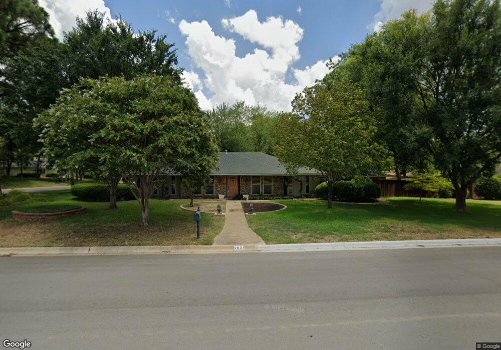
2021 Southridge Dr Denton, TX 76205
South Denton NeighborhoodEstimated Value: $385,336 - $457,000
3
Beds
3
Baths
1,912
Sq Ft
$225/Sq Ft
Est. Value
About This Home
This home is located at 2021 Southridge Dr, Denton, TX 76205 and is currently estimated at $429,334, approximately $224 per square foot. 2021 Southridge Dr is a home located in Denton County with nearby schools including Houston Elementary School, McMath Middle School, and Denton High School.
Ownership History
Date
Name
Owned For
Owner Type
Purchase Details
Closed on
Jan 13, 1994
Sold by
Reynolds Jessie Collings
Bought by
Anderson George F and Anderson Dawn K
Current Estimated Value
Home Financials for this Owner
Home Financials are based on the most recent Mortgage that was taken out on this home.
Original Mortgage
$100,700
Interest Rate
7.09%
Create a Home Valuation Report for This Property
The Home Valuation Report is an in-depth analysis detailing your home's value as well as a comparison with similar homes in the area
Home Values in the Area
Average Home Value in this Area
Purchase History
| Date | Buyer | Sale Price | Title Company |
|---|---|---|---|
| Anderson George F | -- | -- |
Source: Public Records
Mortgage History
| Date | Status | Borrower | Loan Amount |
|---|---|---|---|
| Closed | Anderson George F | $100,700 |
Source: Public Records
Tax History Compared to Growth
Tax History
| Year | Tax Paid | Tax Assessment Tax Assessment Total Assessment is a certain percentage of the fair market value that is determined by local assessors to be the total taxable value of land and additions on the property. | Land | Improvement |
|---|---|---|---|---|
| 2025 | $2,249 | $324,000 | $118,639 | $205,361 |
| 2024 | $6,833 | $354,000 | $118,639 | $235,361 |
| 2023 | $2,254 | $337,248 | $112,881 | $244,119 |
| 2022 | $6,508 | $306,589 | $104,681 | $237,090 |
| 2021 | $6,196 | $278,717 | $69,788 | $208,929 |
| 2020 | $6,014 | $263,107 | $69,788 | $193,319 |
| 2019 | $6,378 | $267,291 | $69,788 | $197,503 |
| 2018 | $6,197 | $256,522 | $69,788 | $186,734 |
| 2017 | $5,958 | $241,042 | $69,788 | $171,254 |
| 2016 | $4,037 | $221,024 | $69,788 | $151,236 |
| 2015 | $3,874 | $206,254 | $69,788 | $136,466 |
| 2013 | -- | $197,475 | $80,247 | $117,228 |
Source: Public Records
Map
Nearby Homes
- 2012 Hollyhill Ln
- 2218 Southridge Dr
- 209 Pennsylvania Dr
- 412 Hollyhill Ln Unit 412
- 408 Hollyhill Ln
- 924 Ridgecrest Cir
- 1412 Ridgecrest Cir
- 2100 Fairfax Rd
- 2120 Fairfax Rd
- 2253 Hollyhill Ln
- 1500 Sandy Creek Dr
- 2226 Savannah Trail
- 1000 Lynhurst Ln
- 2272 Hollyhill Ln
- 2216 Jefferson Trail
- 829 Skylark Dr
- 1541 Valley Creek Rd
- 916 Smokerise Cir
- 1536 Valley Creek Rd
- 821 Sandpiper Dr
- 1821 Stonegate Dr
- 2025 Southridge Dr
- 1824 Stonegate Dr
- 2020 Southridge Dr
- 1207 Ridgecrest Cir
- 1820 Stonegate Dr
- 1819 Stonegate Dr
- 2024 Southridge Dr
- 2016 Southridge Dr
- 1818 Stonegate Dr
- 1901 Stonegate Dr
- 1213 Ridgecrest Cir
- 1813 Stonegate Dr
- 1200 Ridgecrest Cir
- 2001 Southridge Dr
- 1821 Concord Ln
- 1206 Ridgecrest Cir
- 1124 Ridgecrest Cir
- 2006 Southridge Dr
- 1900 Stonegate Dr