2021 Upper Bay Rd Arcata, CA 95521
Estimated Value: $360,010 - $477,000
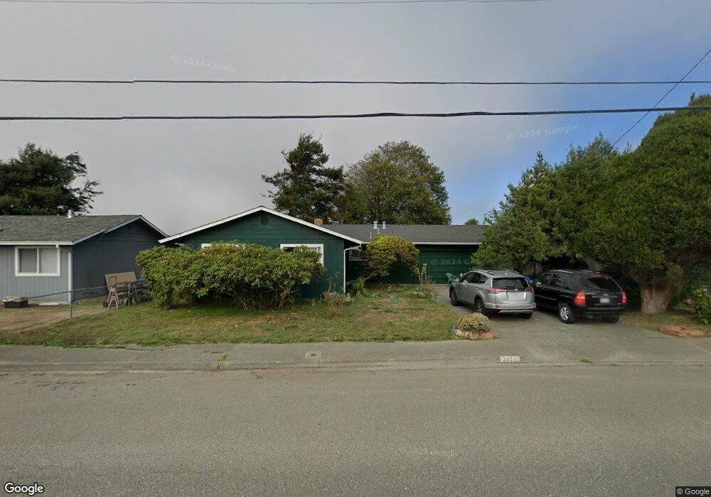
About This Home
This home is located at 2021 Upper Bay Rd, Arcata, CA 95521 and is currently estimated at $432,503. 2021 Upper Bay Rd is a home located in Humboldt County with nearby schools including Pacific Union Elementary School, Arcata High School, and Trillium Charter School.
Ownership History
We collect this data history from publicly available records. To have your information removed, we recommend requesting removal directly through your county’s website.
Purchase Details
Purchase Details
Purchase History
We collect this data history from publicly available records. To have your information removed, we recommend requesting removal directly through your county’s website.
| Date | Buyer | Sale Price | Title Company |
|---|---|---|---|
| -- | Hjerpe & Godinho Llp | ||
| -- | -- |
Tax History
We collect this data history from publicly available records. To have your information removed, we recommend requesting removal directly through your county’s website.
| Year | Tax Paid | Tax Assessment Tax Assessment Total Assessment is a certain percentage of the fair market value that is determined by local assessors to be the total taxable value of land and additions on the property. | Land | Improvement |
|---|---|---|---|---|
| 2025 | $1,564 | $139,802 | $51,501 | $88,301 |
| 2024 | $1,564 | $137,062 | $50,492 | $86,570 |
| 2023 | $1,562 | $134,375 | $49,502 | $84,873 |
| 2022 | $1,553 | $131,741 | $48,532 | $83,209 |
| 2021 | $1,544 | $129,159 | $47,581 | $81,578 |
| 2020 | $1,440 | $127,836 | $47,094 | $80,742 |
| 2019 | $1,417 | $125,330 | $46,171 | $79,159 |
| 2018 | $1,327 | $122,873 | $45,266 | $77,607 |
| 2017 | $1,306 | $120,465 | $44,379 | $76,086 |
| 2016 | $1,283 | $118,104 | $43,509 | $74,595 |
| 2015 | $1,260 | $116,331 | $42,856 | $73,475 |
| 2014 | $1,242 | $114,053 | $42,017 | $72,036 |
Map
- 3735 Shetland Ln
- 2084 Mustang Ln
- 2074 Mustang Ln
- 4349 Bay Meadows Ct
- 1330 Spear Ave
- 3028 Alliance Rd
- 1731 Stewart Ave
- 3245 W End Rd
- 4690 Mckinnon Ct
- 2966 Janes Creek Dr
- 3122 St Louis Rd
- 2529 Baldwin St
- 1283 Poplar Dr
- 452 Tanglewood Rd
- 448 Tanglewood Rd
- 2220 Wisteria Way
- 444 Tanglewood Rd
- 1082 Cedar Dr
- 1184 Poplar Dr
- 954 Courtyard Cir
Ask me questions while you tour the home.