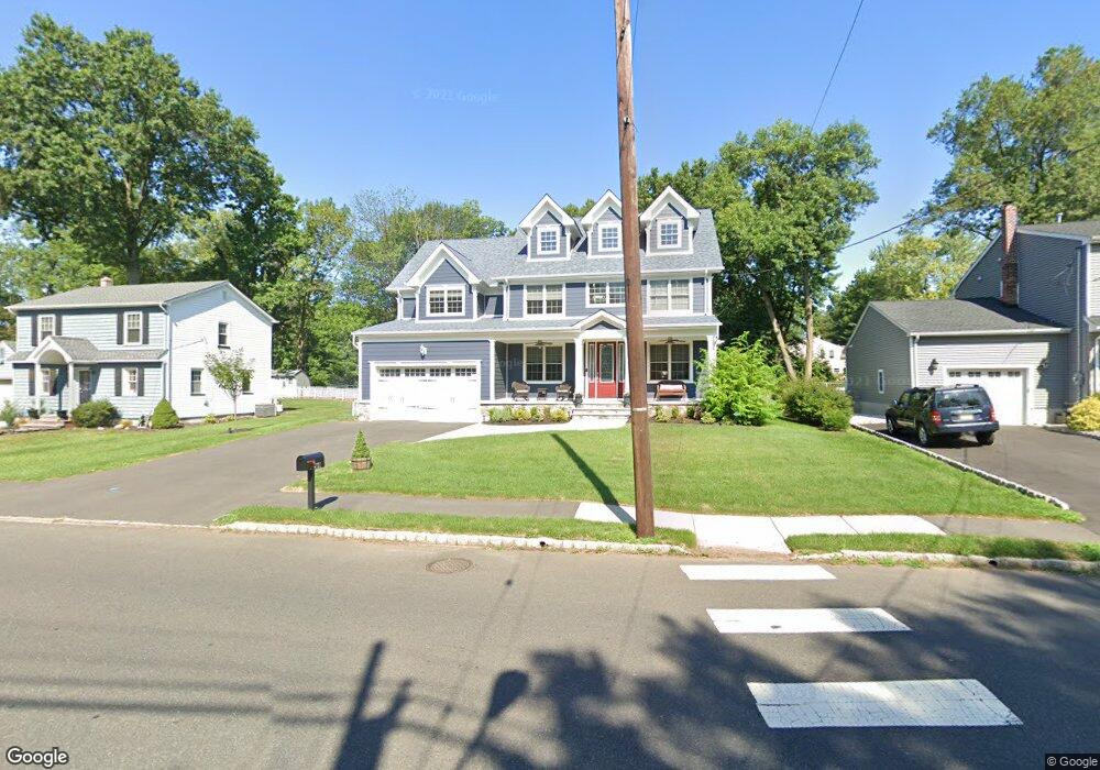
2021 W Broad St Scotch Plains, NJ 07076
Estimated Value: $1,090,845 - $1,660,000
--
Bed
--
Bath
3,239
Sq Ft
$403/Sq Ft
Est. Value
About This Home
This home is located at 2021 W Broad St, Scotch Plains, NJ 07076 and is currently estimated at $1,303,961, approximately $402 per square foot. 2021 W Broad St is a home located in Union County with nearby schools including William J. McGinn Elementary School, Terrill Middle School, and Scotch Plains-Fanwood High School.
Ownership History
Date
Name
Owned For
Owner Type
Purchase Details
Closed on
Jun 23, 2017
Sold by
Konstruct Enetrprises Inc
Bought by
Zdatny Jon and Zdatny Christina
Current Estimated Value
Home Financials for this Owner
Home Financials are based on the most recent Mortgage that was taken out on this home.
Original Mortgage
$791,950
Outstanding Balance
$651,393
Interest Rate
3.62%
Mortgage Type
Adjustable Rate Mortgage/ARM
Estimated Equity
$652,568
Purchase Details
Closed on
Jun 30, 2016
Sold by
Malinski Teresa
Bought by
Konstruct Enterprises Inc
Create a Home Valuation Report for This Property
The Home Valuation Report is an in-depth analysis detailing your home's value as well as a comparison with similar homes in the area
Home Values in the Area
Average Home Value in this Area
Purchase History
| Date | Buyer | Sale Price | Title Company |
|---|---|---|---|
| Zdatny Jon | $989,990 | Elite Title Group Llc | |
| Konstruct Enterprises Inc | $200,000 | -- |
Source: Public Records
Mortgage History
| Date | Status | Borrower | Loan Amount |
|---|---|---|---|
| Open | Zdatny Jon | $791,950 |
Source: Public Records
Tax History Compared to Growth
Tax History
| Year | Tax Paid | Tax Assessment Tax Assessment Total Assessment is a certain percentage of the fair market value that is determined by local assessors to be the total taxable value of land and additions on the property. | Land | Improvement |
|---|---|---|---|---|
| 2025 | $24,889 | $211,500 | $29,200 | $182,300 |
| 2024 | $24,155 | $211,500 | $29,200 | $182,300 |
| 2023 | $24,155 | $211,500 | $29,200 | $182,300 |
| 2022 | $23,868 | $211,500 | $29,200 | $182,300 |
| 2021 | $23,828 | $211,500 | $29,200 | $182,300 |
| 2020 | $23,713 | $211,500 | $29,200 | $182,300 |
| 2019 | $23,538 | $211,500 | $29,200 | $182,300 |
| 2018 | $23,142 | $211,500 | $29,200 | $182,300 |
| 2017 | $3,124 | $29,200 | $29,200 | $0 |
| 2016 | $7,597 | $72,400 | $29,200 | $43,200 |
| 2015 | $6,972 | $72,400 | $29,200 | $43,200 |
| 2014 | $6,726 | $72,400 | $29,200 | $43,200 |
Source: Public Records
Map
Nearby Homes
- 1933 W Broad St
- 2 Brookside Ct
- 1933 Mary Ellen Ln
- 2154 W Broad St
- 119 Lamberts Mill Rd
- 2116 Newark Ave
- 1466 Lamberts Mill Rd
- 314 Highgate Ave
- 187 King St
- 57 Rambling Dr
- 2 Dutch Ln
- 2212 Shady Ln
- 5 Robin Rd
- 120 S Martine Ave
- 345 La Grande Ave
- 2314 Longfellow Ave
- 2219 North Ave Unit 6
- 524 Edgar Rd
- 525 Edgar Rd
- 1380 Terrill Rd
- 2015 W Broad St
- 2027 W Broad St
- 1280 White Oak Rd
- 2009 W Broad St
- 2033 W Broad St
- 1282 White Oak Rd
- 1278 White Oak Rd
- 2016 W Broad St
- 2005 W Broad St
- 1 Ravine Ct
- 1290 White Oak Rd
- 2039 W Broad St
- 2010 W Broad St
- 2036 W Broad St
- 1286 White Oak Rd
- 1276 White Oak Rd
- 2000 W Broad St
- 1995 W Broad St
- 1277 White Oak Rd
- 1990 Mary Beth Ct