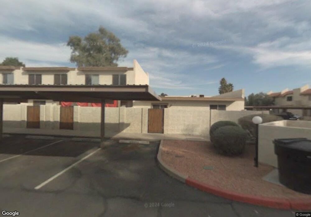
20218 N 21st Dr Phoenix, AZ 85027
North Deer Valley NeighborhoodEstimated Value: $222,000 - $310,000
2
Beds
3
Baths
1,280
Sq Ft
$203/Sq Ft
Est. Value
About This Home
This home is located at 20218 N 21st Dr, Phoenix, AZ 85027 and is currently estimated at $260,324, approximately $203 per square foot. 20218 N 21st Dr is a home located in Maricopa County with nearby schools including Esperanza Elementary School, Deer Valley Middle School, and Barry Goldwater High School.
Ownership History
Date
Name
Owned For
Owner Type
Purchase Details
Closed on
Mar 24, 2006
Sold by
Tilley Shannan
Bought by
Tilley Robin E
Current Estimated Value
Home Financials for this Owner
Home Financials are based on the most recent Mortgage that was taken out on this home.
Original Mortgage
$122,000
Outstanding Balance
$69,275
Interest Rate
6.25%
Mortgage Type
Fannie Mae Freddie Mac
Estimated Equity
$191,049
Purchase Details
Closed on
Sep 21, 2004
Sold by
Tilley Shannan
Bought by
Tilley Shannan and Tilley Robin
Home Financials for this Owner
Home Financials are based on the most recent Mortgage that was taken out on this home.
Original Mortgage
$80,800
Interest Rate
6.87%
Mortgage Type
New Conventional
Create a Home Valuation Report for This Property
The Home Valuation Report is an in-depth analysis detailing your home's value as well as a comparison with similar homes in the area
Home Values in the Area
Average Home Value in this Area
Purchase History
| Date | Buyer | Sale Price | Title Company |
|---|---|---|---|
| Tilley Robin E | -- | Grand Canyon Title Agency In | |
| Tilley Shannan | -- | Transnation Title | |
| Tilley Shannan | $101,000 | Transnation Title |
Source: Public Records
Mortgage History
| Date | Status | Borrower | Loan Amount |
|---|---|---|---|
| Open | Tilley Robin E | $122,000 | |
| Previous Owner | Tilley Shannan | $80,800 | |
| Closed | Tilley Shannan | $20,200 |
Source: Public Records
Tax History Compared to Growth
Tax History
| Year | Tax Paid | Tax Assessment Tax Assessment Total Assessment is a certain percentage of the fair market value that is determined by local assessors to be the total taxable value of land and additions on the property. | Land | Improvement |
|---|---|---|---|---|
| 2025 | $494 | $5,738 | -- | -- |
| 2024 | $486 | $5,465 | -- | -- |
| 2023 | $486 | $16,430 | $3,280 | $13,150 |
| 2022 | $468 | $13,250 | $2,650 | $10,600 |
| 2021 | $488 | $12,730 | $2,540 | $10,190 |
| 2020 | $479 | $11,120 | $2,220 | $8,900 |
| 2019 | $465 | $9,510 | $1,900 | $7,610 |
| 2018 | $448 | $8,480 | $1,690 | $6,790 |
| 2017 | $433 | $7,880 | $1,570 | $6,310 |
| 2016 | $409 | $6,870 | $1,370 | $5,500 |
| 2015 | $365 | $6,180 | $1,230 | $4,950 |
Source: Public Records
Map
Nearby Homes
- 2120 W Pontiac Dr
- 2107 W Yukon Dr
- 2241 W Tonto Ln
- 20813 N 22nd Ave
- 20818 N 21st Dr
- 1826 W Oraibi Dr
- 19249 N 23rd Ave
- 2142 W Kerry Ln
- 1942 W Kristal Way
- 1725 W Oraibi Dr
- 1676 W Sequoia Dr
- 19251 N 17th Dr
- 2201 W Topeka Dr
- 20813 N 16th Ave
- 1480 W Montoya Ln
- 2110 W Morrow Dr
- 19013 N 18th Ave
- 1444 W Wickieup Ln
- 21622 N 23rd Ave Unit B102
- 21622 N 23rd Ave Unit B304
- 20220 N 21st Dr
- 20216 N 21st Dr
- 20222 N 21st Dr
- 20214 N 21st Dr
- 20224 N 21st Dr Unit 68
- 20212 N 21st Dr
- 20219 N 21st Ln
- 20221 N 21st Ln
- 20217 N 21st Ln
- 20223 N 21st Ln
- 20215 N 21st Ln
- 20213 N 21st Ln
- 20225 N 21st Ln
- 20228 N 21st Dr
- 2122 W Pontiac Dr
- 20227 N 21st Ln
- 20230 N 21st Dr
- 20219 N 21st Dr
- 20221 N 21st Dr
- 20223 N 21st Dr